MyTopo
Siler City North Carolina US Topo Map
Couldn't load pickup availability
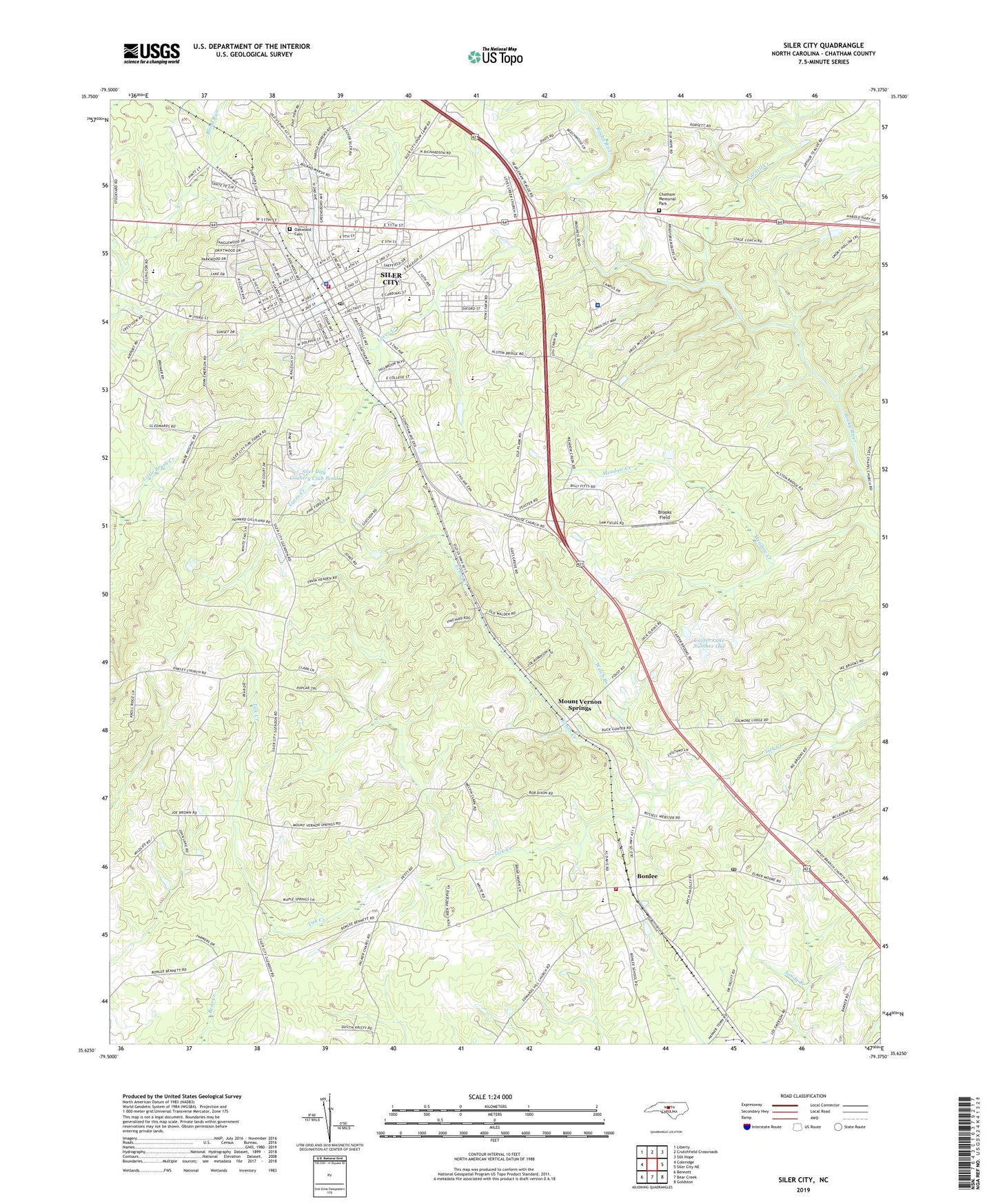
2022 topographic map quadrangle Siler City in the state of North Carolina. Scale: 1:24000. Based on the newly updated USGS 7.5' US Topo map series, this map is in the following counties: Chatham. The map contains contour data, water features, and other items you are used to seeing on USGS maps, but also has updated roads and other features. This is the next generation of topographic maps. Printed on high-quality waterproof paper with UV fade-resistant inks.
Quads adjacent to this one:
West: Coleridge
Northwest: Liberty
North: Crutchfield Crossroads
Northeast: Silk Hope
East: Siler City NE
Southeast: Goldston
South: Bear Creek
Southwest: Bennett
This map covers the same area as the classic USGS quad with code o35079f4.
Contains the following named places: Black Tulip Farms, Bonlee, Bonlee Elementary School, Bonlee Fire Department Station 6, Bonlee Post Office, Braxton School, Bray Park, Brookdale Church, Brooks Field, Carter Lake Dam Number One, Carter Lake Number One, Chatham County Rescue Squad, Chatham Hospital, Chatham Memorial Park, Chatham Middle School, Chatham Square, Edwards Hill, Evans Creek, Gees Grove Church, Hackneys Mill Pond, Hackneys Millpond Dam, Harris Grove Church, Jordan-Matthews High School, Loves Creek, Loves Creek Church, Mount Vernon Springs, Mount Vernon Springs Church, Oakley Church, Oakwood Cemetery, Palmers Chapel, Park Shopping Center, Saint Lukes Church, Saint Marks Church, Siler City, Siler City Country Club Pond, Siler City Country Club Pond Dam, Siler City Elementary School, Siler City Fire Department Station 9, Siler City Police Department, Siler City Post Office, Town of Siler City, Township of Matthews, Varnell Creek, Welch Branch, Wesley Chapel, West End Church, WNCA-AM (Siler City), ZIP Code: 27344