MyTopo
Davis North Carolina US Topo Map
Couldn't load pickup availability
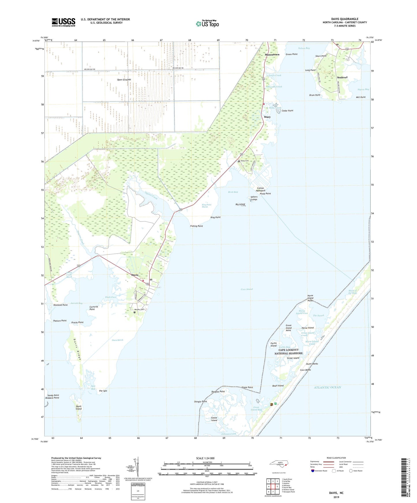
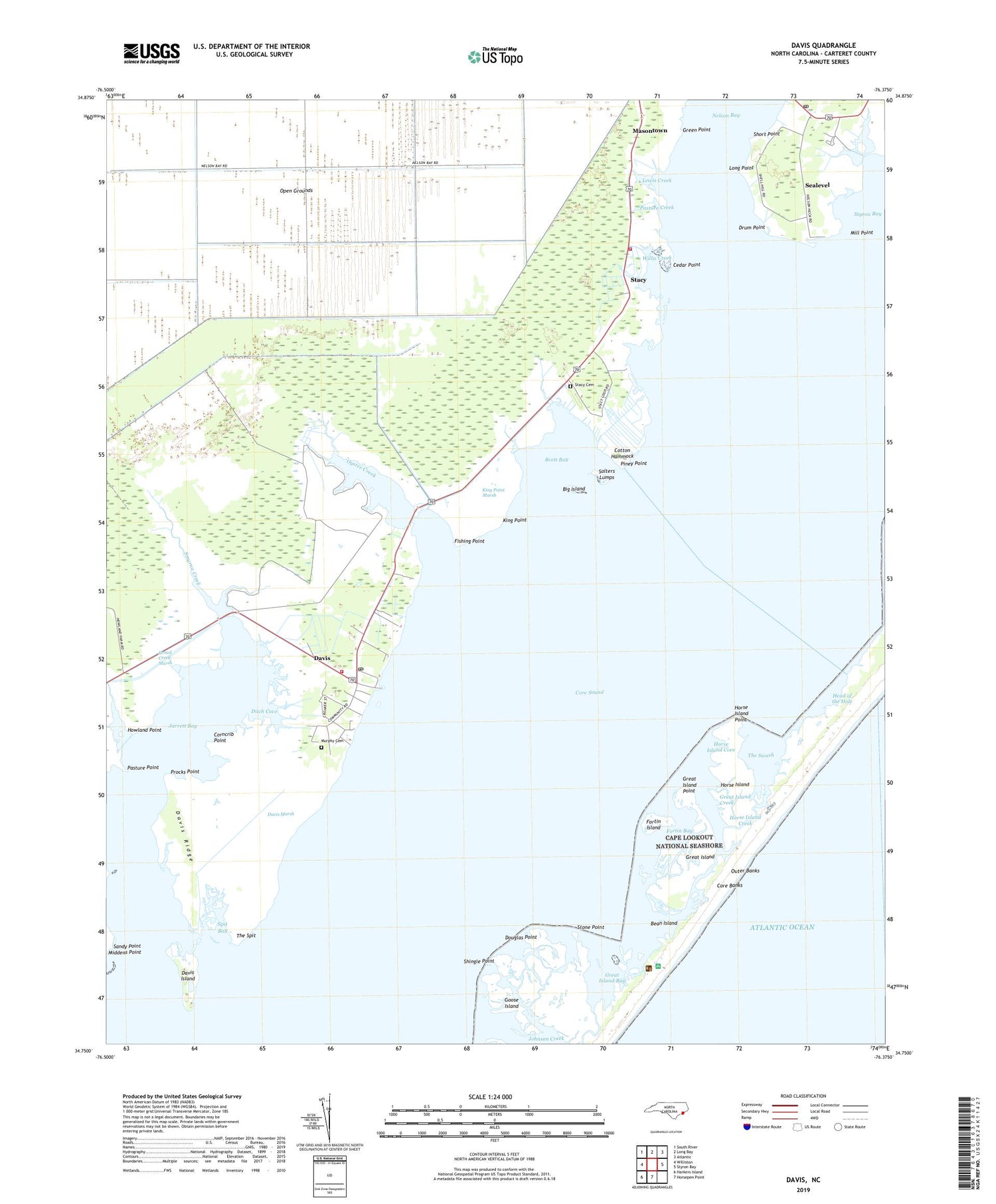
2019 topographic map quadrangle Davis in the state of North Carolina. Scale: 1:24000. Based on the newly updated USGS 7.5' US Topo map series, this map is in the following counties: Carteret. The map contains contour data, water features, and other items you are used to seeing on USGS maps, but also has updated roads and other features. This is the next generation of topographic maps. Printed on high-quality waterproof paper with UV fade-resistant inks.
Quads adjacent to this one:
West: Williston
Northwest: South River
North: Long Bay
Northeast: Atlantic
East: Styron Bay
South: Horsepen Point
Southwest: Harkers Island
Contains the following named places: Bean Island, Big Island, Brett Bay, Broad Creek, Broad Creek Marsh, Cedar Creek, Cedar Point, Corncrib Point, Cotton Hammock, Davis, Davis Census Designated Place, Davis Island, Davis Landing, Davis Marsh, Davis Post Office, Davis Ridge, Davis Volunteer Fire Department, Ditch Cove, Douglas Point, Drum Point, Fishing Point, Fork Creek, Fortin Bay, Fortin Island, Fulchers Creek, Goose Island, Great Creek, Great Island, Great Island Bay, Great Island Creek, Great Island Point, Green Point, Head of the Hole, Horse Island, Horse Island Cove, Horse Island Creek, Horse Island Point, Howland Creek, Howland Point, Jarrett Bay, Johnson Creek, King Point, King Point Marsh, Lewis Creek, Long Point, Marina Creek, Masontown, Middens Point, Mill Point, Murphy Cemetery, Nelson Bay, Oyster Creek, Pasture Creek, Pasture Point, Piney Point, Procks Point, Salters Lumps, Sandy Point, Sealevel, Sealevel Post Office, Shingle Point, Short Point, Smyrna Creek, Spit Bay, Stacy, Stacy Cemetery, Stacy School, Stacy Volunteer Fire Department, Stone Point, Styron Creek, The Spit, The Swash, Township of Stacy, Willis Creek, ZIP Codes: 28524, 28581