MyTopo
Harkers Island North Carolina US Topo Map
Couldn't load pickup availability
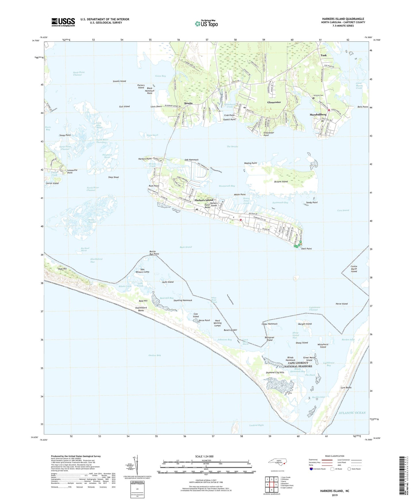
2022 topographic map quadrangle Harkers Island in the state of North Carolina. Scale: 1:24000. Based on the newly updated USGS 7.5' US Topo map series, this map is in the following counties: Carteret. The map contains contour data, water features, and other items you are used to seeing on USGS maps, but also has updated roads and other features. This is the next generation of topographic maps. Printed on high-quality waterproof paper with UV fade-resistant inks.
Quads adjacent to this one:
West: Beaufort
Northwest: Core Creek
North: Williston
Northeast: Davis
East: Horsepen Point
South: Cape Lookout
This map covers the same area as the classic USGS quad with code o34076f5.
Contains the following named places: Back Sound, Bald Hill, Bald Hill Bay, Barden Inlet, Baregrass Island, Bells Island, Big Shoal Marsh, Black Hammock Point, Blinds Hammock, Blinds Hammock Bay, Bottle Run Point, Brooks Creek, Browns Island, Bunch of Hair, Cabs Creek, Cedar Hammock, Cockle Marsh Island, Conch Shoal Marsh, Cow Island, Crab Point, Crystal Coast, Davis Bay, Diamond City Hills, Eastmouth Bay, Gaskill Landing, Gaskill Point, Gloucester, Gloucester Census Designated Place, Gloucester Point, Gloucester Post Office, Goose Bay, Great Marsh Creek, Great Marsh Island, Gull Island, Gunning Hammock Island, Hard Working Lumps, Harkers Island, Harkers Island Census Designated Place, Harkers Island Fire and Rescue Squad, Harkers Island Post Office, Harkers Island School, Harkers Point, Henry Jones Creek, High Hill, Horse Island, Horse Marsh, Horse Point, Island Road Baptist Church, Jacks Island, Janes Creek, Johnsons Bay, L R Rose Marina and Boatworks, Lenoxville Point, Lighthouse Bay, Lighthouse Channel, Little Deep Marsh Island, Lovis Shore, Marshallberg, Marshallberg Census Designated Place, Marshallberg Post Office, Marshallberg Volunteer Fire Department, Middle Marshes, Morgan Island, Newby Creek, North River, North River Channel, North River Marsh, North River Thorofare, Oak Hammock, Porters Island, Refuge Fellowship Church, Rush Point, Sam Winsors Lump, Sam Winter Lump, Sandy Point, Shackleford Banks, Shackleford Slue, Sheep Island, Sheep Island Slue, Sheephead Marsh, Shell Point, Shep Shoal, Shooting Hammock, Simons Island, Sleepy Creek, Steep Point, Steep Point Channel, Straits, Straits Haven, Straits United Methodist Church, The Black Cat, The Ditch, The Straits, Township of Harkers Island, Township of Marshallberg, Tusk, Tusk Creek, Victoria Cemetery, Wading Point, Westmouth Bay, Whale Creek, White Point, White Shoal Marsh, Whitehurst Creek, Whitehurst Island, Willow Pond, ZIP Codes: 28528, 28531, 28553