MyTopo
Long Bay North Carolina US Topo Map
Couldn't load pickup availability
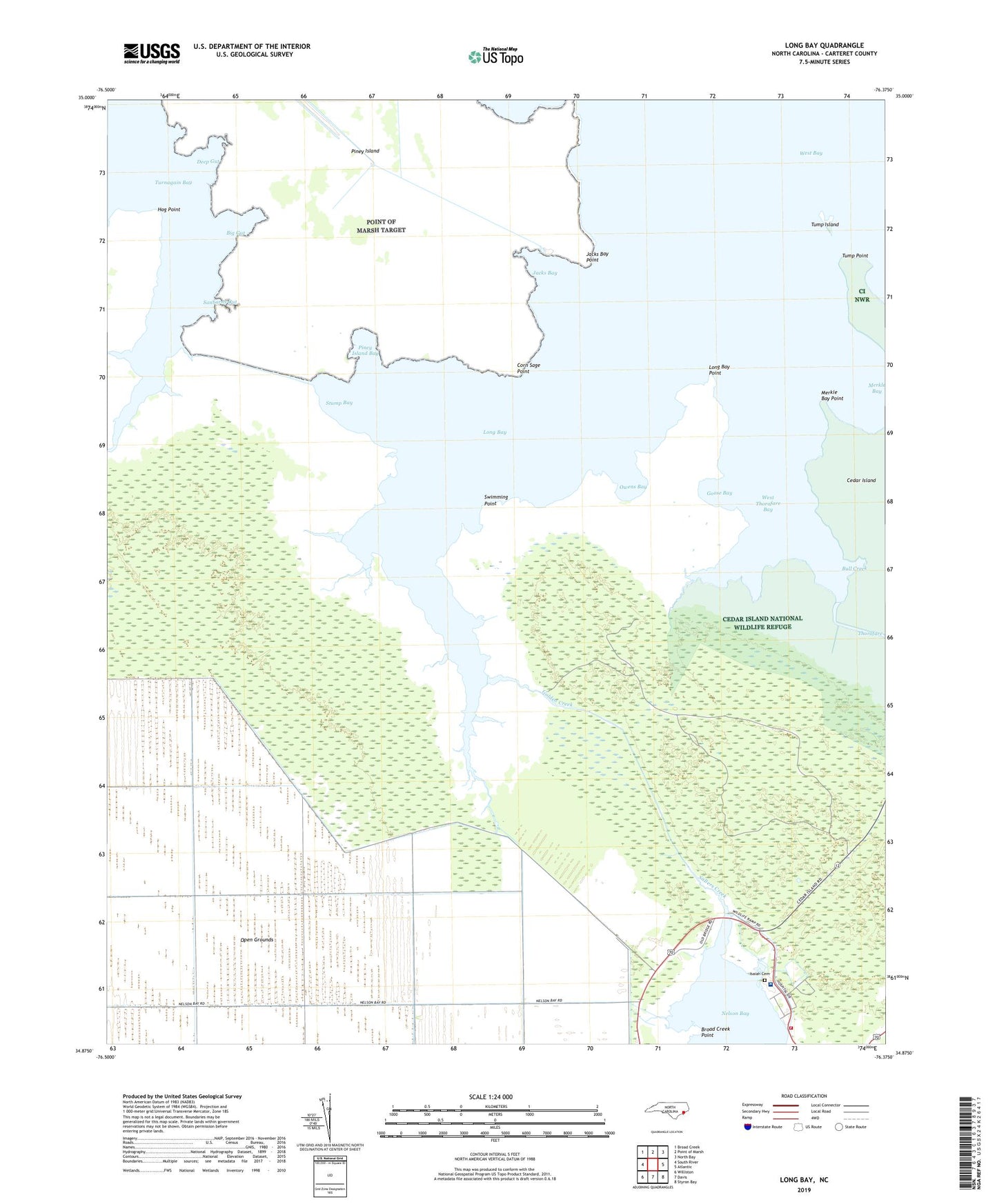
2022 topographic map quadrangle Long Bay in the state of North Carolina. Scale: 1:24000. Based on the newly updated USGS 7.5' US Topo map series, this map is in the following counties: Carteret. The map contains contour data, water features, and other items you are used to seeing on USGS maps, but also has updated roads and other features. This is the next generation of topographic maps. Printed on high-quality waterproof paper with UV fade-resistant inks.
Quads adjacent to this one:
West: South River
Northwest: Broad Creek
North: Point of Marsh
Northeast: North Bay
East: Atlantic
Southeast: Styron Bay
South: Davis
Southwest: Williston
This map covers the same area as the classic USGS quad with code o34076h4.
Contains the following named places: Benneys Creek, Big Gut, Broad Creek, Broad Creek Point, Bull Creek, Cadduggen Creek, Cedar Island Light, Corn Sage Point, Deep Gut, Dowdy Bay, Eastern Carteret Medical Center, Flag Creek, Fur Creek, Golden Creek, Goose Bay, Henrys Creek, Hog Point, Isaiah Cemetery, Jacks Bay, Jacks Bay Point, Long Bay, Long Bay Point, Merkle Bay, Merkle Bay Point, Mingo Creek, Old Canal, Owens Bay, Park Sealevel Hospital, Piney Island, Piney Island Bay, Point of Marsh Target Airfield, Salters Creek, Sanborns Gut, Sea Level Fire and Rescue, Stump Bay, Swimming Point, Taylor Hospital and Extended Care Facility, Thorofare West Day Beacon, Thorofare West Light, Township of Davis, Tump Island, Tump Point, Turnagain Bay, Volvee Camp, West Thorofare Bay