MyTopo
Styron Bay North Carolina US Topo Map
Couldn't load pickup availability
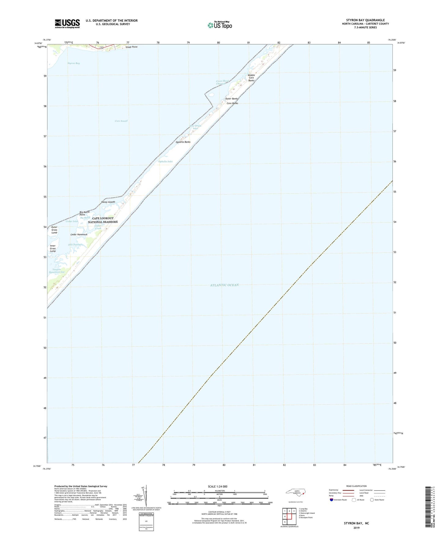
2022 topographic map quadrangle Styron Bay in the state of North Carolina. Scale: 1:24000. Based on the newly updated USGS 7.5' US Topo map series, this map is in the following counties: Carteret. The map contains contour data, water features, and other items you are used to seeing on USGS maps, but also has updated roads and other features. This is the next generation of topographic maps. Printed on high-quality waterproof paper with UV fade-resistant inks.
Quads adjacent to this one:
West: Davis
Northwest: Long Bay
North: Atlantic
Northeast: Wainwright Island
Southwest: Horsepen Point
This map covers the same area as the classic USGS quad with code o34076g3.
Contains the following named places: Annis Run, Big Marsh, Big Marsh Point, Cape Lookout National Seashore, Carteret Rod and Gun Club, Cedar Hammock, Cedar Inlet, Core Banks, Core Sound, Cross Shoal Channel, Glover Creek, Gutter Creek, Horsepen Creek, Inner Grass Lump, Middle Core Banks, Negro Creek Bay, New Drum Inlet, Old Channel, Old Channel Point, Ophelia Banks, Ophelia Inlet, Outer Grass Lump, Sheep Islands, Sheep Pen Creek, Steep Point, Styron Bay, Township of Sea Level, Yaupon Hammock Gut, ZIP Code: 28577