MyTopo
Drexel North Carolina US Topo Map
Couldn't load pickup availability
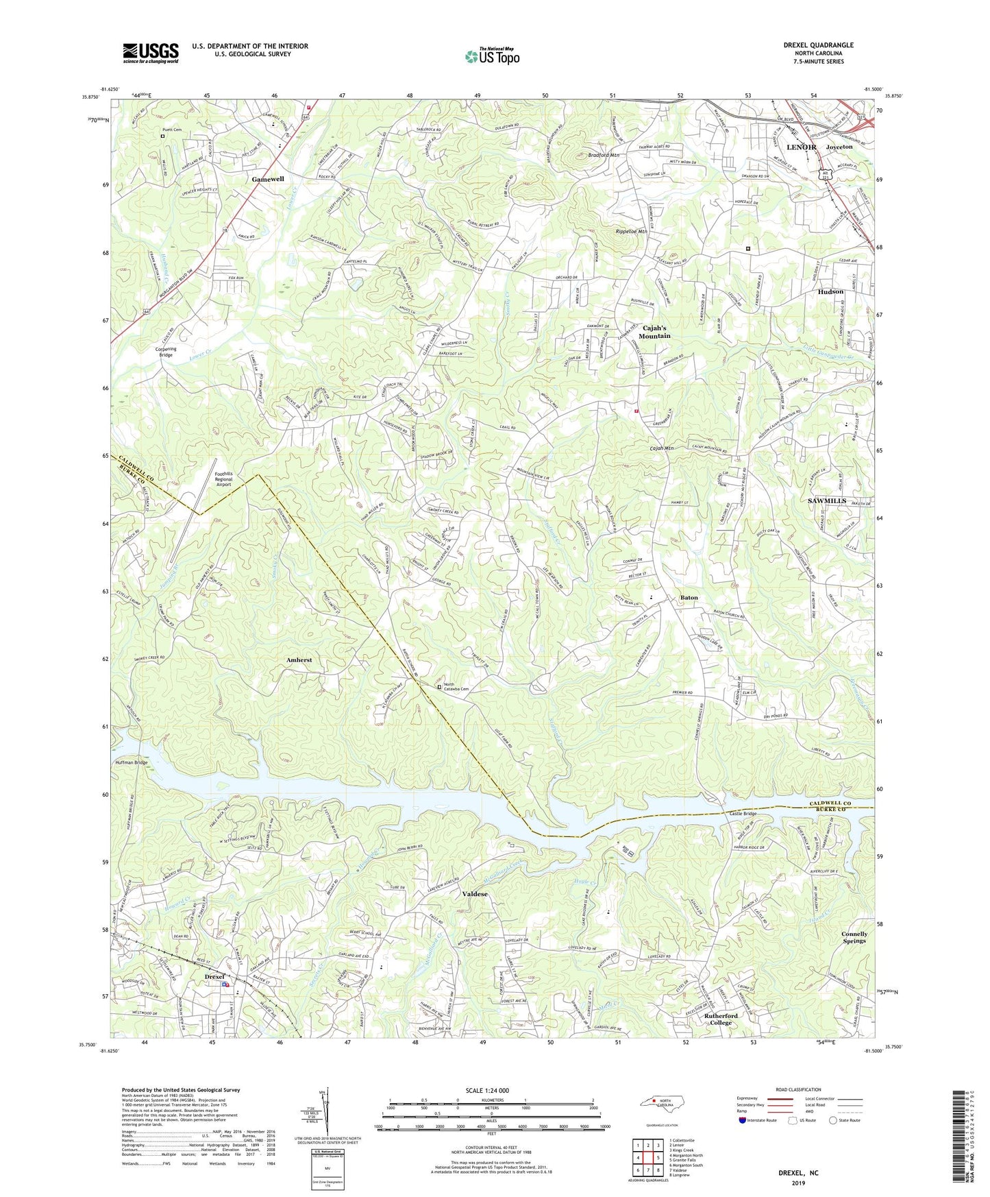
2019 topographic map quadrangle Drexel in the state of North Carolina. Scale: 1:24000. Based on the newly updated USGS 7.5' US Topo map series, this map is in the following counties: Caldwell, Burke. The map contains contour data, water features, and other items you are used to seeing on USGS maps, but also has updated roads and other features. This is the next generation of topographic maps. Printed on high-quality waterproof paper with UV fade-resistant inks.
Quads adjacent to this one:
West: Morganton North
Northwest: Collettsville
North: Lenoir
Northeast: Kings Creek
East: Granite Falls
Southeast: Longview
South: Valdese
Southwest: Morganton South
Contains the following named places: Abernethy Memorial Church, Amherst, Antioch Church, Baton, Baton Elementary School, Bradford Mountain, Cajah Mountain, Cajah Mountain Baptist Church, Cajahs Mountain, Caldwell Correctional Center, Calico Place, Castle Bridge, Celia Creek, Clarks Chapel, Cloverdale, Colliers Church, Copenhagen, Corpening Bridge, Drexel, Drexel Fire Department, Drexel Police Department, Drexel Post Office, Dye Branch, Eastern Burke County Rescue Squad, Enon Church, Fairway Acres, Foothills Regional Airport, Forest Hills, Gamewell, Gamewell Elementary School, Gamewell Heights, Gamewell Middle School, Gamewell Volunteer Fire Department, Hampton Heights, Harris Chapel, High Hills Golf Course, Howard Creek, Hoyle Creek, Huffman Bridge, Husband Creek, Island Creek, Johnson Development, Joyceton, Jumping Branch, Lakeview Church, Lakeview Mission Church, Linville River, Lovelady, Lovelady Church, McGalliard Creek, Micol Creek, Mount Zion Church, Mountain Grove Church, North Catawba Cemetery, North Catawba Church, North Catawba Fire and Rescue Department, North Laurel Church, Oakmont Estates, Philadelphia Church, Pineburr, Pinehurst, Pleasant Hill Church, Puett Cemetery, Rambling Acres, Rhodhiss Lake, Rippetoe Mountain, Secrets Creek, Smokey Creek, Smoky Creek, Stafford Creek, Sycamore Acres, Town and Country, Town of Cajah's Mountain, Town of Drexel, Town of Gamewell, Town of Rutherford College, Township of Drexel, Township of North Catawba, Township of Smoky Creek, Tri County Golf Course, Union Grove Church, Zion Methodist, ZIP Codes: 28619, 28671