MyTopo
Morganton North North Carolina US Topo Map
Couldn't load pickup availability
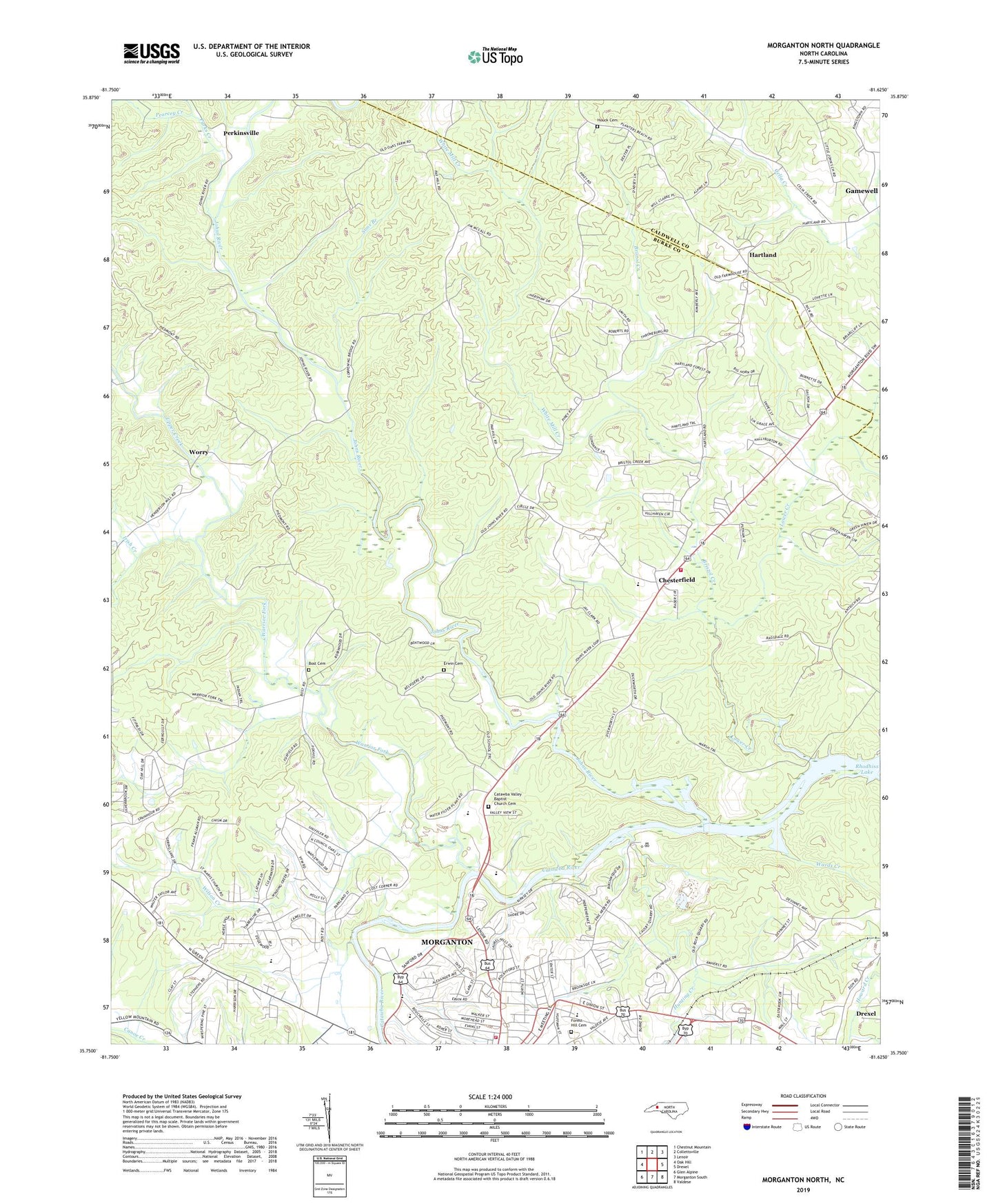
2022 topographic map quadrangle Morganton North in the state of North Carolina. Scale: 1:24000. Based on the newly updated USGS 7.5' US Topo map series, this map is in the following counties: Burke, Caldwell. The map contains contour data, water features, and other items you are used to seeing on USGS maps, but also has updated roads and other features. This is the next generation of topographic maps. Printed on high-quality waterproof paper with UV fade-resistant inks.
Quads adjacent to this one:
West: Oak Hill
Northwest: Chestnut Mountain
North: Collettsville
Northeast: Lenoir
East: Drexel
Southeast: Valdese
South: Morganton South
Southwest: Glen Alpine
This map covers the same area as the classic USGS quad with code o35081g6.
Contains the following named places: Amherst Baptist Church, Arneys Chapel Methodist Church, Arneys Store, Bethel Church, Bost Cemetery, Bristol Creek, Burke County Rescue Squad, Calvary Church, Cascade Park, Catawba Valley Baptist Church Cemetery, Catawba Valley Church, Causby Quarry, Chesterfield, Chesterfield Fire and Rescue, Chesterfield School, Collins, Corpening School, El Bethel Church, Erwin Cemetery, Forest Hill Cemetery, Hartland, Hartland Baptist Church, Hillcrest Elementary School, Houck Cemetery, Hunting Creek, Irish Creek, Johns River, Littlejohn Church, Lower Creek, M L King Park, Mission Church, Missionary Church, Morganton Fire Station 70 - 1, Mount Pleasant Church, Mountain View Elementary School, Mountain View Recreation Center, Parks Creek, Pearcey Creek, Perkinsville, Pleasant View Church, Quaker Meadows Golf Club, Riverside Church, Saint Marys Mission Church, Shadow Line Park, Sims Branch, Spencer Heights, Township of Lower Creek, Township of Quaker Meadows, Upper Creek, Wards Creek, Warrior Fork, White Mill Creek, Wilson Creek, WMNC-AM (Morganton), Worry, WQXX-FM (Morganton), ZIP Code: 28655