MyTopo
Elm City North Carolina US Topo Map
Couldn't load pickup availability
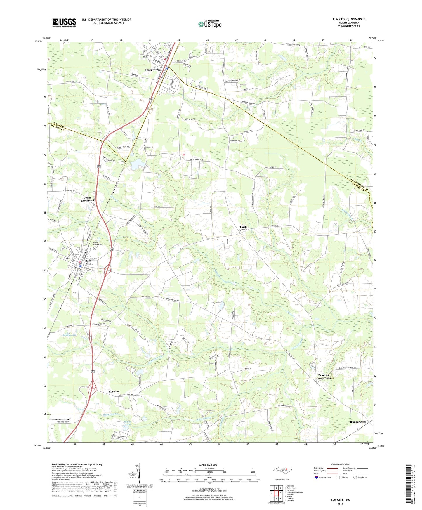
2019 topographic map quadrangle Elm City in the state of North Carolina. Scale: 1:24000. Based on the newly updated USGS 7.5' US Topo map series, this map is in the following counties: Wilson, Edgecombe, Nash. The map contains contour data, water features, and other items you are used to seeing on USGS maps, but also has updated roads and other features. This is the next generation of topographic maps. Printed on high-quality waterproof paper with UV fade-resistant inks.
Quads adjacent to this one:
West: Winstead Crossroads
Northwest: Nashville
North: Rocky Mount
Northeast: Hartsease
East: Pinetops
Southeast: Fountain
South: Saratoga
Southwest: Wilson
Contains the following named places: Adams Dam, Adams Pond, Aenon Church, Bridgersville, Cattail Branch, Cattail Swamp, Cedar Grove Cemetery, Cherrys Chapel, Cobbs Crossroad, Community Church, Elm City, Elm City Elementary School, Elm City Emergency Services, Elm City Middle School, Elm City Police Department, Elm City Post Office, Gospel Missionary Church, Little Union Church, New Hope Church, Oak Grove Church, Penders Crossroads, Peoples Chapel, Pleasant Hope Church, Putneys Lake, Putneys Lake Dam, Rosebud, Sharpsburg, Sharpsburg Fire Prevention Association Volunteer Fire Department Main Station, Sharpsburg Fire Prevention Association Volunteer Fire Department Substation, Sharpsburg Police Department, Sharpsburg Post Office, Toisnot Rural Fire Department, Town Creek, Town of Elm City, Town of Sharpsburg, Township 14-Upper Town Creek, Township of Toisnot, Upper Town Creek Church, Vaughn Church, White Swamp, Wilson County Sheriff's Office, ZIP Codes: 27822, 27878