MyTopo
Saratoga North Carolina US Topo Map
Couldn't load pickup availability
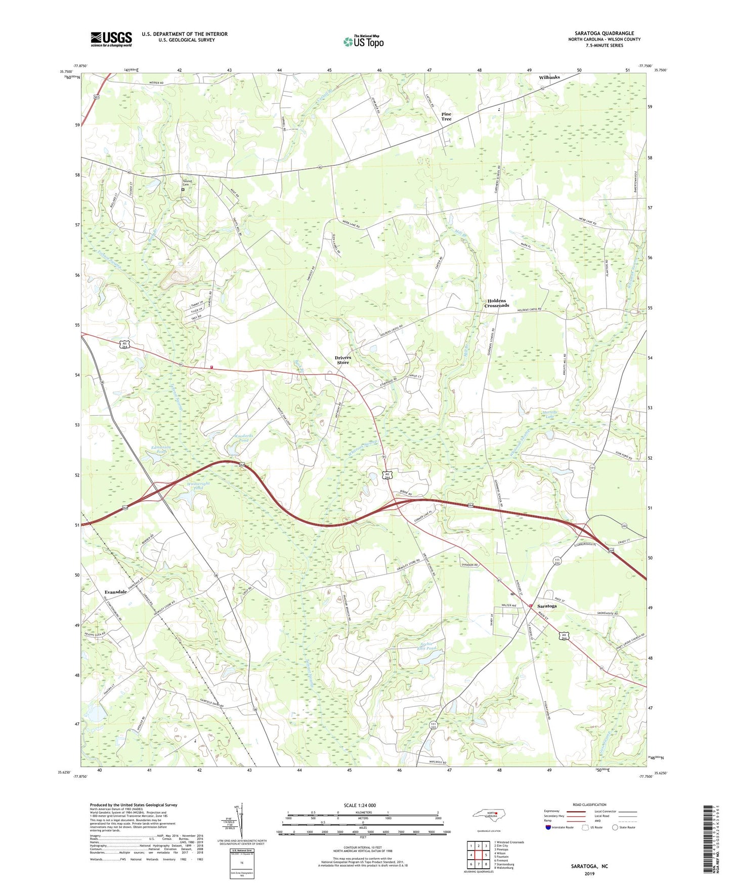
2022 topographic map quadrangle Saratoga in the state of North Carolina. Scale: 1:24000. Based on the newly updated USGS 7.5' US Topo map series, this map is in the following counties: Wilson. The map contains contour data, water features, and other items you are used to seeing on USGS maps, but also has updated roads and other features. This is the next generation of topographic maps. Printed on high-quality waterproof paper with UV fade-resistant inks.
Quads adjacent to this one:
West: Wilson
Northwest: Winstead Crossroads
North: Elm City
Northeast: Pinetops
East: Fountain
Southeast: Walstonburg
South: Stantonsburg
Southwest: Fremont
This map covers the same area as the classic USGS quad with code o35077f7.
Contains the following named places: Archie Ellis Pond, Archie Ellis Pond Dam, Barnes Chapel, Bethany Church, Buck Branch, Corner Line Church, Drivers Store, East Nash Volunteer Fire Department, Eastwood, Edmunson Pond, Edmunson Pond Dam, Evansdale, Gardners School, Harrells Lake, Harrells Lake Dam, Holdens Crossroads, Mill Branch, Moores Church, New Bethel Church, Ocal Church, Owens Chapel, Pine Tree, Rose Chapel, Sanoca Volunteer Fire Department, Saratoga, Saratoga Post Office, Simmon Grove Church, Speight Middle School, Sun, Toisnot Cemetery, Town of Saratoga, Township of Gardners, Township of Saratoga, Township of Stantonsburg, Wainwright Pond, Wainwright Pond Dam, Whiteoak Swamp, Wilbanks, Woodards Pond, Woodards Pond Dam, Zimmerman Chapel, ZIP Code: 27873