MyTopo
Hartsease North Carolina US Topo Map
Couldn't load pickup availability
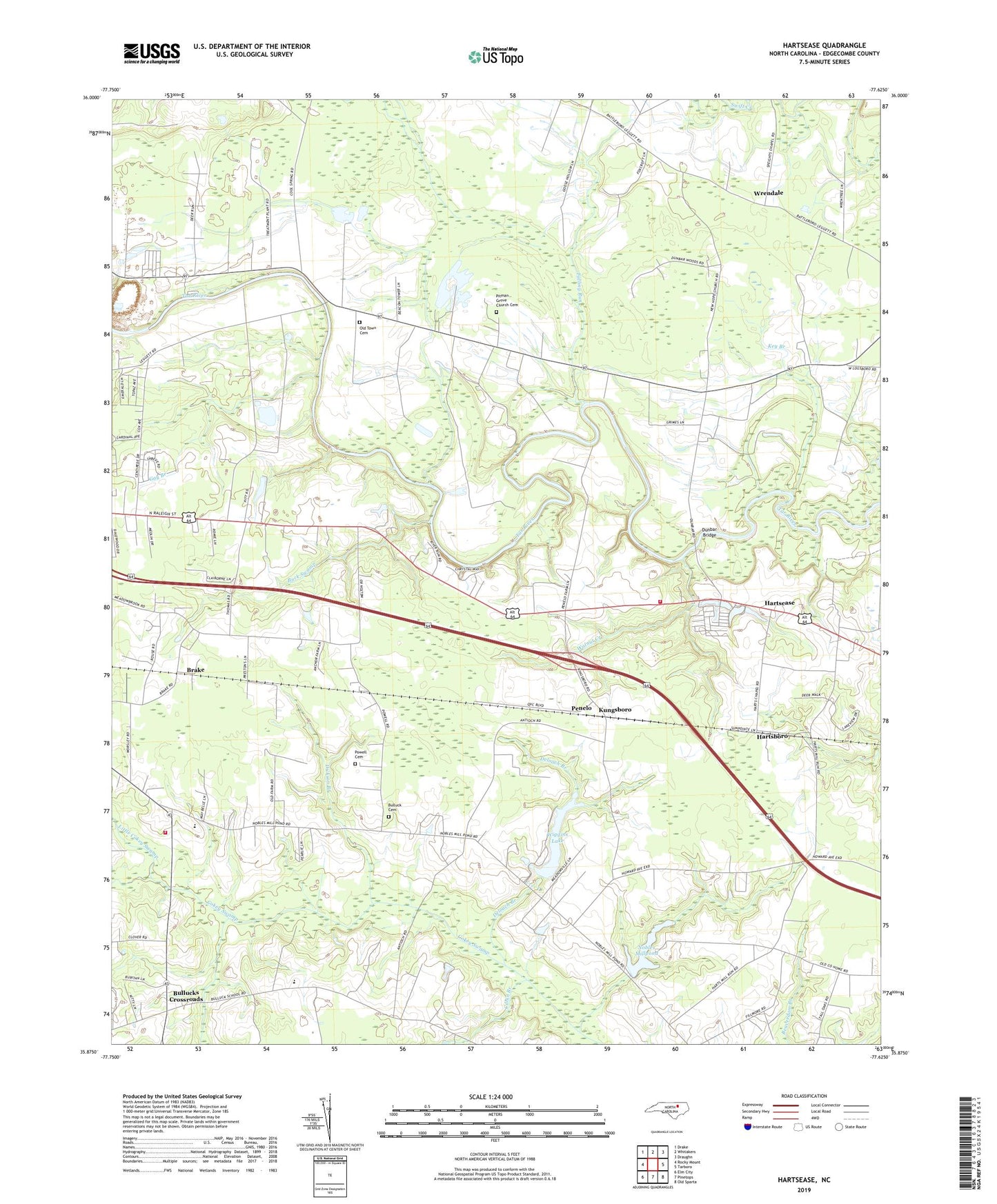
2022 topographic map quadrangle Hartsease in the state of North Carolina. Scale: 1:24000. Based on the newly updated USGS 7.5' US Topo map series, this map is in the following counties: Edgecombe. The map contains contour data, water features, and other items you are used to seeing on USGS maps, but also has updated roads and other features. This is the next generation of topographic maps. Printed on high-quality waterproof paper with UV fade-resistant inks.
Quads adjacent to this one:
West: Rocky Mount
Northwest: Drake
North: Whitakers
Northeast: Draughn
East: Tarboro
Southeast: Old Sparta
South: Pinetops
Southwest: Elm City
This map covers the same area as the classic USGS quad with code o35077h6.
Contains the following named places: Antioch Church, Beech Branch, Brake, Buck Swamp, Bullock School, Bulluck Cemetery, Bullucks Crossroads, Cabin Branch, Deloach Branch, Dickson Branch, Dunbar, Dunbar Bridge, Falling Run, Friendship Church, Gay Branch, Gloria Hope Church, Hartsboro, Hartsease, Heartsease Volunteer Fire Department, Hickory View Church, Key Branch, Kungsboro, Little Cokey Swamp, Meadowbrook Church, Mount Galilee Church, New Hope Church, Nobles Mill Pond Dam, Nobles Millpond, Oakdale Church, Old Town Cemetery, Penelo, Pitman Grove Church Cemetery, Pittman Grove Church, Pleasant Hill Church, Powell Cemetery, Rocky Mount Fairgrounds, Rocky Mount Pit, Rocky Mount Quarry 11, Saint Matthew Church, Township 11-Walnut Creek, Township 12-Rocky Mount, Township 7-Swift Creek, Walnut Creek, West Edgecombe, West Edgecombe Junior High School, West Edgecombe Rescue Squad Ambulance Service, West Edgecombe Volunteer Fire Department, Wiggins Lake, Wiggins Lake Dam, Wrendale, ZIP Code: 27801