MyTopo
Fairfield NE North Carolina US Topo Map
Couldn't load pickup availability
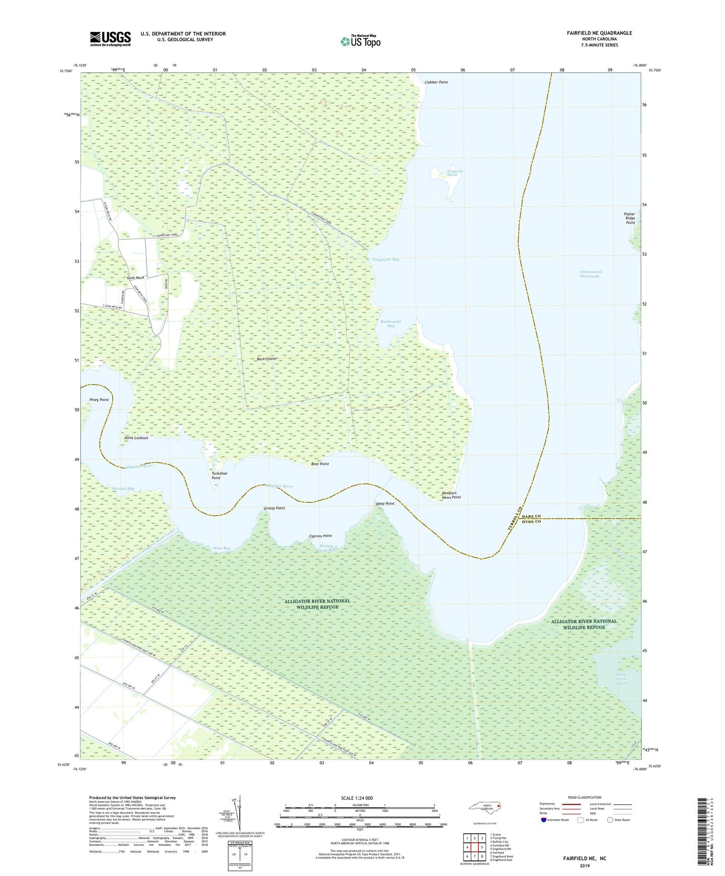
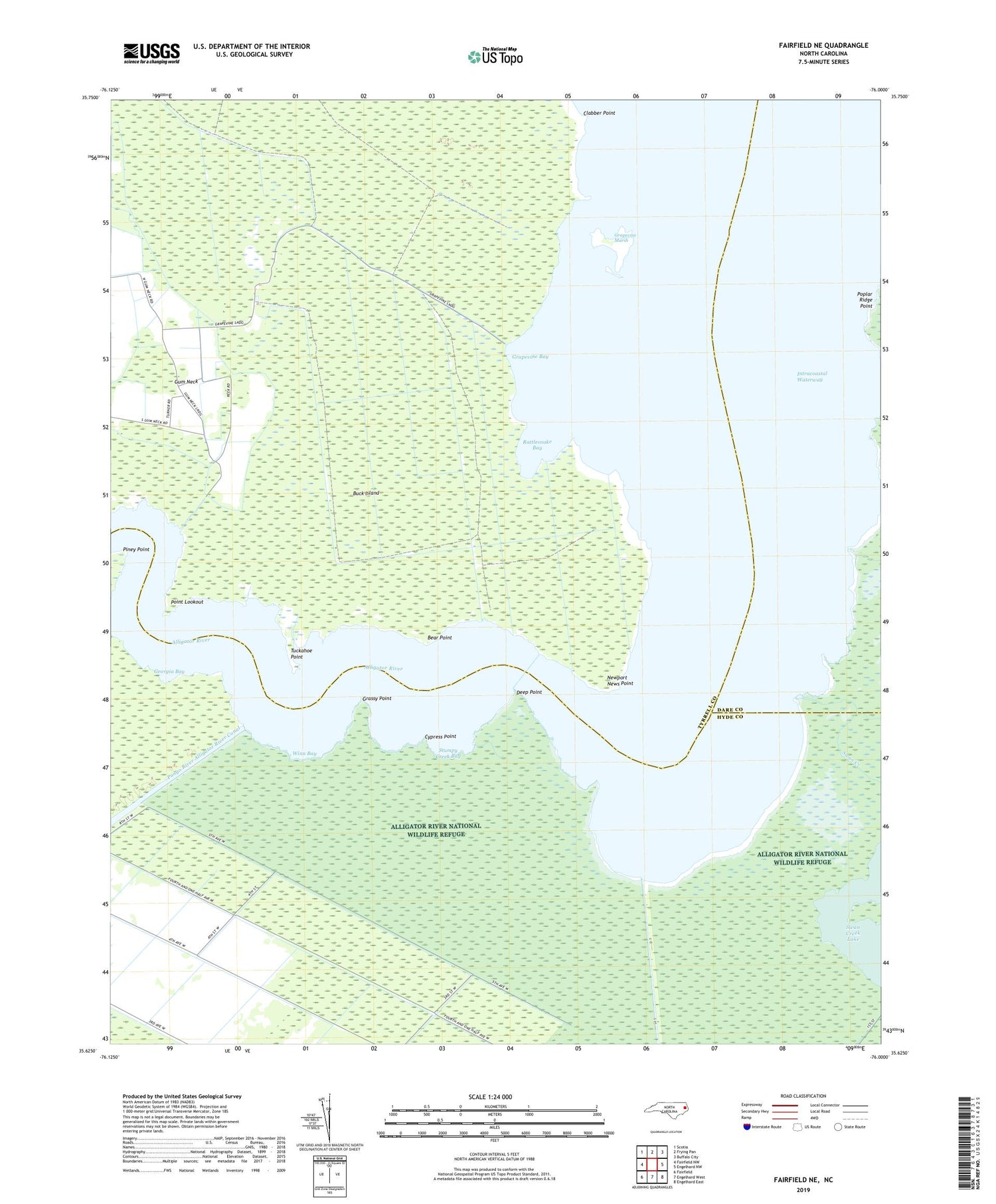
2019 topographic map quadrangle Fairfield NE in the state of North Carolina. Scale: 1:24000. Based on the newly updated USGS 7.5' US Topo map series, this map is in the following counties: Tyrrell, Hyde, Dare. The map contains contour data, water features, and other items you are used to seeing on USGS maps, but also has updated roads and other features. This is the next generation of topographic maps. Printed on high-quality waterproof paper with UV fade-resistant inks.
Quads adjacent to this one:
West: Fairfield NW
Northwest: Scotia
North: Frying Pan
Northeast: Buffalo City
East: Engelhard NW
Southeast: Engelhard East
South: Engelhard West
Southwest: Fairfield
Contains the following named places: Bear Point, Buck Island, Clabber Point, Cypress Point, Deep Point, Georgia Bay, Grapevine Bay, Grapevine Landing, Grapevine Marsh, Grassy Point, Gum Neck Creek, Gum Neck Landing, Newport News Point, Piney Point, Point Lookout, Poplar Ridge Point, Rattlesnake Bay, Stumpy Creek, Stumpy Creek Bay, Swan Creek, Swan Creek Lake, Swindells Store, Tuckahoe Point, Whipping Creek, Winn Bay