MyTopo
Fairfield NW North Carolina US Topo Map
Couldn't load pickup availability
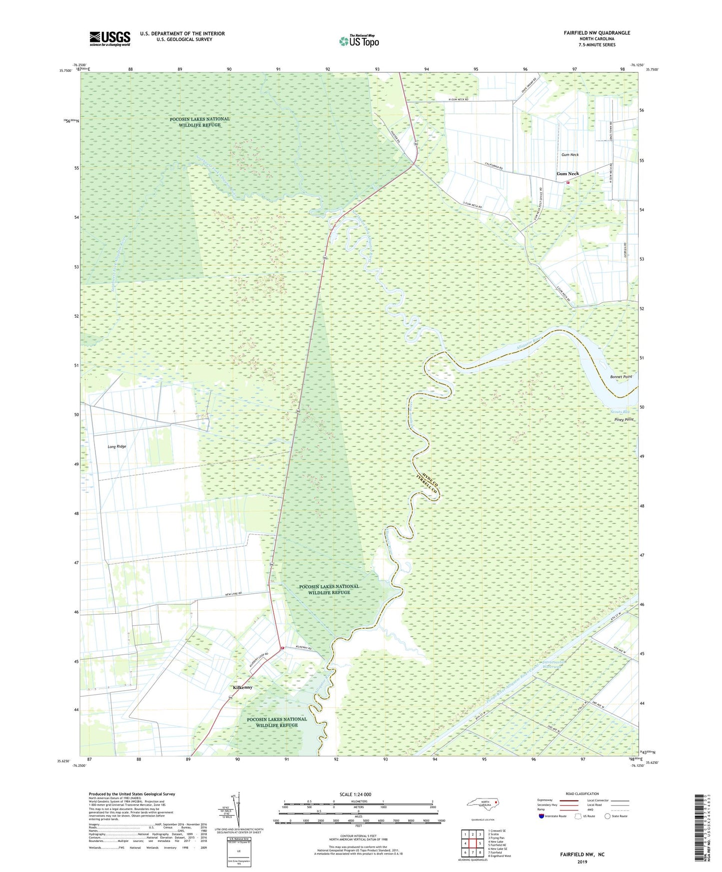
2022 topographic map quadrangle Fairfield NW in the state of North Carolina. Scale: 1:24000. Based on the newly updated USGS 7.5' US Topo map series, this map is in the following counties: Tyrrell, Hyde. The map contains contour data, water features, and other items you are used to seeing on USGS maps, but also has updated roads and other features. This is the next generation of topographic maps. Printed on high-quality waterproof paper with UV fade-resistant inks.
Quads adjacent to this one:
West: New Lake
Northwest: Creswell SE
North: Scotia
Northeast: Frying Pan
East: Fairfield NE
Southeast: Engelhard West
South: Fairfield
Southwest: New Lake SE
This map covers the same area as the classic USGS quad with code o35076f2.
Contains the following named places: Bonnet Point, Cedar Grove Church, Cherry Ridge Landing, Church of Christ, Gum Neck, Gum Neck Fire Department Station 2, Kilkenny, Kilkenny Fire Department Station 3, Kilkenny Landing, Northwest Fork Alligator River, Piney Grove Church, Scouts Bay, Southwest Fork Alligator River, Township of Gum Neck, Union Chapel