MyTopo
Frying Pan North Carolina US Topo Map
Couldn't load pickup availability
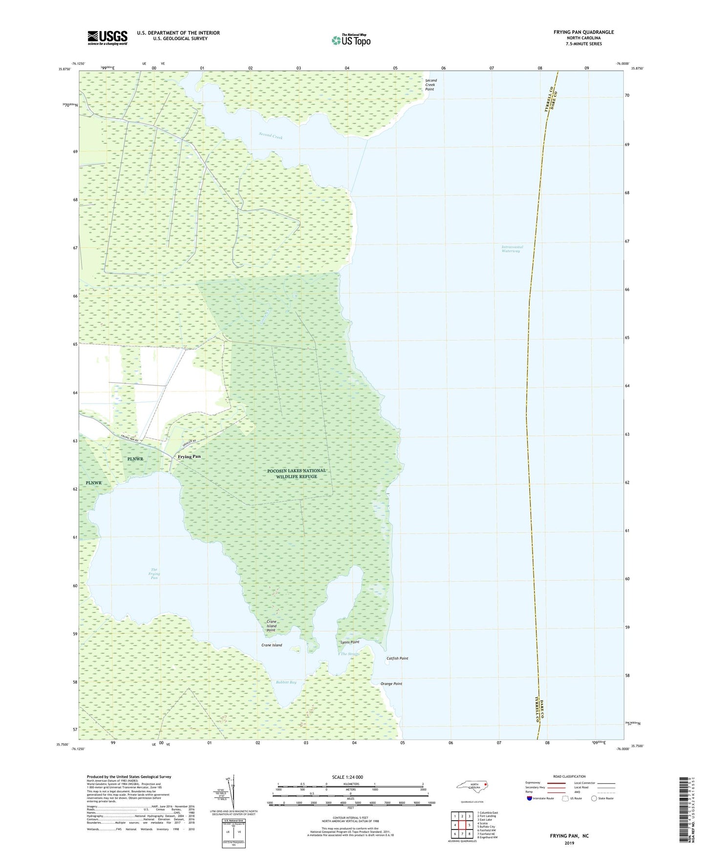
2022 topographic map quadrangle Frying Pan in the state of North Carolina. Scale: 1:24000. Based on the newly updated USGS 7.5' US Topo map series, this map is in the following counties: Tyrrell, Dare. The map contains contour data, water features, and other items you are used to seeing on USGS maps, but also has updated roads and other features. This is the next generation of topographic maps. Printed on high-quality waterproof paper with UV fade-resistant inks.
Quads adjacent to this one:
West: Scotia
Northwest: Columbia East
North: Fort Landing
Northeast: East Lake
East: Buffalo City
Southeast: Engelhard NW
South: Fairfield NE
Southwest: Fairfield NW
This map covers the same area as the classic USGS quad with code o35076g1.
Contains the following named places: Babbitt Bay, Catfish Point, Coopers Creek, Crane Island, Crane Island Point, Free Union Church, Frying Pan, Frying Pan Landing, Goose Creek, Lyons Point, Orange Point, Second Creek, Second Creek Point, The Frying Pan, The Straits