MyTopo
Flowers North Carolina US Topo Map
Couldn't load pickup availability
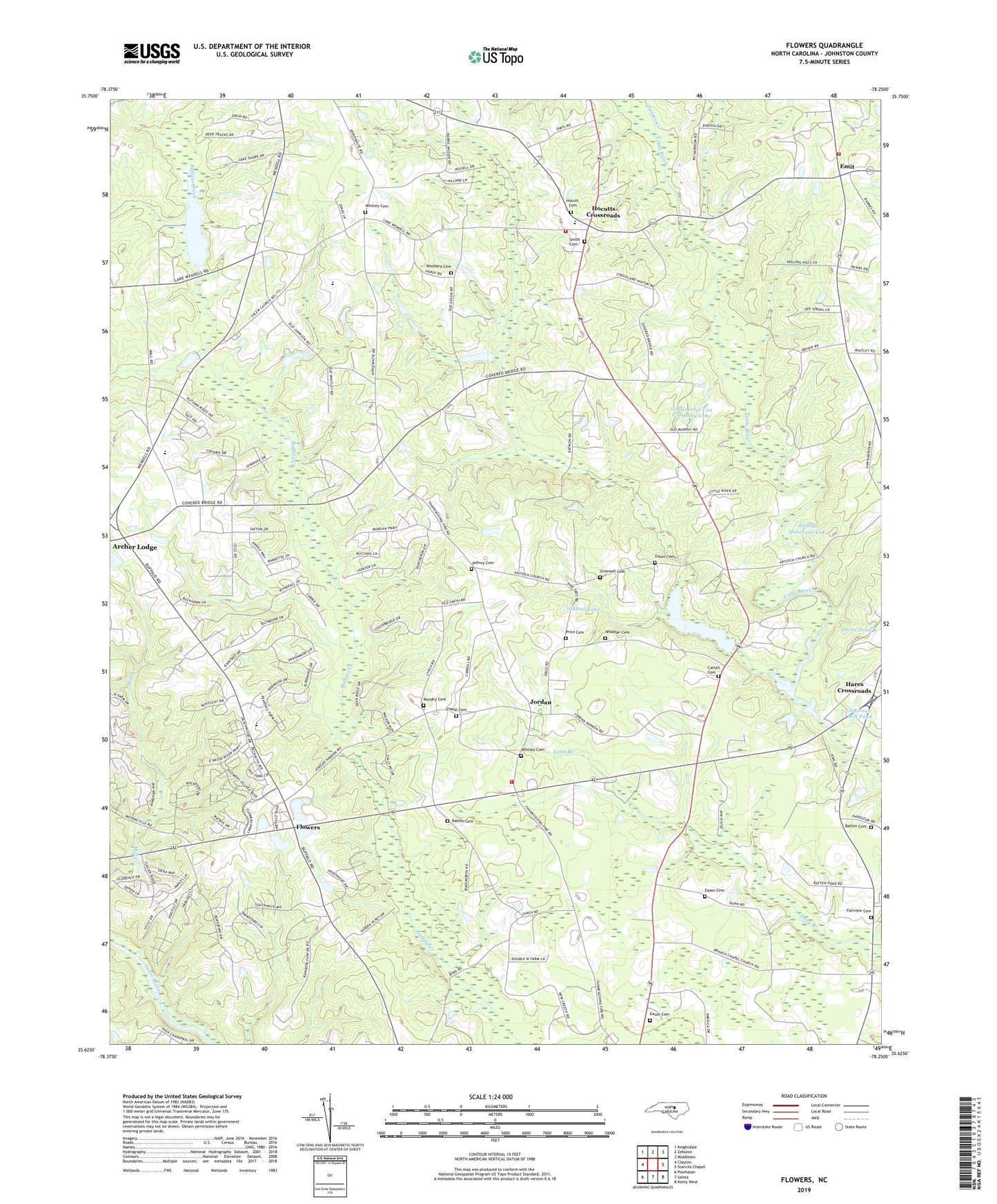
2019 topographic map quadrangle Flowers in the state of North Carolina. Scale: 1:24000. Based on the newly updated USGS 7.5' US Topo map series, this map is in the following counties: Johnston. The map contains contour data, water features, and other items you are used to seeing on USGS maps, but also has updated roads and other features. This is the next generation of topographic maps. Printed on high-quality waterproof paper with UV fade-resistant inks.
Quads adjacent to this one:
West: Clayton
Northwest: Knightdale
North: Zebulon
Northeast: Middlesex
East: Stancils Chapel
Southeast: Kenly West
South: Selma
Southwest: Powhatan
Contains the following named places: Atkinson Lake Dam, Atkinson Mill Pond, Atkinson Mill Pond Dam, Batten Cemetery, Branch Chapel, Camp Atkinson, Cattail Cemetery, Cattail Creek, Cattail Lake, Cattail Pond Dam, Continental Can Company Lake, Corinth - Holder Fire Department Station 2, Corinth - Holder Volunteer Fire Department Station 1, Corinth Church, Corinth Holders High School, Dover Pond A, Eason Cemetery, Emit, Fairview Cemetery, Flowers, Flowers Pond Number One Dam, Flowers Ranch Airport, Greswell Cemetery, Hares Crossroads, Hocutt Cemetery, Hocutts Crossroads, Jeffrey Cemetery, Jordan, Lake Andrew Acres Dam, Lake Wendell Dam, Murphy Cemetery, New Bethel Church, O'Neal Cemetery, Pineville Church, Price Cemetery, Raleigh Municipal Lake, Red Hill Church, Salem Church, Smith Cemetery, Snipes Creek, Spring Hill Church, Thanksgiving Church, Thanksgiving Fire Department, Town of Archer Lodge, Township of Wilders, Watkins Chapel, Wheeler Cemetery, Whitley Cemetery, Woodard Cemetery