MyTopo
Selma North Carolina US Topo Map
Couldn't load pickup availability
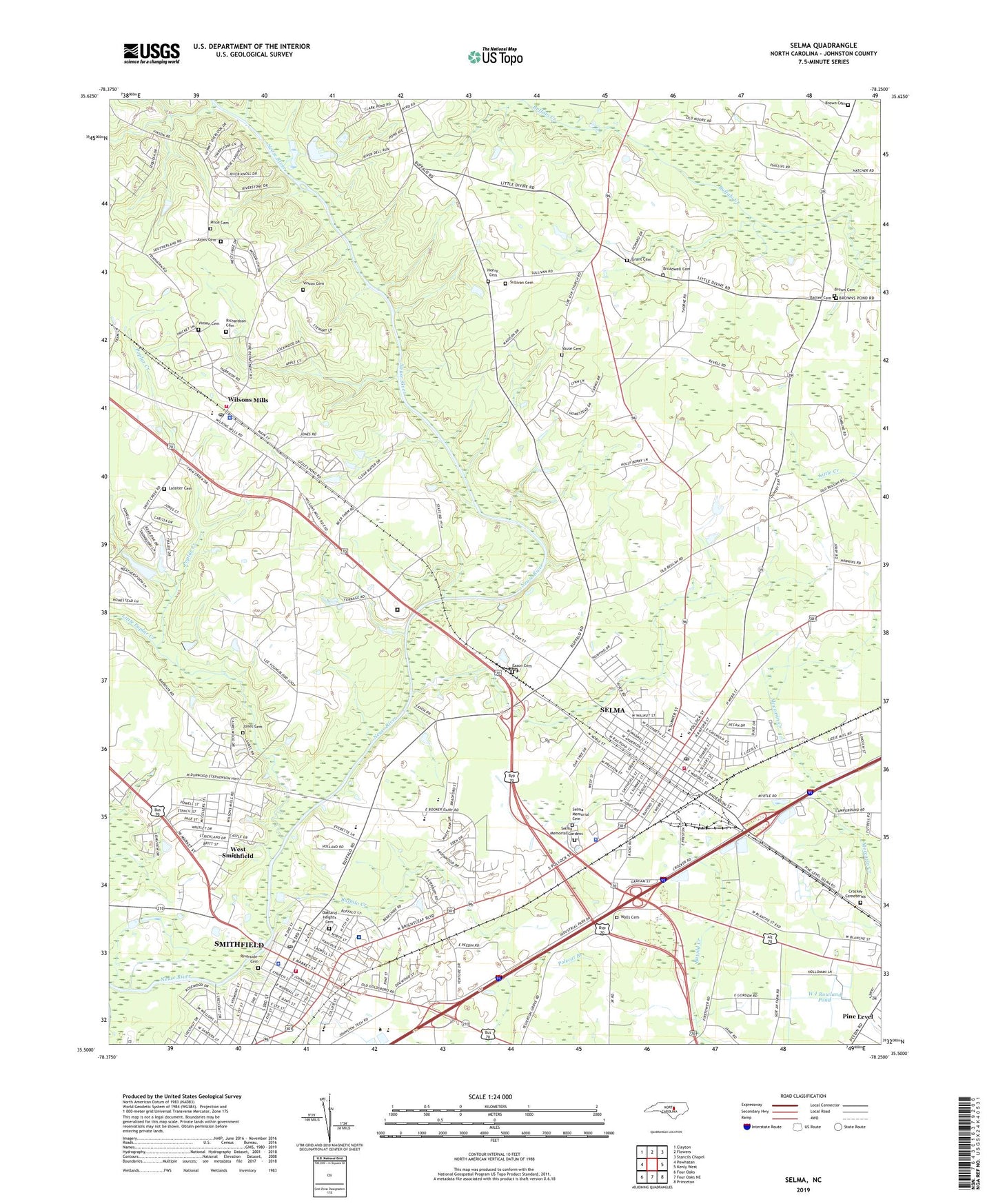
2022 topographic map quadrangle Selma in the state of North Carolina. Scale: 1:24000. Based on the newly updated USGS 7.5' US Topo map series, this map is in the following counties: Johnston. The map contains contour data, water features, and other items you are used to seeing on USGS maps, but also has updated roads and other features. This is the next generation of topographic maps. Printed on high-quality waterproof paper with UV fade-resistant inks.
Quads adjacent to this one:
West: Powhatan
Northwest: Clayton
North: Flowers
Northeast: Stancils Chapel
East: Kenly West
Southeast: Princeton
South: Four Oaks NE
Southwest: Four Oaks
This map covers the same area as the classic USGS quad with code o35078e3.
Contains the following named places: Batten Cemetery, Belleview Church, Broadwell Cemetery, Brown Cemetery, Buffalo Creek, Burning Bush Church, Calvary Church, Castlehaven, Central Church, Crestwood Church, Crocker Cemetery, Eason Cemetery, Eden Woods, Fairfield, Faith Church, Free Will Church, Grant Cemetery, Harrison High School, Henry Family Cemetery, Holy Temple Church, Johnston Ambulance Service, Johnston Correctional Institution, Johnston County, Johnston County Sheriff's Office, Johnston County Wildlife Pond Dam, Johnston Plaza, Johnston UNC Health Care, Jones Cemetery, Landwood Church, Lassiter Cemetery, Laurelwood Hills, Lees Church, Little Poplar Creek, Live Oak Church, New Hill Church, Noble Hills, Oakland Heights Cemetery, Old Farm Acres, Outlet Plaza, Pine Needle Square, Pleasant Plain Church, Poplar Creek, Price Cemetery, Prison Unit 4043, Redwood Village, Richardson Cemetery, Riverside Cemetery, Rose Manor, Rose Manor Shopping Center, Saint Johns Church, Selma, Selma Airport, Selma Elementary School, Selma Fire Department, Selma Memorial Cemetery, Selma Memorial Gardens, Selma Police Department, Selma Post Office, Sharon Church, Sky City Shopping Center, Smithfield, Smithfield - Selma High School, Smithfield Elementary School, Smithfield Emergency Medical Services, Smithfield Fire Station, Smithfield Middle School, Smithfield Post Office, Southland Estate Winery, Sullivan Cemetery, Sunrise Acres, Sunset Memorial Park, Town of Selma, Town of Smithfield, Town of Wilson's Mills, Township of Selma, Township of Wilson Mills, Union Hill Church, Uzzles Pond, Uzzles Pond Dam, Vause Cemetery, Vinson Cemetery, W I Rowland Pond, Walls Cemetery, WBZB-AM (Selma), West Calvary Church, West Smithfield, West Smithfield Church, Westview, Wilson Mills Church, Wilsons Mills, Wilsons Mills Elementary School, Wilsons Mills Fire Department Station 1, Wilson's Mills Police Department, Wilsons Mills Post Office, WMPM-AM (Smithfield), Yelverton Grove Church, ZIP Code: 27576