MyTopo
Kenly West North Carolina US Topo Map
Couldn't load pickup availability
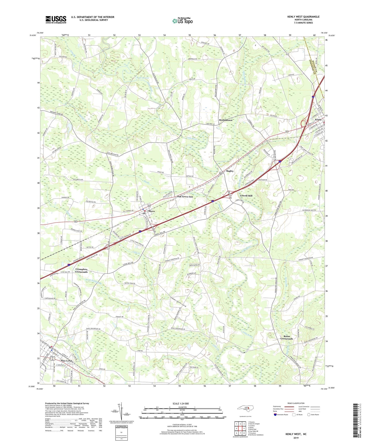
2022 topographic map quadrangle Kenly West in the state of North Carolina. Scale: 1:24000. Based on the newly updated USGS 7.5' US Topo map series, this map is in the following counties: Johnston, Wilson. The map contains contour data, water features, and other items you are used to seeing on USGS maps, but also has updated roads and other features. This is the next generation of topographic maps. Printed on high-quality waterproof paper with UV fade-resistant inks.
Quads adjacent to this one:
West: Selma
Northwest: Flowers
North: Stancils Chapel
Northeast: Lucama
East: Kenly East
Southeast: Northwest Goldsboro
South: Princeton
Southwest: Four Oaks NE
This map covers the same area as the classic USGS quad with code o35078e2.
Contains the following named places: Bagley, Bethany Church, Beulah Church, Beulahtown, Big Branch, Browns Pond Dam, Buffalo Creek, Burnt Stocking Branch, Cardinal Country Club, Carters Chapel, Country Squire Mobile Estates, Crumplers Crossroads, Faith Church, Fellowship Church, Giles Chapel, Glendale Chapel School, Holly Springs Church, Kenly Elementary School, Kenly Volunteer Fire Department, Lake Benson, Little Buffalo Creek, Little Creek, Long Branch, Lowell Mill, Micro, Micro - Pine Level Elementary School, Micro Elementary School, Micro Police Department, Micro Post Office, Micro Volunteer Fire Department, Niagara Church, North Johnston Emergency Medical Services - Micro, North Johnston High School, Oak Grove Inn, Parrish Church, Pine Level, Pine Level Fire Department, Pine Level Police Department, Pine Level Post Office, Rains Crossroads, Ramblewood Mobile Home Park, Town of Kenly, Town of Micro, Town of Pine Level, Township of Beulah, Township of Micro, Township of Pine Level, Warren Chapel, White Rock Church, ZIP Codes: 27542, 27555, 27568