MyTopo
Stancils Chapel North Carolina US Topo Map
Couldn't load pickup availability
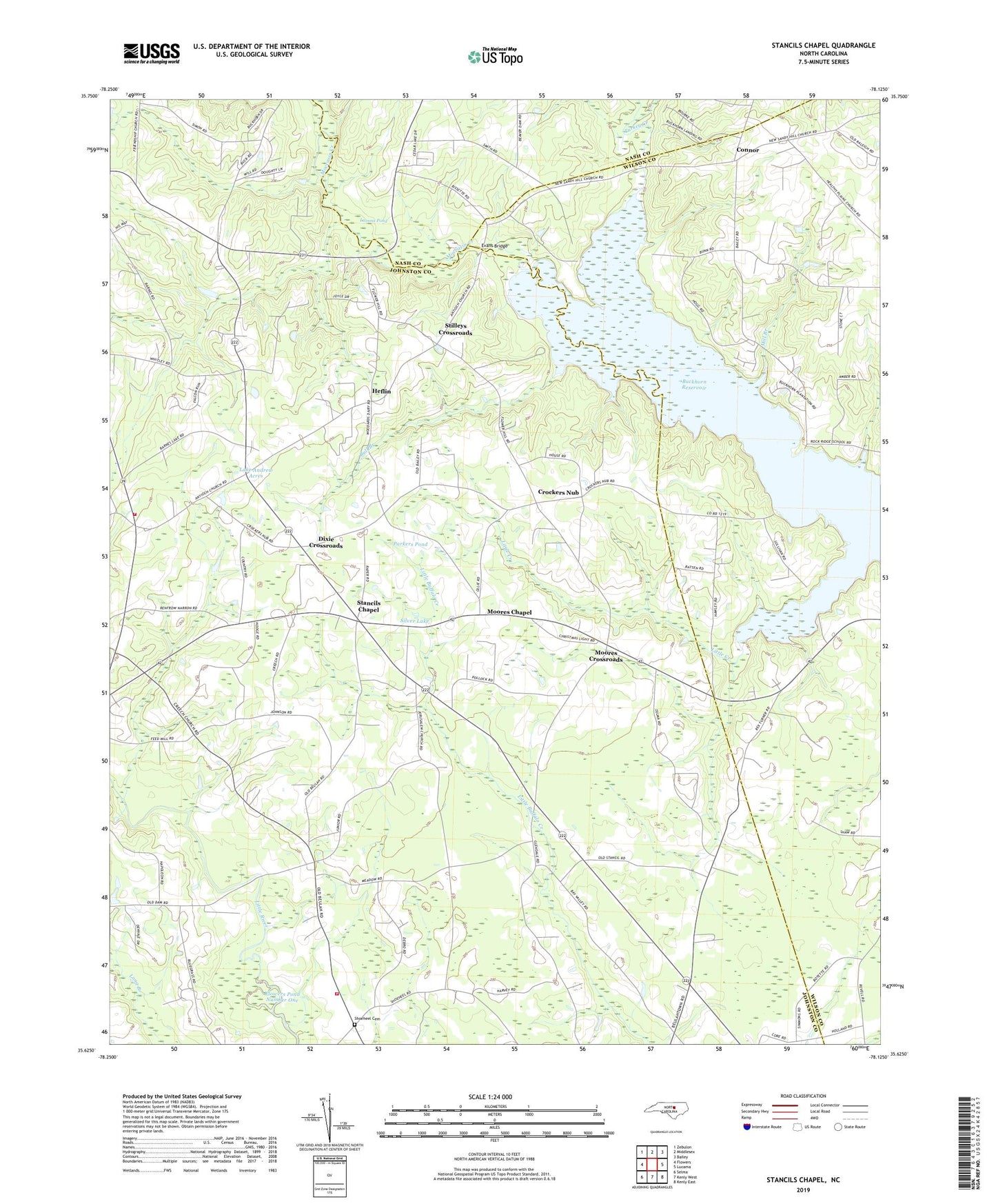
2022 topographic map quadrangle Stancils Chapel in the state of North Carolina. Scale: 1:24000. Based on the newly updated USGS 7.5' US Topo map series, this map is in the following counties: Johnston, Wilson, Nash. The map contains contour data, water features, and other items you are used to seeing on USGS maps, but also has updated roads and other features. This is the next generation of topographic maps. Printed on high-quality waterproof paper with UV fade-resistant inks.
Quads adjacent to this one:
West: Flowers
Northwest: Zebulon
North: Middlesex
Northeast: Bailey
East: Lucama
Southeast: Kenly East
South: Kenly West
Southwest: Selma
This map covers the same area as the classic USGS quad with code o35078f2.
Contains the following named places: Antioch Church, Antioch Volunteer Fire Department, Beaverdam Creek, Bethany Church, Bethany Volunteer Fire Department, Buckhorn Reservoir, Bull Branch, Center Ridge Church, Connor, Creechs Church, Crockers Nub, Dixie Crossroads, Evans Bridge, Flowers Pond Number One, Heflin, Lake Andrew Acres, Lamms Pond, Little Creek, Little River Picnic Area, Mill Branch, Mizpah Church, Moccasin Creek, Moores Chapel, Moores Crossroads, Mount Zion Church, New Jerusalem Church, Oak Grove Church, Pleasant Grove Church, Saint James Church, Saint Pauls Church, Shoeheel, Shoeheel Cemetery, Silver Lake, Southern Grove Church, Stancil Chapel, Stancils Chapel, Stilleys Crossroads, Sylvia Chapel, Township of O'Neals, Turkey Creek, Union Chapel, White Oak Church, Williamson Chapel