MyTopo
Forest City North Carolina US Topo Map
Couldn't load pickup availability
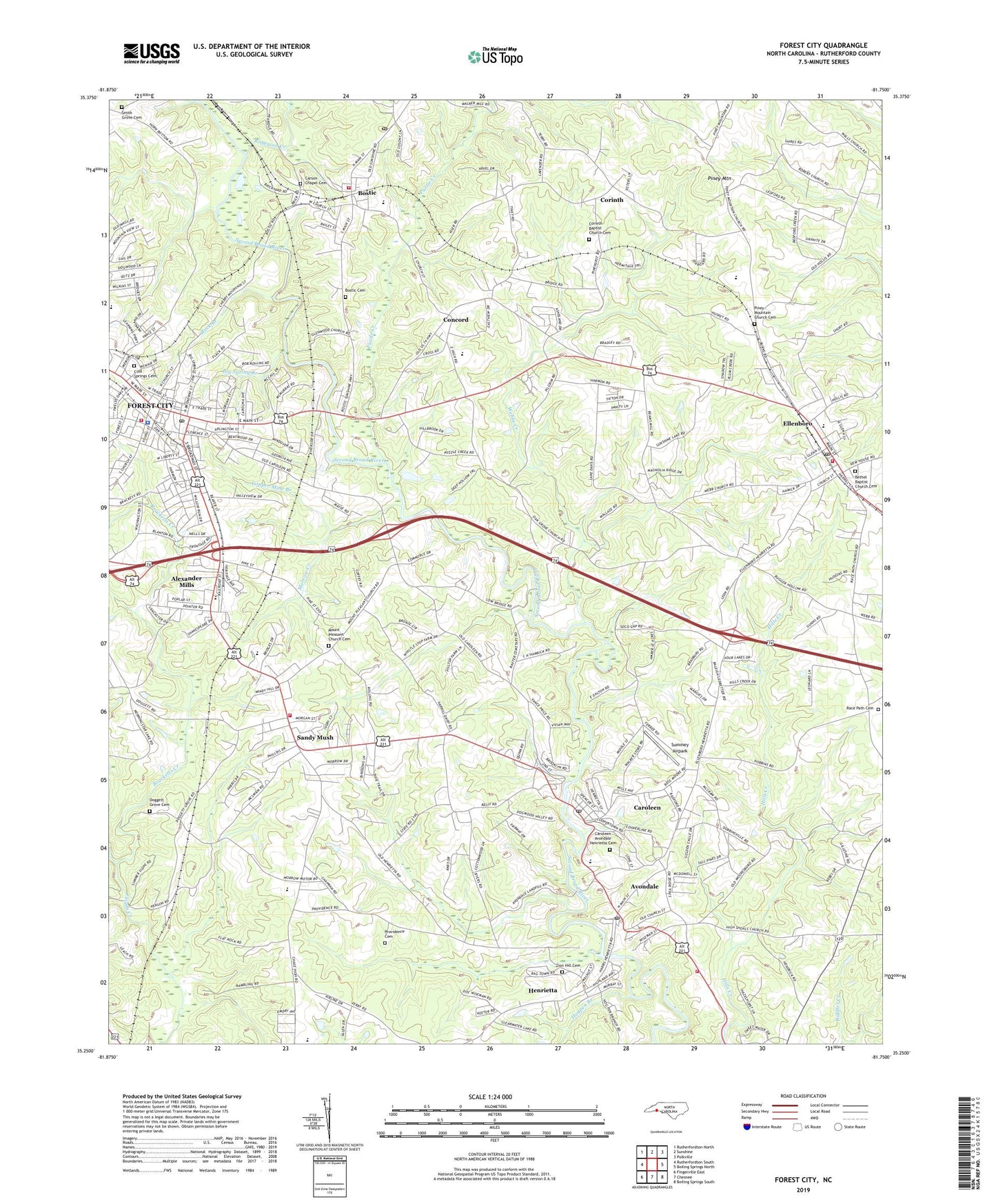
2019 topographic map quadrangle Forest City in the state of North Carolina. Scale: 1:24000. Based on the newly updated USGS 7.5' US Topo map series, this map is in the following counties: Rutherford. The map contains contour data, water features, and other items you are used to seeing on USGS maps, but also has updated roads and other features. This is the next generation of topographic maps. Printed on high-quality waterproof paper with UV fade-resistant inks.
Quads adjacent to this one:
West: Rutherfordton South
Northwest: Rutherfordton North
North: Sunshine
Northeast: Polkville
East: Boiling Springs North
Southeast: Boiling Springs South
Contains the following named places: Alexander Elementary School, Alexander Mills, Avondale, Avondale Methodist Church, Avondale-Henrietta School, Beamans Mill, Bethel Baptist Church Cemetery, Bethel Church, Big Spring Branch, Bostic, Bostic Cemetery, Bostic Elementary School, Bostic Post Office, Bostic Volunteer Fire Department, Bracketts Creek, Buck Branch, Caroleen, Caroleen Avondale Henrietta Cemetery, Caroleen Census Designated Place, Caroleen Post Office, Carson Chapel, Carson Chapel Cemetery, Catheys Creek, Chase High School, Cliffside Area Volunteer Fire Department Substation, Cliffside Junction, Concord, Concord Baptist Church, Concord Church, Cone Mills Lake, Cone Mills Lake Dam, Cool Spring High School, Cool Springs Cemetery, Copper Mine Branch, Corinth, Corinth Baptist Church Cemetery, Doggett Grove Cemetery, Doggett Grove Church, Doggetts Store, Dogwood Valley Golf Club, East Rutherford High School, Ellenboro, Ellenboro Elementary School, Ellenboro Post Office, Ellenboro Presbyterian Church, Ellenboro Volunteer Fire Department, Forest City, Forest City Elementary School, Forest City Fire Department, Forest City Police Department, Forest City Post Office, Freewill Church, Friendship Church, Glenwood Church, Haynes Memorial Church, Henrietta, Henrietta Census Designated Place, Henrietta Post Office, High Shoals Church, Hillcrest Church, Hogpen Branch, Horne Shopping Center, Morrow Creek, Mount Pisgah Church, Mount Pleasant Church, Mount Pleasant Church Cemetery, New Zion Church, Oak Grove Church, Oak Grove School, Pinehurst School, Piney Mountain, Piney Mountain Church, Piney Mountain Church Cemetery, Proctor School, Providence Cemetery, Providence Church, Puzzle Creek, Race Path Cemetery, Race Path Church, River Hills, Roberson Creek, Rutherford County Rescue Crew, Sandy Mush, Sandy Mush Volunteer Fire Department, Smith Grove Cemetery, Smith Grove Church, Summey Airpark, Town of Bostic, Town of Ellenboro, Town of Forest City, Township of Colfax, Township of Cool Spring, Tri-Community Elementary School, Walkers Mill, Webbs Chapel, Webbs Creek, Westside Rest Home, Zion Hill Cemetery, Zion Hill Church, ZIP Codes: 28019, 28043, 28076