MyTopo
Rutherfordton North North Carolina US Topo Map
Couldn't load pickup availability
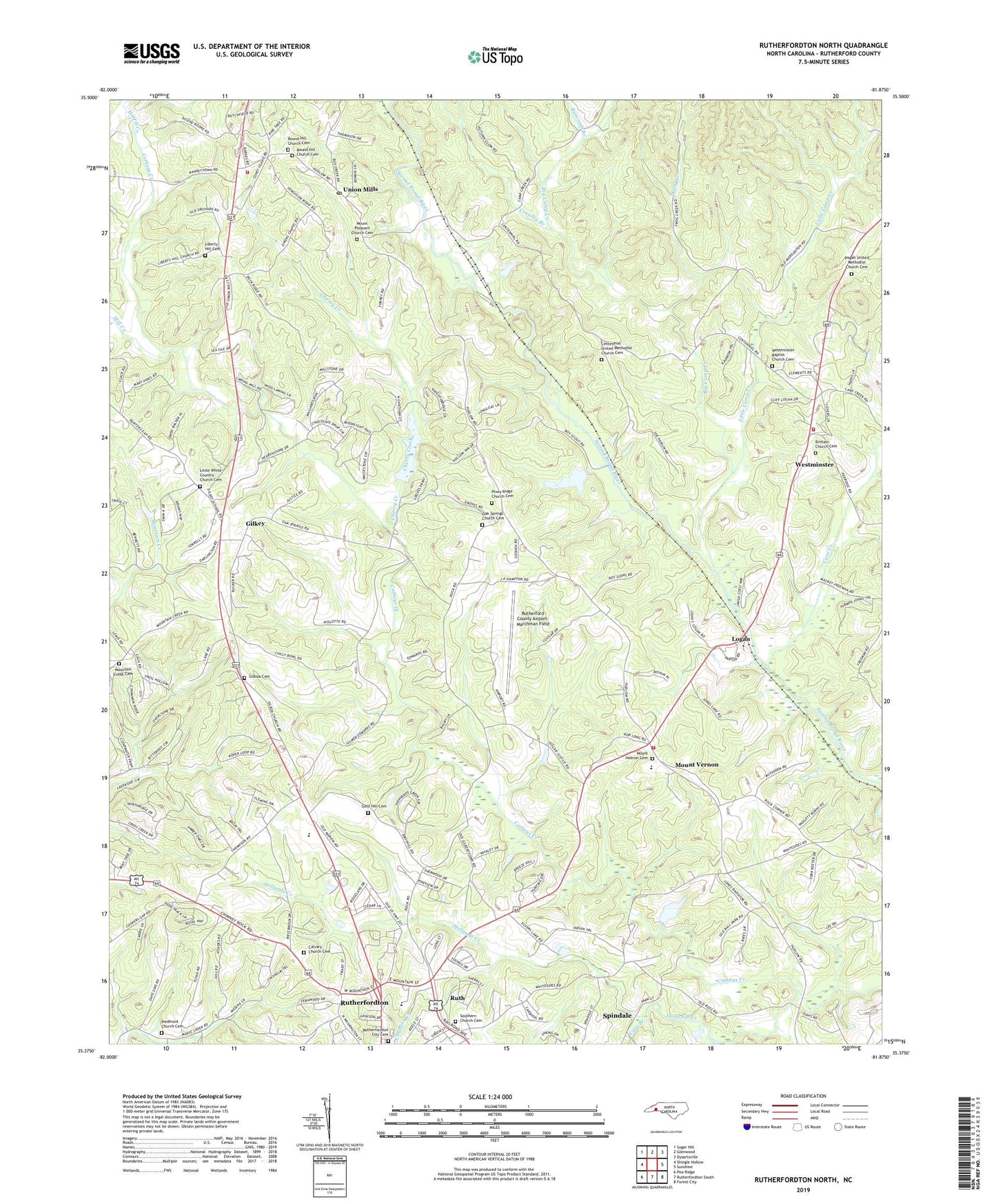
2022 topographic map quadrangle Rutherfordton North in the state of North Carolina. Scale: 1:24000. Based on the newly updated USGS 7.5' US Topo map series, this map is in the following counties: Rutherford. The map contains contour data, water features, and other items you are used to seeing on USGS maps, but also has updated roads and other features. This is the next generation of topographic maps. Printed on high-quality waterproof paper with UV fade-resistant inks.
Quads adjacent to this one:
West: Shingle Hollow
Northwest: Sugar Hill
North: Glenwood
Northeast: Dysartsville
East: Sunshine
Southeast: Forest City
South: Rutherfordton South
Southwest: Pea Ridge
This map covers the same area as the classic USGS quad with code o35081d8.
Contains the following named places: Alexander School, Big Camp Creek, Brittain Cemetery, Brittain Presbyterian Church, Brittain School, Buncomb Branch, Calvary Church, Calvary Church Cemetery, Cane Creek, Case Branch, Centennial Church, Centennial United Methodist Church Cemetery, Cherry Creek, Crawley Branch, Fernwood, Frog Creek, Gilboa Cemetery, Gilboa Methodist Church, Gilkey, Gilkey Elementary School, Gold Hill Cemetery, Gold Hill Church, Grace Bible Church, Grace Tabernacle, Harmon, Harris Creek, Hollands Creek, Hudlow Fire and Rescue Department Station 1, Hudlow Volunteer Fire Department Station 2, Liberty Hill Cemetery, Little Camp Creek, Little White Country Church Cemetery, Logan, Mill Creek, Mitchell Chapel, Mount Hebron Church, Mount Hebron United Methodist Church Graveyard, Mount Pisgah, Mount Pleasant Church, Mount Pleasant Church Cemetery, Mount Vernon, Mount Vernon Baptist Church, Mount Vernon Elementary School, Mountain Creek Cemetery, Mountain Creek Church, Oak Springs Church, Oak Springs Church Cemetery, Owens Chapel, Piedmont Church, Piedmont Church Cemetery, Piney Ridge Church, Piney Ridge Church Cemetery, Pisgah Church, Pisgah United Methodist Church Cemetery, Round Hill Church, Round Hill Church Cemetery, Ruth, Ruth Elementary School, Rutherford County, Rutherford County Airport-Marchman Field, Rutherfordton City Cemetery, Southern Church, Southern Church Cemetery, Tate, The Bible Tabernacle, The Little White Country Church, Thermal Valley, Town of Ruth, Township of Camp Creek, Township of Gilkey, Tryon County, Union Mills, Union Mills Post Office, Union Mills Presbyterian Church, Union Mills Volunteer Fire Department, Watkins School, WCAB-AM (Rutherfordton), Westminister Church, Westminster, Westminster Baptist Church Cemetery, Westminster School