MyTopo
Polkville North Carolina US Topo Map
Couldn't load pickup availability
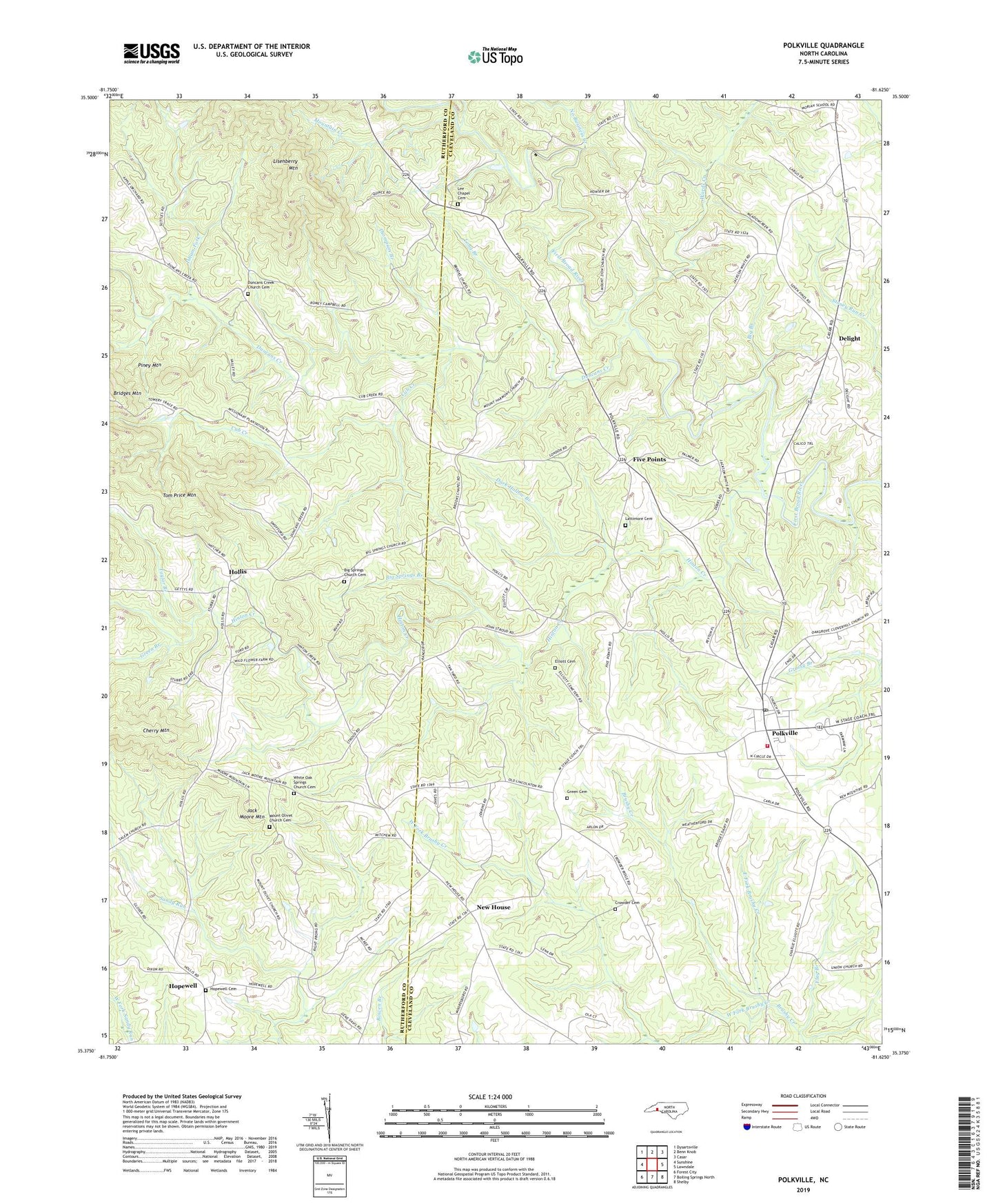
2022 topographic map quadrangle Polkville in the state of North Carolina. Scale: 1:24000. Based on the newly updated USGS 7.5' US Topo map series, this map is in the following counties: Cleveland, Rutherford. The map contains contour data, water features, and other items you are used to seeing on USGS maps, but also has updated roads and other features. This is the next generation of topographic maps. Printed on high-quality waterproof paper with UV fade-resistant inks.
Quads adjacent to this one:
West: Sunshine
Northwest: Dysartsville
North: Benn Knob
Northeast: Casar
East: Lawndale
Southeast: Shelby
South: Boiling Springs North
Southwest: Forest City
This map covers the same area as the classic USGS quad with code o35081d6.
Contains the following named places: Allen Crowder Cemetery, Big Branch, Big Springs Branch, Big Springs Church, Big Springs Church Cemetery, Brooks Chapel, Brooks Chapel School, City of Polkville, Cleveland Airport, Cleveland County Emergency Medical Services Station 13, Cleveland Mills, Clover Hill Church, Cub Creek, Dark Hollow Branch, Daves Mill, Delight, Duncans Creek, Duncans Creek Church Cemetery, Duncans Creek Presbyterian Church, East Fork Brushy Creek, Elliott Church, Five Points, Flag Branch, Flint Hill, Green Branch, Green Cemetery, Hinton Creek, Hollis, Hollis Methodist Church, Hollis School, Holly Rush, Hopewell, Hopewell Cemetery, Hopewell Church, Isham Fork, Jack Moore Mountain, Lattimore Cemetery, Lee Chapel, Lee Chapel Cemetery, Lisenberry Mountain, Long Branch, Morris Memorial Church, Mount Harmony Church, Mount Olivet Church, Mount Olivet Church Cemetery, Mount Zion Church, Mountain Creek, New House, No Business Creek, Palmers Grove Church, Palmers Grove School, Parker Branch, Piney Mountain, Polkville, Polkville Post Office, Polkville School, Polkville Township 8, Polkville Volunteer Fire Department, Sandy Plains Baptist Church, Taylor Branch, Thompson Branch, Tom Price Mountain, Township of Duncans Creek, Wards Creek, West Fork Brushy Creek, White Oak Springs Church, White Oak Springs Church Cemetery