
MyTopo
Fort Landing North Carolina US Topo Map
Couldn't load pickup availability
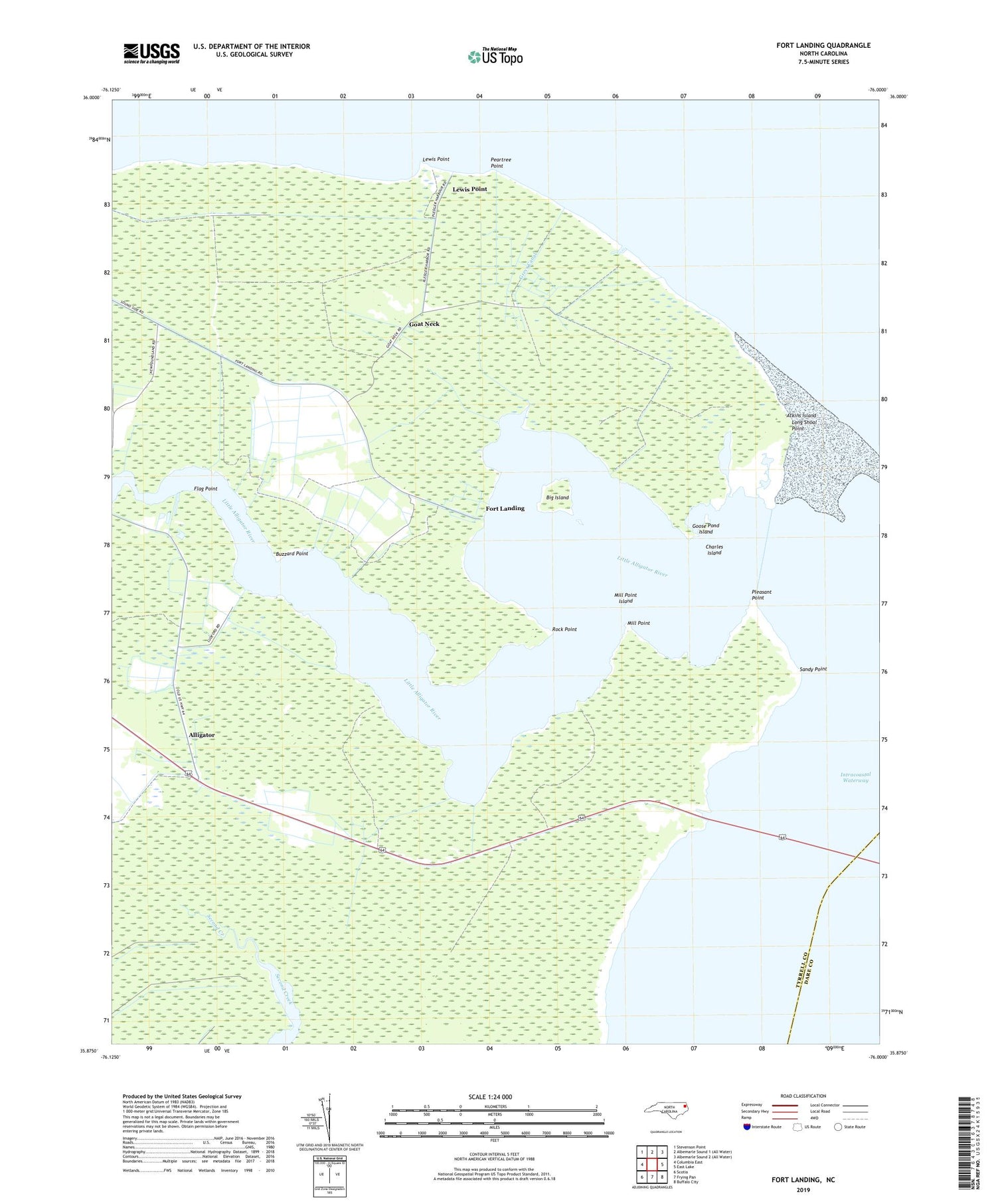
2019 topographic map quadrangle Fort Landing in the state of North Carolina. Scale: 1:24000. Based on the newly updated USGS 7.5' US Topo map series, this map is in the following counties: Tyrrell, Dare. The map contains contour data, water features, and other items you are used to seeing on USGS maps, but also has updated roads and other features. This is the next generation of topographic maps. Printed on high-quality waterproof paper with UV fade-resistant inks.
Quads adjacent to this one:
West: Columbia East
Northwest: Stevenson Point
East: East Lake
Southeast: Buffalo City
South: Frying Pan
Southwest: Scotia
Contains the following named places: Alligator, Alligator Chapel, Atkins Island, Big Island, Buzzard Point, Charles Island, Flag Point, Fort Landing, Goat Neck, Goose Pond, Goose Pond Island, Greys Canal, Lewis Point, Little Alligator River, Log Landing, Long Shoal Point, Mill Point, Mill Point Island, Miller Landing, Mount Maria Church, Peartree Point, Pleasant Point, Pledger Landing, Rock Point, Saint John Church, Sandy Point, Sandy Point Marina, Southshore Landing, Township of Alligator, Wesley Chapel, WTHD-FM (Columbia)


