MyTopo
East Lake North Carolina US Topo Map
Couldn't load pickup availability
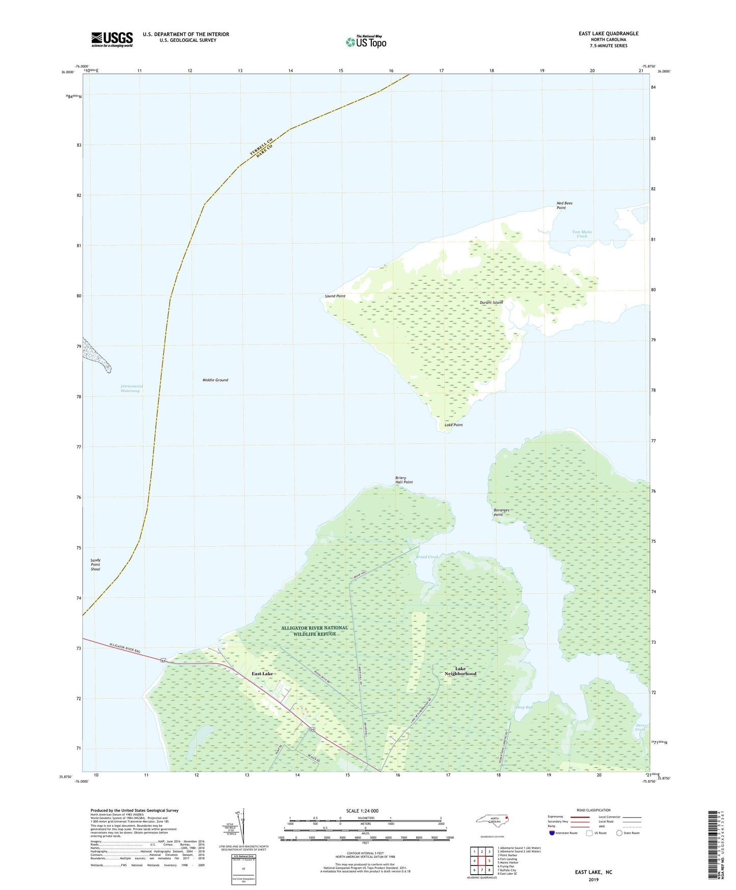
2022 topographic map quadrangle East Lake in the state of North Carolina. Scale: 1:24000. Based on the newly updated USGS 7.5' US Topo map series, this map is in the following counties: Dare, Tyrrell. The map contains contour data, water features, and other items you are used to seeing on USGS maps, but also has updated roads and other features. This is the next generation of topographic maps. Printed on high-quality waterproof paper with UV fade-resistant inks.
Quads adjacent to this one:
West: Fort Landing
Northeast: Point Harbor
East: Manns Harbor
Southeast: East Lake SE
South: Buffalo City
Southwest: Frying Pan
This map covers the same area as the classic USGS quad with code o35075h8.
Contains the following named places: Alligator River, Boranges Point, Briery Hall Point, Broad Creek, Deep Bay, Deer Creek, Durant Island, East Lake, East Lake Landing, Lake Neighborhood, Lake Point, Middle Ground, Ned Bees Point, Sandy Point Shoal, Sound Point, South Lake, Tom Mann Creek