MyTopo
Fountain North Carolina US Topo Map
Couldn't load pickup availability
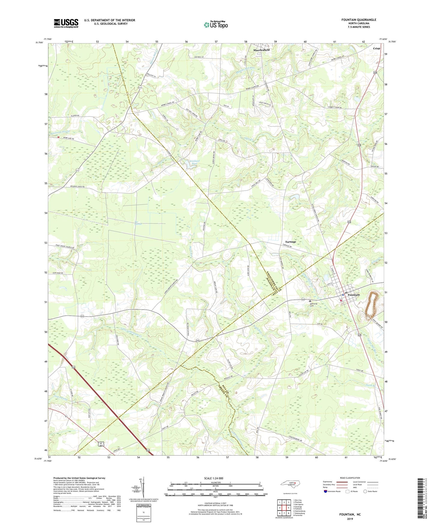
2019 topographic map quadrangle Fountain in the state of North Carolina. Scale: 1:24000. Based on the newly updated USGS 7.5' US Topo map series, this map is in the following counties: Wilson, Edgecombe, Pitt, Greene. The map contains contour data, water features, and other items you are used to seeing on USGS maps, but also has updated roads and other features. This is the next generation of topographic maps. Printed on high-quality waterproof paper with UV fade-resistant inks.
Quads adjacent to this one:
West: Saratoga
Northwest: Elm City
North: Pinetops
Northeast: Old Sparta
East: Falkland
Southeast: Farmville
South: Walstonburg
Southwest: Stantonsburg
Contains the following named places: Aspen Grove Church, Baker Town Fire Department, Carraway Church, Fountain, Fountain Police Department, Fountain Post Office, Fountain Quarry, Fountain Rescue and Emergency Medical Services, Fountain Rural Fire Department, Good News Church, Living Hope Church, Memorial Cemetery, Otter Creek Church, Piney Grove Church, Reba, Reid Chapel, Saint James Church, Spring Branch Church, Strickland Pond, Strickland Pond Dam, The Pocosin, Toddy, Town of Fountain, Township 9-Otter Creek, Turnage, Ward Run, Webbs, Webbs Chapel, Webbtown Church, ZIP Code: 27829