MyTopo
Walstonburg North Carolina US Topo Map
Couldn't load pickup availability
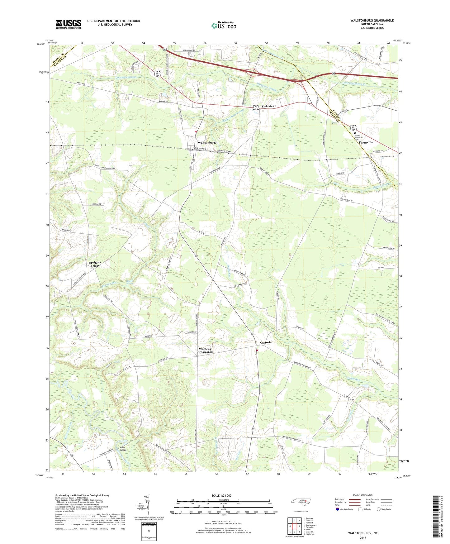
2022 topographic map quadrangle Walstonburg in the state of North Carolina. Scale: 1:24000. Based on the newly updated USGS 7.5' US Topo map series, this map is in the following counties: Greene, Pitt, Wilson. The map contains contour data, water features, and other items you are used to seeing on USGS maps, but also has updated roads and other features. This is the next generation of topographic maps. Printed on high-quality waterproof paper with UV fade-resistant inks.
Quads adjacent to this one:
West: Stantonsburg
Northwest: Saratoga
North: Fountain
Northeast: Falkland
East: Farmville
Southeast: Hookerton
South: Snow Hill
Southwest: Jason
This map covers the same area as the classic USGS quad with code o35077e6.
Contains the following named places: Appie, Castoria, Castoria Fire Department and Emergency Medical Services, Contentnea, Daisy Siding, Fieldsboro, Fieldsboro Post Office, Fools Bridge, Fort Run, Free Union Church, Friendship Church, Herrings Crossroads, Holy Temple Church, Howell Swamp, Howell Swamp Church, Lighter Knot Swamp, Meadow Church, Nahunta Swamp, North Greene School, Saint Delight Church, Speights Bridge, Speights Bridge Post Office, Sunset Memorial Park, Tabernacle Church, Thompson Swamp, Town of Walstonburg, Township of Carrs, Township of Speights Bridge, Walstonburg, Walstonburg Post Office, Walstonburg Rural Fire Department and Emergence Medical Services, Washington Branch Church, Wootens Crossroads, Zecharias Zion Church, ZIP Code: 27888