MyTopo
Falkland North Carolina US Topo Map
Couldn't load pickup availability
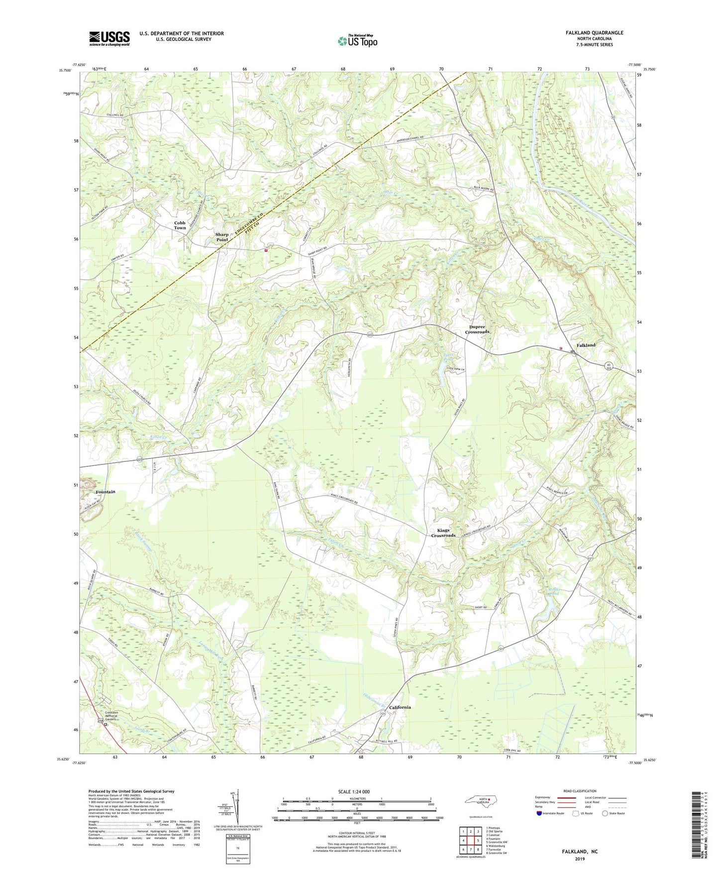
2022 topographic map quadrangle Falkland in the state of North Carolina. Scale: 1:24000. Based on the newly updated USGS 7.5' US Topo map series, this map is in the following counties: Pitt, Edgecombe. The map contains contour data, water features, and other items you are used to seeing on USGS maps, but also has updated roads and other features. This is the next generation of topographic maps. Printed on high-quality waterproof paper with UV fade-resistant inks.
Quads adjacent to this one:
West: Fountain
Northwest: Pinetops
North: Old Sparta
Northeast: Conetoe
East: Greenville NW
Southeast: Greenville SW
South: Farmville
Southwest: Walstonburg
This map covers the same area as the classic USGS quad with code o35077f5.
Contains the following named places: Andrews Church, California, Cobb Town, Crestlawn Memorial Gardens, Dildas Grove Church, Dildys Chapel, Dupree Crossroads, Dupree Landing, Edgewood Church, Edson Millpond, Falkland, Falkland Fire Department, Falkland Post Office, Falkland Rescue Squad, Harris Millpond, Kings Crossroads, Kitten Creek, Langs Mill Run, Lawrence Run, Monk Memorial Church, Monks Pond, Monts Pond Dam, Otter Creek Church, Saint Johns Church, Saint Peters Church, Seven Holly Church, Sharp Point, Sharp Point Volunteer Fire Department, Town of Falkland, Township of Falkland, Township of Fountain, Tucker Farms, Tugwell, Tyers Pond, Tyers Pond Dam, Union Grove Church, Vines Landing, Whiskey Branch, ZIP Code: 27827