MyTopo
Garland North Carolina US Topo Map
Couldn't load pickup availability
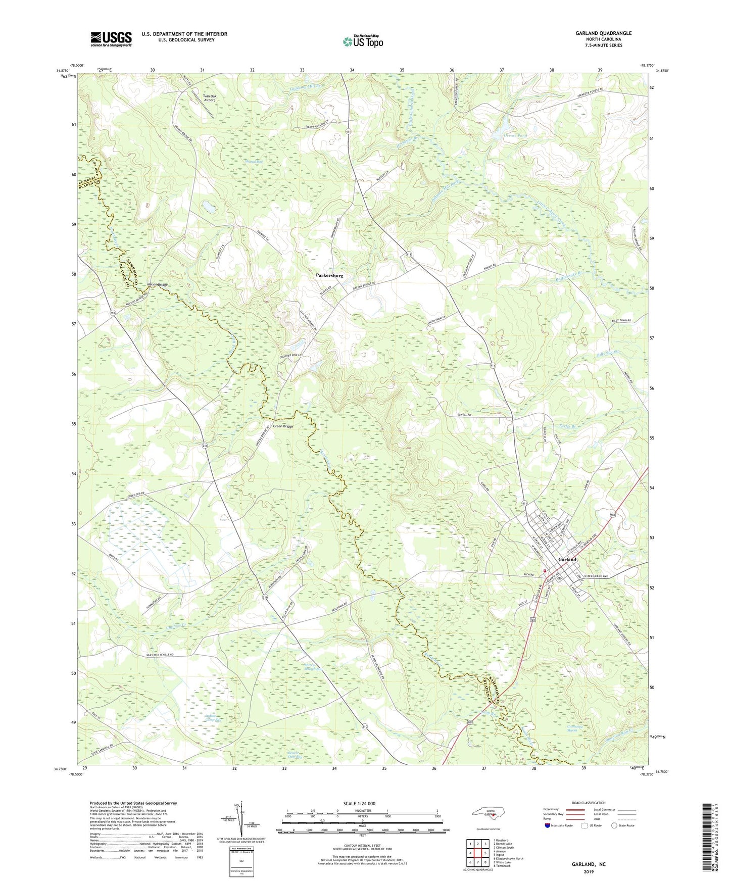
2019 topographic map quadrangle Garland in the state of North Carolina. Scale: 1:24000. Based on the newly updated USGS 7.5' US Topo map series, this map is in the following counties: Sampson, Bladen, Cumberland. The map contains contour data, water features, and other items you are used to seeing on USGS maps, but also has updated roads and other features. This is the next generation of topographic maps. Printed on high-quality waterproof paper with UV fade-resistant inks.
Quads adjacent to this one:
West: Ammon
Northwest: Roseboro
North: Bonnetsville
Northeast: Clinton South
East: Ingold
Southeast: Tomahawk
South: White Lake
Southwest: Elizabethtown North
Contains the following named places: Antioch Church, Cypress Creek, Cypress Creek Church, Derose Pond, Derose Pond Dam, Dismal Bay, Ebenezer Church, Evening Light Church, Galilee Church, Garland, Garland Church, Garland Elementary School, Garland Fire Department, Garland Police Department, Garland Post Office, Garland Rescue and Emergency Medical Services, Grace Church, Green Bridge, Horsepen Branch, Indian Camp Bay, Johnson Mill Race, Long Branch, Marry Branch Bay, Melvin Bridge, Miller Chapel, Mount Elam Church, Parkersburg, Peters Creek, Rattlesnake Branch, Sinai Church, Smith Chapel, Town of Garland, Township of Cypress Creek, Twin Oak Airport, ZIP Code: 28441