MyTopo
Grassy Creek North Carolina US Topo Map
Couldn't load pickup availability
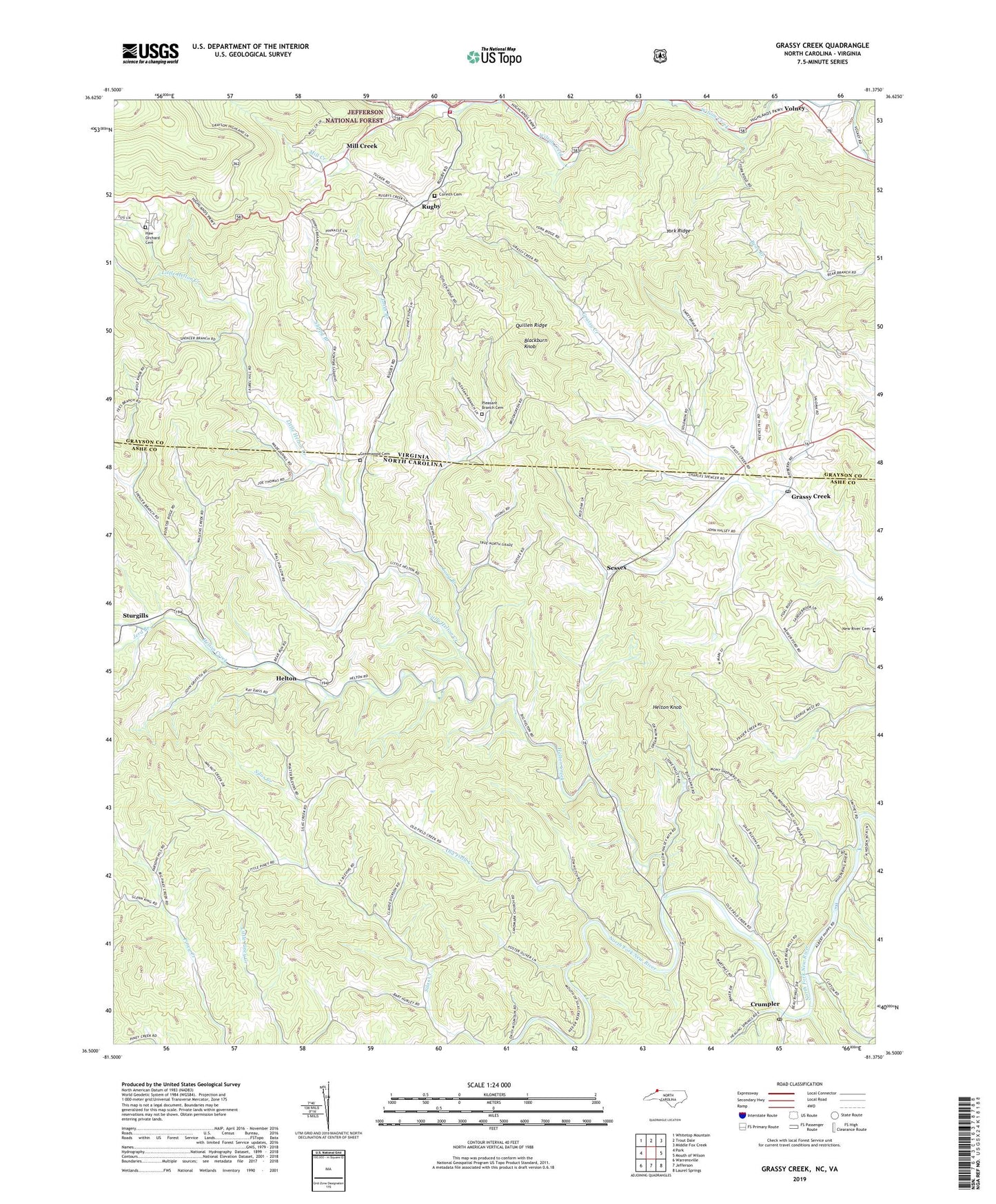
2019 topographic map quadrangle Grassy Creek in the states of North Carolina, Virginia. Scale: 1:24000. Based on the newly updated USGS 7.5' US Topo map series, this map is in the following counties: Ashe, Grayson. The map contains contour data, water features, and other items you are used to seeing on USGS maps, but also has updated roads and other features. This is the next generation of topographic maps. Printed on high-quality waterproof paper with UV fade-resistant inks.
Quads adjacent to this one:
West: Park
Northwest: Whitetop Mountain
North: Trout Dale
Northeast: Middle Fox Creek
Southeast: Laurel Springs
South: Jefferson
Southwest: Warrensville
Contains the following named places: Blackburn Knob, Brier Run, Corinth Cemetery, Corinth Church, Crumpler, Crumpler Post Office, Grassy Creek, Grassy Creek Post Office, Grayson Highlands State Park, Greenwood Cemetery, Greenwood Church, Haw Orchard, Haw Orchard Cemetery, Healing Springs Church, Healing Springs School, Helton, Helton Ambulance Service, Helton Church, Helton Creek, Helton Knob, Helton School, Jerd Branch, Jones Branch, Landmark Church, Laurel Hill Church, Liberty Church, Little Helton Church, Little Helton Creek, Little Helton School, Little Piney Church, Long Branch, Mill Creek, Mill Creek School, Millpond Branch, New River Cemetery, New River Church, Old Field Creek, Pleasant Branch Cemetery, Pleasant Branch Church, Pleasant Home Church, Pleasant Valley Church, Quillen Ridge, Rugby, Rugby Fire and Rescue Department, Saint Johns Church, Sessex, Shippy Branch, Silas Creek Church, Sturgills, Township of Grassy Creek, Township of Helton, Trinity Church, Virginia-North Carolina School, Volney Church, Wolf Knob Church, Wolf Knob School, York Ridge, York Ridge School, ZIP Codes: 24363, 28631