MyTopo
Laurel Springs North Carolina US Topo Map
Couldn't load pickup availability
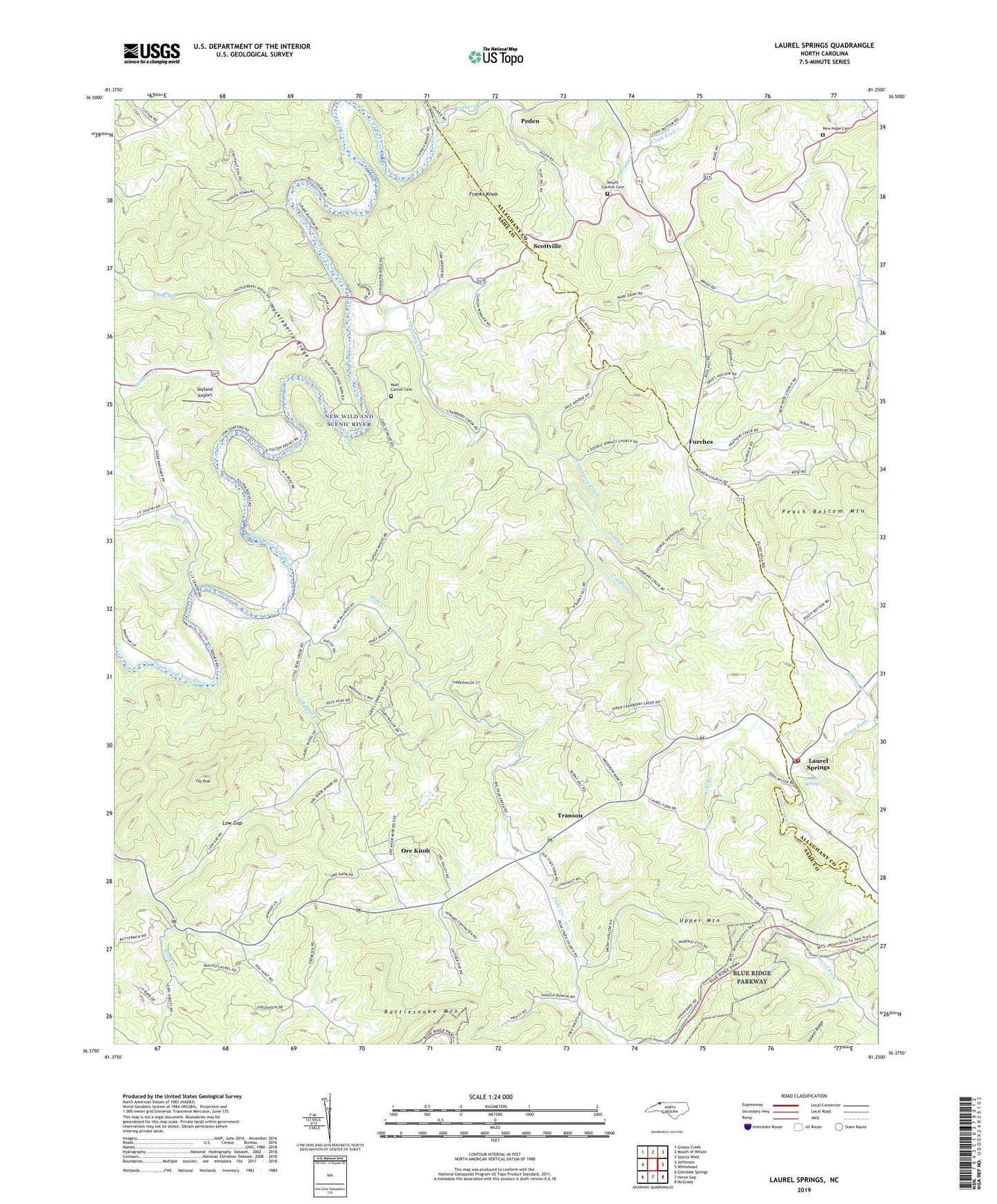
2022 topographic map quadrangle Laurel Springs in the state of North Carolina. Scale: 1:24000. Based on the newly updated USGS 7.5' US Topo map series, this map is in the following counties: Ashe, Alleghany, Wilkes. The map contains contour data, water features, and other items you are used to seeing on USGS maps, but also has updated roads and other features. This is the next generation of topographic maps. Printed on high-quality waterproof paper with UV fade-resistant inks.
Quads adjacent to this one:
West: Jefferson
Northwest: Grassy Creek
Northeast: Sparta West
East: Whitehead
Southeast: McGrady
South: Horse Gap
Southwest: Glendale Springs
This map covers the same area as the classic USGS quad with code o36081d3.
Contains the following named places: Beaver Branch, Belview Church, Church Mill, Crab Fork, Cranberry Creek, Cranberry Primitive Baptist Church, Ebenezer Church, Franks Knob, Furches, Huckleberry Ridge, Irwin Mill, Laurel Fork, Laurel Springs, Laurel Springs Baptist Church, Laurel Springs Post Office, Laurel Springs School, Laurel Springs Volunteer Fire Department, Liberty Hill Church, Little Peak Creek, Long Branch, Low Gap, Low Gap Church, Maines Mill, Matt Carson Cemetery, Meadow Fork, Mount Carmel Cemetery, Mount Carmel Church of the Brethren, Nathans Creek, New Hope, New Hope Baptist Church, New Hope Cemetery, New Wild and Scenic River, Ore Knob, Peak Creek, Peak Creek Church of the Brethren, Peden, Perry Mill, Piney Branch, Piney Fork, Pleasant Valley Church, Prathers Creek, Pruitt Mill, Pugh Mill, Rattlesnake Mountain, Reeves Branch, Roan Creek Church, Scottville, Silas Branch, Skyland Airport, The Peak, Township of Chestnut Hill, Township of Peak Creek, Township of Prathers Creek, Transou, Transou Church, Upper Mountain, Weaver Mill, Wolf Branch, ZIP Codes: 28617, 28644, 28672