MyTopo
Hatteras North Carolina US Topo Map
Couldn't load pickup availability
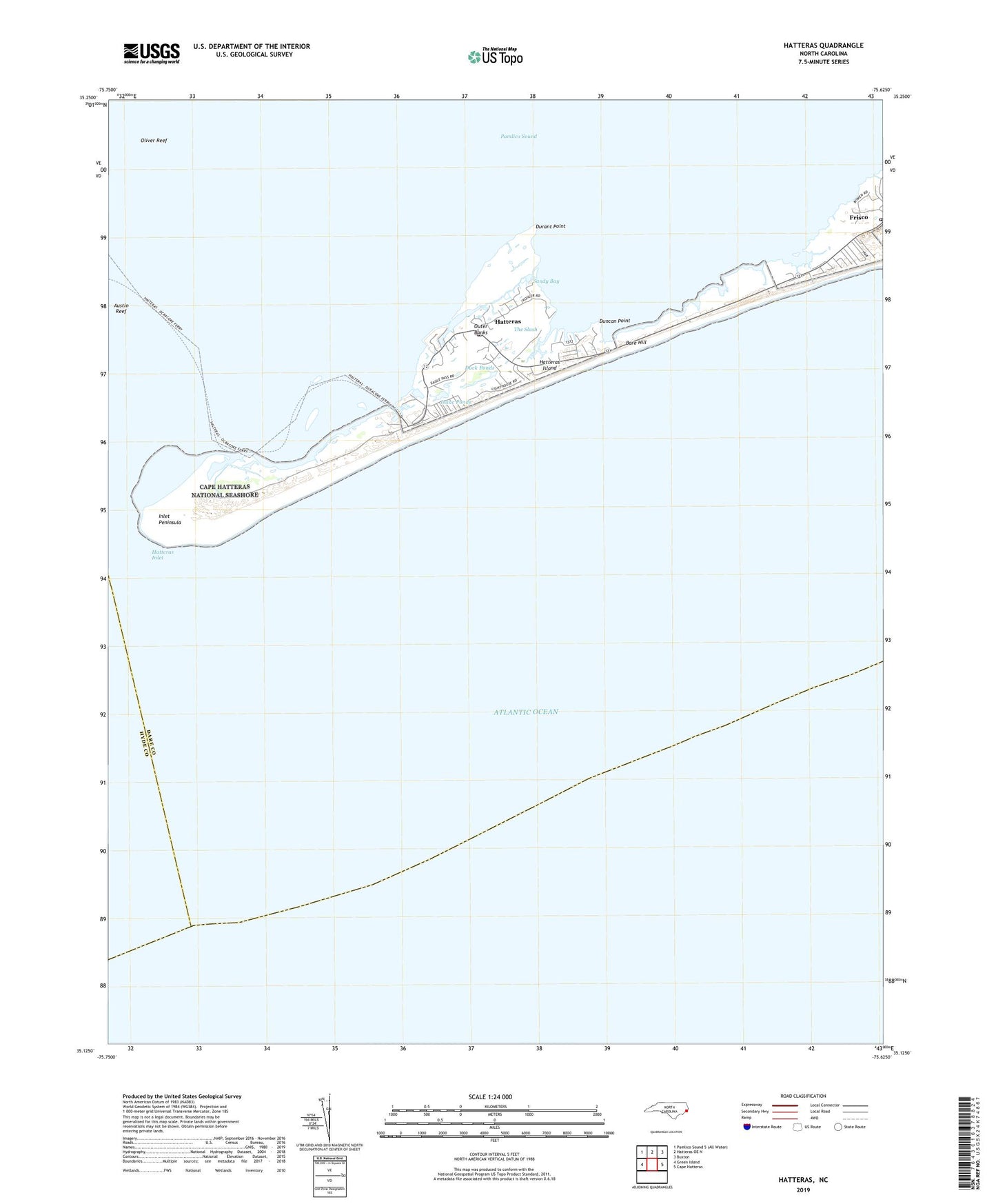
2022 topographic map quadrangle Hatteras in the state of North Carolina. Scale: 1:24000. Based on the newly updated USGS 7.5' US Topo map series, this map is in the following counties: Dare, Hyde. The map contains contour data, water features, and other items you are used to seeing on USGS maps, but also has updated roads and other features. This is the next generation of topographic maps. Printed on high-quality waterproof paper with UV fade-resistant inks.
Quads adjacent to this one:
West: Green Island
North: Hatteras OE N
Northeast: Buxton
East: Cape Hatteras
This map covers the same area as the classic USGS quad with code o35075b6.
Contains the following named places: Austin Creek, Austin Reef, Bare Hill, Barney Slue Beacon, Coast Guard Station Hatteras Inlet, Cross Shoal Beacon, Dare County Sheriff's District Office, Duck Ponds, Duncan Point, Durant Point, Fort Clark, Fort Hatteras, Fort Totten, Frisco, Frisco Post Office, Goose Creek, Hatteras, Hatteras Census Designated Place, Hatteras Fire Department, Hatteras Inlet Light, Hatteras Island Free Ferry, Hatteras Post Office, Inlet Peninsula, Isaac Ponds, Isabel Breach, Isabel Inlet, Joe Saur Creek, Little Hatteras Island, Oliver Reef, Rollinson Channel Beacon, Rollinson Channel Light, Sandy Bay, The Slash, ZIP Code: 27943