MyTopo
Hurdle Mills North Carolina US Topo Map
Couldn't load pickup availability
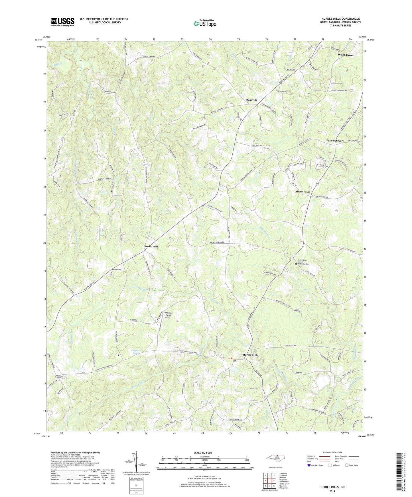
2019 topographic map quadrangle Hurdle Mills in the state of North Carolina. Scale: 1:24000. Based on the newly updated USGS 7.5' US Topo map series, this map is in the following counties: Person. The map contains contour data, water features, and other items you are used to seeing on USGS maps, but also has updated roads and other features. This is the next generation of topographic maps. Printed on high-quality waterproof paper with UV fade-resistant inks.
Quads adjacent to this one:
West: Ridgeville
Northwest: Leasburg
North: Olive Hill
Northeast: Roxboro
East: Timberlake
Southeast: Rougemont
South: Caldwell
Southwest: Cedar Grove
Contains the following named places: Alderidge Creek, Allens Level, Broachs Mill Creek, Bushy Fork, Bushy Fork Creek, Bushy Fork School, Byrds Creek, Clement Cemetery, Clement Missionary Baptist Church, Double Creek, Hurdle Mills, Hurdle Mills Post Office, Hurdle Mills School, Hurdle Mills Volunteer Fire Department Station 2, Lick Creek, Mount Zion United Methodist Cemetery, Mount Zion United Methodist Church, Oak Lane School, Paschall Church, Paynes Tavern, Perry Field, Pine Hill Church, Push, Roseville, Snipe Creek, Thaxton Pond, Thaxton Pond Dam, Township of Bushy Fork, Warrens Grove School, Wheelers Church, Wheelers Primitive Baptist Church Cemetery, Whitfield Farms Airport, Whitfield Pond, Whitfield Pond Dam, Whitfields Store, Whitt Town, Wilderness Church, Youngs Chapel, ZIP Code: 27541