MyTopo
Cedar Grove North Carolina US Topo Map
Couldn't load pickup availability
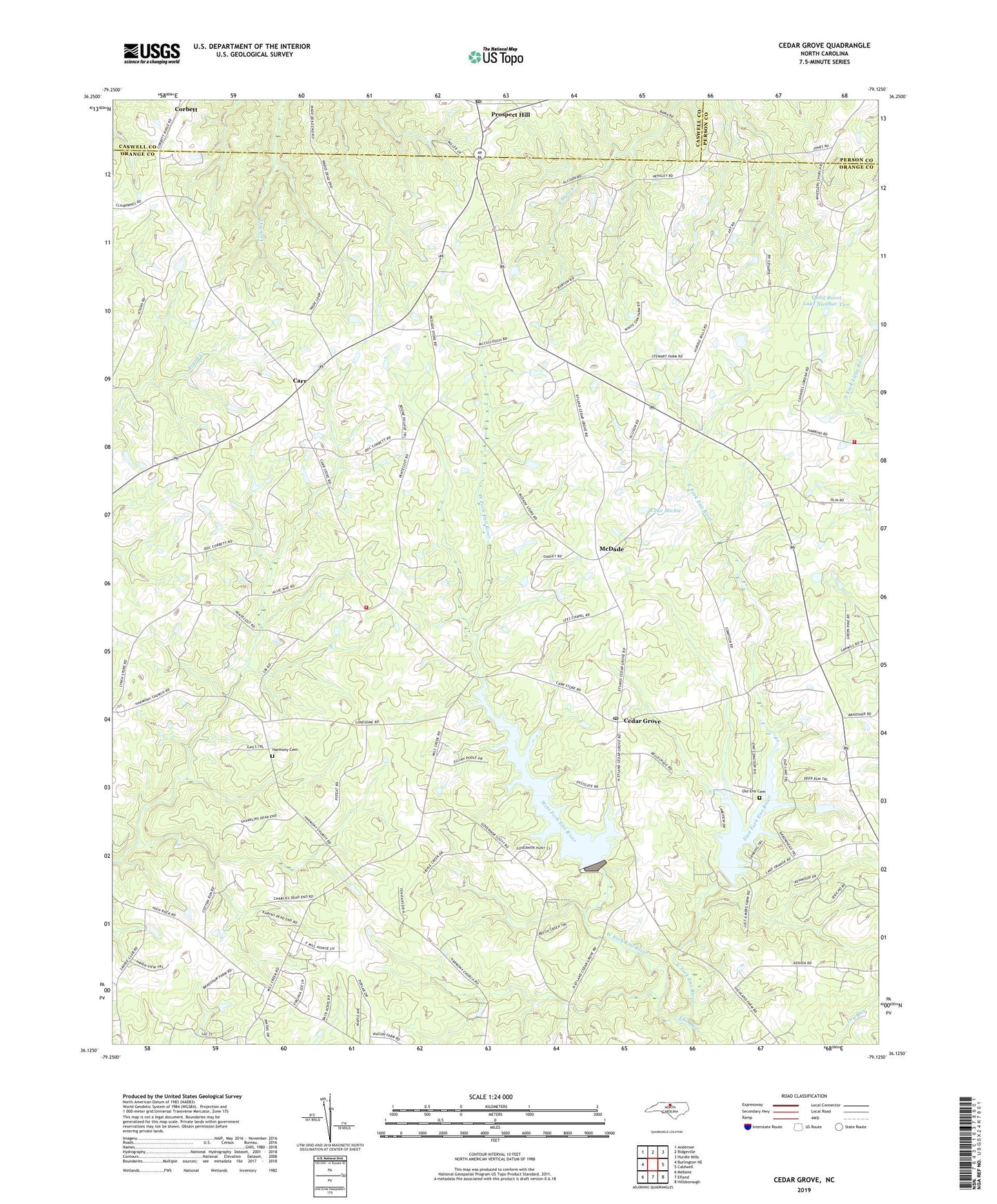
2022 topographic map quadrangle Cedar Grove in the state of North Carolina. Scale: 1:24000. Based on the newly updated USGS 7.5' US Topo map series, this map is in the following counties: Orange, Caswell, Person. The map contains contour data, water features, and other items you are used to seeing on USGS maps, but also has updated roads and other features. This is the next generation of topographic maps. Printed on high-quality waterproof paper with UV fade-resistant inks.
Quads adjacent to this one:
West: Burlington NE
Northwest: Anderson
North: Ridgeville
Northeast: Hurdle Mills
East: Caldwell
Southeast: Hillsborough
South: Efland
Southwest: Mebane
This map covers the same area as the classic USGS quad with code o36079b2.
Contains the following named places: Arrowhead, Arrowhead Lake Dam, Aycock School, Carr, Cedar Grove, Cedar Grove Fire Department, Cedar Grove Fire Department Station 2, Cedar Grove Post Office, Cedar Grove School, Corbett, Deer Run, East Fork Eno River, Eno Church, Five Forks Church, Glass House Creek, Green Pines, Harmony Cemetery, Just-A-Mere Landing, Kenwood Estates, Lake Michie, Lake Orange Dam, Lees Chapel, McDade, Mount Adar Church, Mount Zion Church, Old Eno Cemetery, Prospect Hill, Prospect Hill Post Office, Quail Roost Lake Number Two, Township of Cedar Grove, Walkers Landing, West Fork Eno River, White Oak Grove Church, ZIP Code: 27231