MyTopo
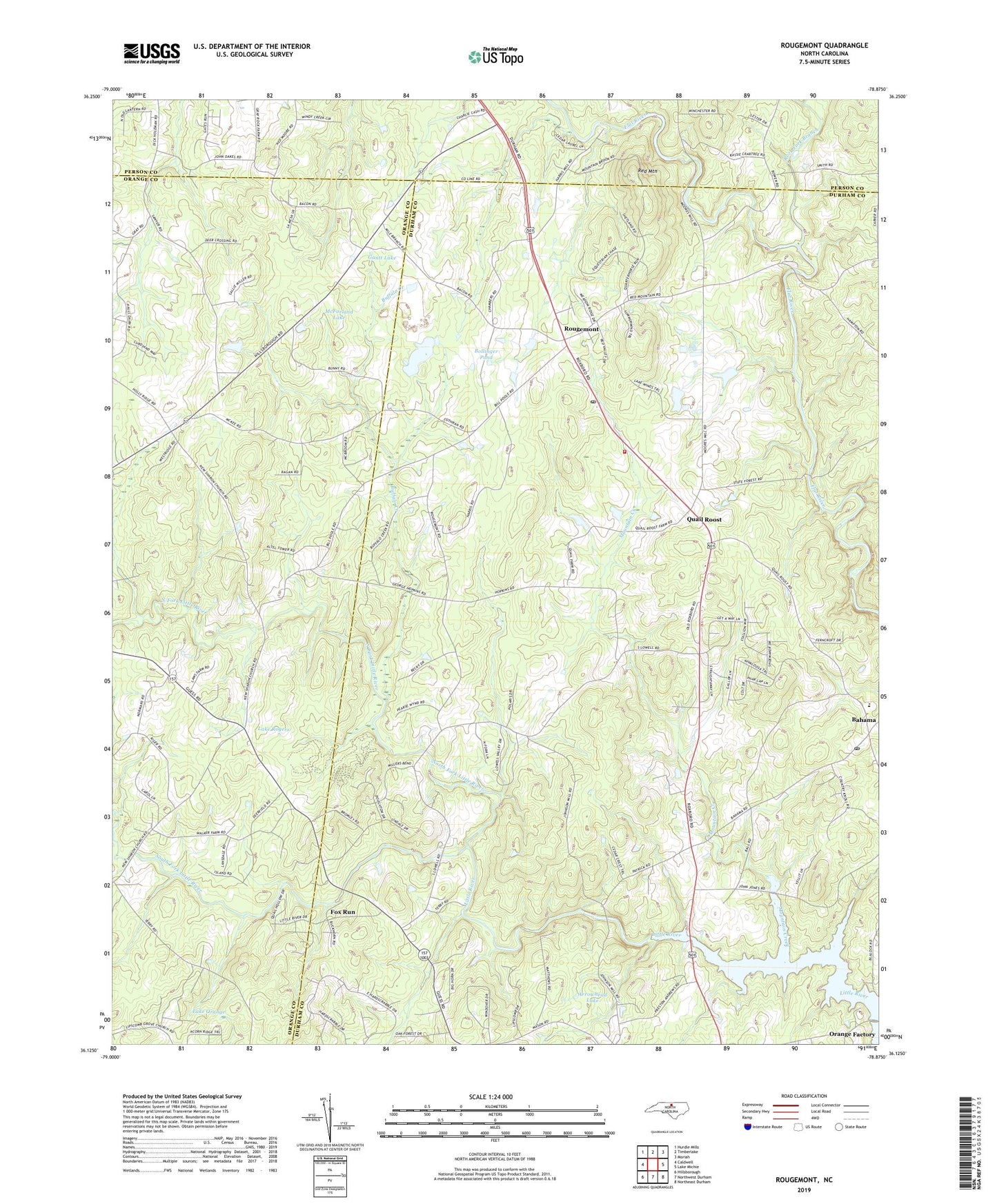
Rougemont North Carolina US Topo Map
Couldn't load pickup availability
2022 topographic map quadrangle Rougemont in the state of North Carolina. Scale: 1:24000. Based on the newly updated USGS 7.5' US Topo map series, this map is in the following counties: Durham, Orange, Person. The map contains contour data, water features, and other items you are used to seeing on USGS maps, but also has updated roads and other features. This is the next generation of topographic maps. Printed on high-quality waterproof paper with UV fade-resistant inks.
Quads adjacent to this one:
West: Caldwell
Northwest: Hurdle Mills
North: Timberlake
Northeast: Moriah
East: Lake Michie
Southeast: Northeast Durham
South: Northwest Durham
Southwest: Hillsborough
This map covers the same area as the classic USGS quad with code o36078b8.
Contains the following named places: Arrowhead Lake, Bahama, Bahama Post Office, Bahama Volunteer Fire Department Station 2, Bartons Mill, Blaylocks Store, Bollinger Pond, Bollinger Pond Dam, Buffalo Creek, Caldmont Lake Dam, Deep Creek, Farlow Field, Fieldstream, Fox Run, Gantt Lake, George K Slocum Forestry Camp, Hunkadora Post Office, Lake Orange, Lake Rogers, Lipscomb Grove Church, Little River School, Lyndover, Mangum School, McFarland Lake, McFarland Lake Dam, Moores Mill, Mountain Creek, New Bethel Church, North Carolina State University Forest, North Fork Little River, Orange Factory, Quail Roost, Quail Roost Lake Dam Number Three, Quail Roost Lake Number One Dam, Quail Roost Lake Number Two Dam, Red Mountain, Red Mountain Church, Rougemont, Rougemont Census Designated Place, Rougemont Post Office, Rougemont Quarry, South Fork Little River, Union Grove Church, ZIP Code: 27503