MyTopo
Olive Hill North Carolina US Topo Map
Couldn't load pickup availability
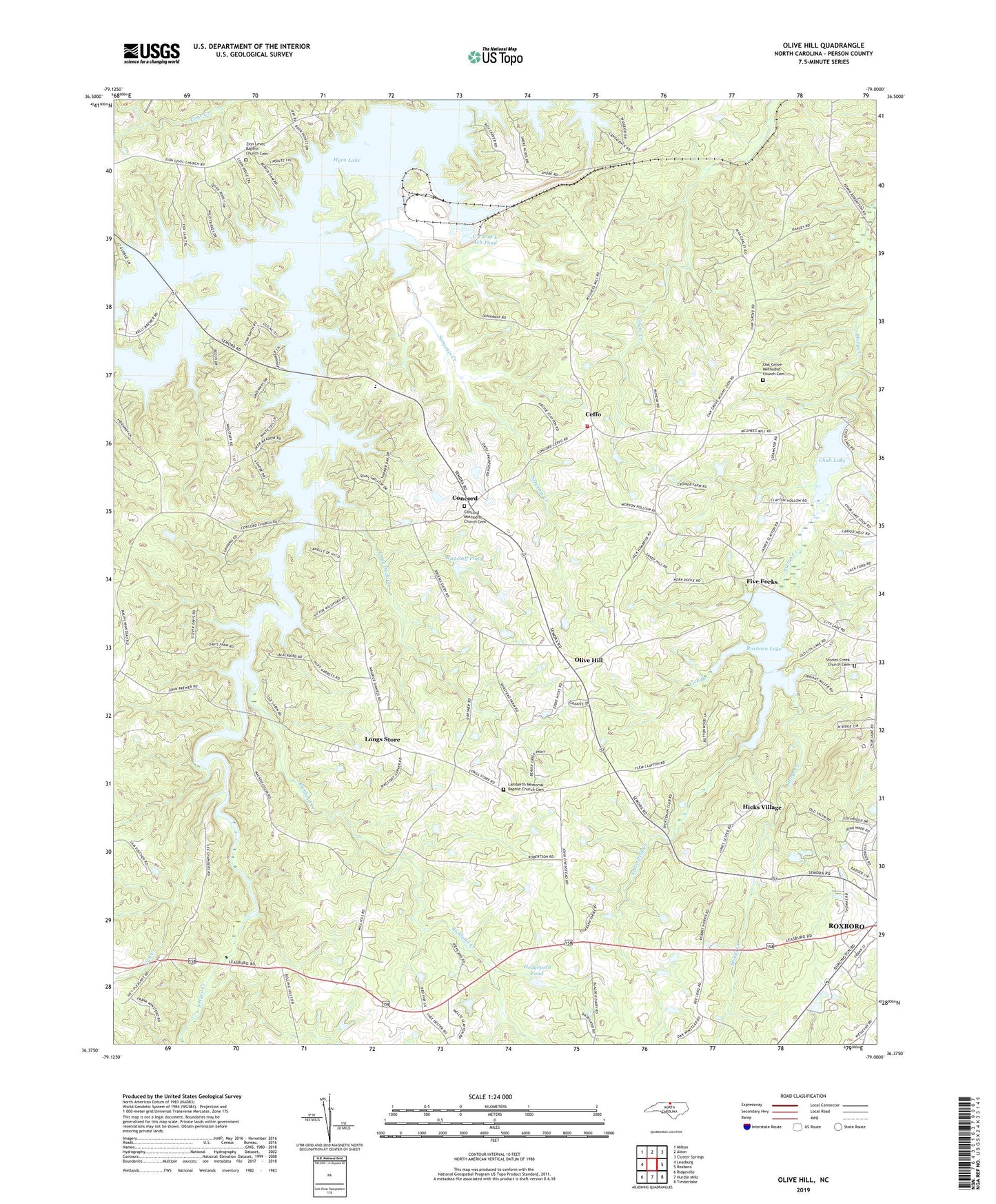
2022 topographic map quadrangle Olive Hill in the state of North Carolina. Scale: 1:24000. Based on the newly updated USGS 7.5' US Topo map series, this map is in the following counties: Person. The map contains contour data, water features, and other items you are used to seeing on USGS maps, but also has updated roads and other features. This is the next generation of topographic maps. Printed on high-quality waterproof paper with UV fade-resistant inks.
Quads adjacent to this one:
West: Leasburg
Northwest: Milton
North: Alton
Northeast: Cluster Springs
East: Roxboro
Southeast: Timberlake
South: Hurdle Mills
Southwest: Ridgeville
This map covers the same area as the classic USGS quad with code o36079d1.
Contains the following named places: C P and L Ash Pond, Ceffo, Ceffo Fire and Rescue Department Station 1, Chub Lake, Chub Lake Dam, Cobbs Creek, Concord, Concord Methodist Church Cemetery, Concord United Methodist Church, Cub Creek, Dunnaways Bridge, Five Forks, Hedgepeth Pond, Hedgepeth Pond Dam, Hicks Village, Hyco Creek, Hyco Lake, Hyco Zion Baptist Church, Lake View, Lamberth Memorial Baptist Church, Lamberth Memorial Baptist Church Cemetery, Leas Chapel United Methodist Church, Lick Branch, Little Duck Creek, Longs Store, Mill Hill Church, Mount Zion Church, Oak Grove Methodist Church Cemetery, Oak Grove United Methodist Church, Olive Hill, Olive Hill School, Person County Farm, Richland Creek, Roxboro City Lake, Roxboro Lake, Roxboro Municipal Lake Dam, Sargents Creek, Satterfield Creek, South Hyco Creek, Stories Creek Church Cemetery, Storys Creek Church, Township of Cunningham, Township of Olive Hill, Wagstaff Pond, Wagstaff Pond Dam, Wagstaff Store, Westwood Baptist Church, Williamsville, Woodland School, Zion Level Baptist Church, Zion Level Baptist Church Cemetery