MyTopo
Kelford North Carolina US Topo Map
Couldn't load pickup availability
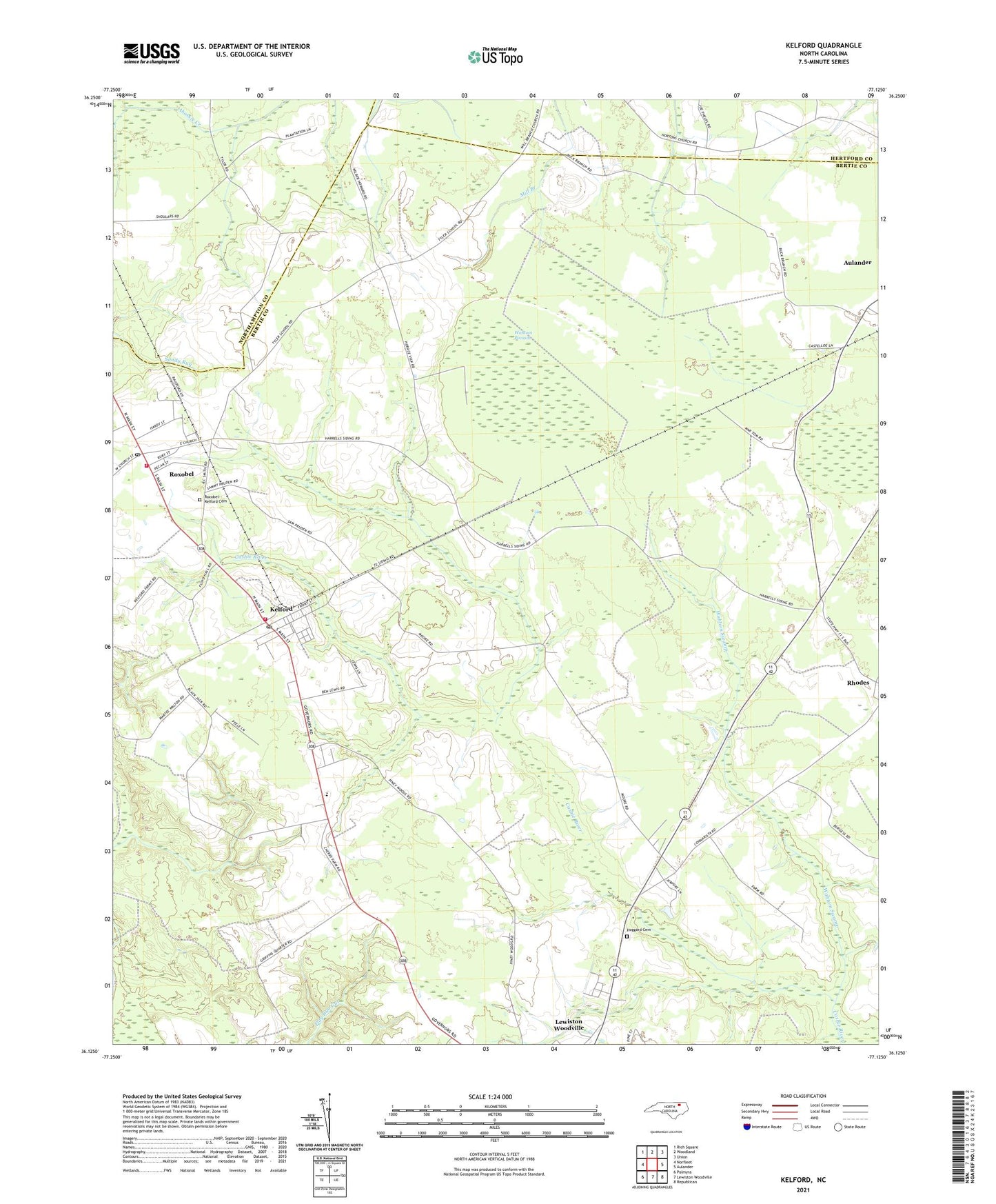
2021 topographic map quadrangle Kelford in the state of North Carolina. Scale: 1:24000. Based on the newly updated USGS 7.5' US Topo map series, this map is in the following counties: Bertie, Northampton, Hertford. The map contains contour data, water features, and other items you are used to seeing on USGS maps, but also has updated roads and other features. This is the next generation of topographic maps. Printed on high-quality waterproof paper with UV fade-resistant inks.
Quads adjacent to this one:
West: Norfleet
Northwest: Rich Square
North: Woodland
Northeast: Union
East: Aulander
Southeast: Republican
South: Lewiston Woodville
Southwest: Palmyra
Contains the following named places: Beautiful Zion Church, Hoggard Cemetery, Kelford, Kelford Post Office, Kelford Volunteer Fire Department, Luella Church, Peanut Belt Research Station, Roxobel, Roxobel Post Office, Roxobel Volunteer Fire Department, Roxobel-Kelford Cemetery, Roxobel-Kelford School, Town of Kelford, Town of Roxobel, Township of Roxobel, Wahtom Pocosin, Wahtom Swamp, West Bertie School, ZIP Code: 27847