MyTopo
Union North Carolina US Topo Map
Couldn't load pickup availability
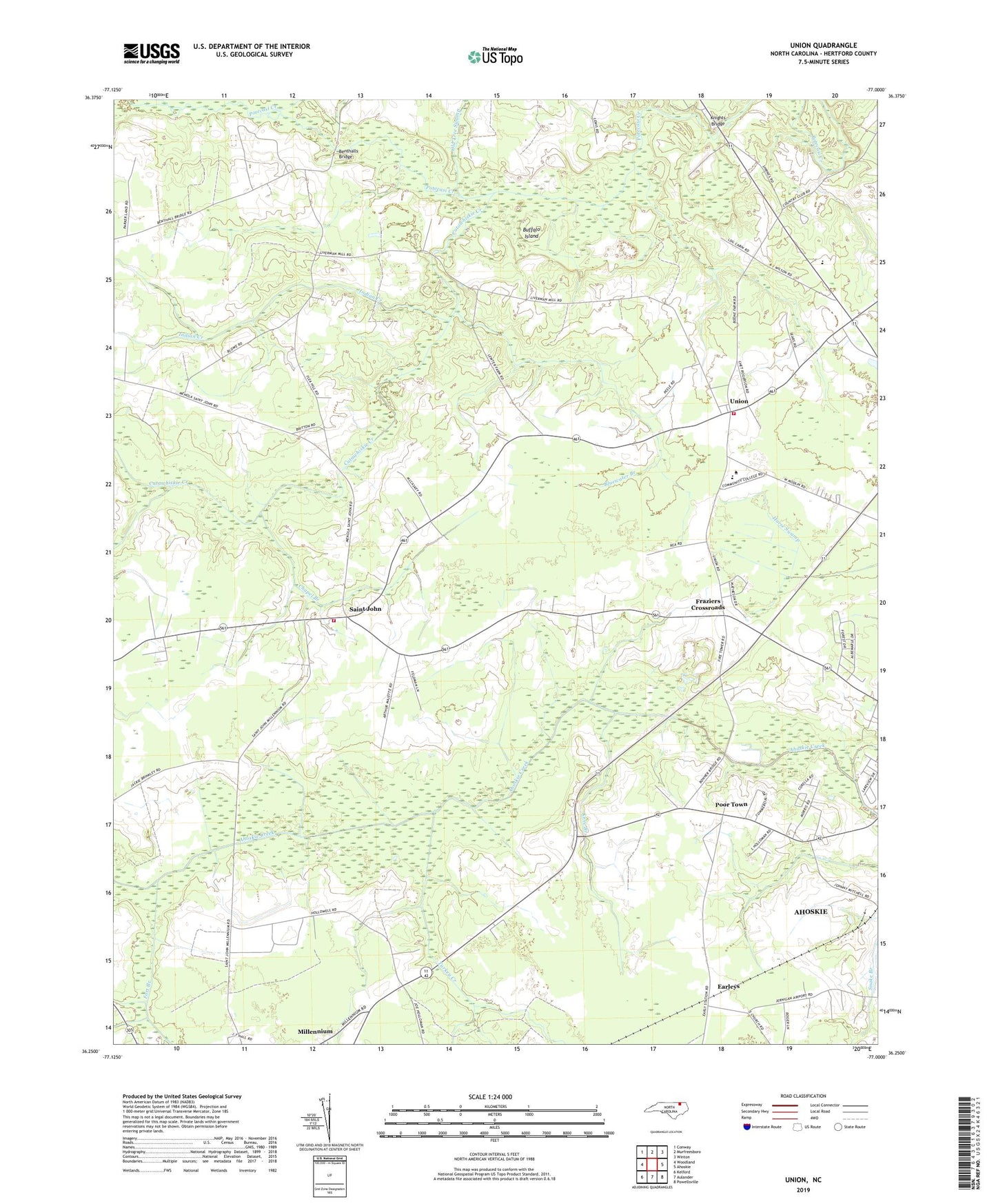
2022 topographic map quadrangle Union in the state of North Carolina. Scale: 1:24000. Based on the newly updated USGS 7.5' US Topo map series, this map is in the following counties: Hertford. The map contains contour data, water features, and other items you are used to seeing on USGS maps, but also has updated roads and other features. This is the next generation of topographic maps. Printed on high-quality waterproof paper with UV fade-resistant inks.
Quads adjacent to this one:
West: Woodland
Northwest: Conway
North: Murfreesboro
Northeast: Winton
East: Ahoskie
Southeast: Powellsville
South: Aulander
Southwest: Kelford
This map covers the same area as the classic USGS quad with code o36077c1.
Contains the following named places: Beechwood Country Club, Benthalls Bridge, Bluewater Branch, Buffalo Island, Chapel Branch, Cutawhiskie Creek, Earleys, Elam Grove Church, Fort Branch, Fraziers Crossroads, Indian Creek, Knee Branch, Knights Bridge, Livermans Mill, North Carolina State Highway Patrol Troop A District 2, Oak Grove Church, Old Tree Swamp, Open Arms Church, Poor Town, Ridgecroft School, Roanoke-Chowan Technical Institute, Saint John, Saint John Fire Department, Saint Johns Church, Township of Saint Johns, Turkey Creek, Union, Union Baptist Church, Union Rural Volunteer Fire Department, Windsor Nursing Home School Street Facility, WQDK-FM (Ahoskie), WRCS-AM (Ahoskie)