MyTopo
Rich Square North Carolina US Topo Map
Couldn't load pickup availability
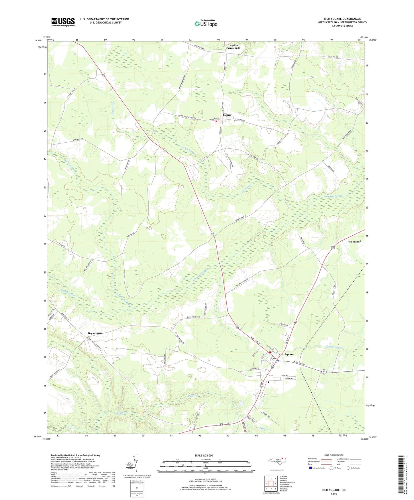
2022 topographic map quadrangle Rich Square in the state of North Carolina. Scale: 1:24000. Based on the newly updated USGS 7.5' US Topo map series, this map is in the following counties: Northampton. The map contains contour data, water features, and other items you are used to seeing on USGS maps, but also has updated roads and other features. This is the next generation of topographic maps. Printed on high-quality waterproof paper with UV fade-resistant inks.
Quads adjacent to this one:
West: Boones Crossroads
Northwest: Jackson
North: Galatia
Northeast: Conway
East: Woodland
Southeast: Kelford
South: Norfleet
Southwest: Scotland Neck
This map covers the same area as the classic USGS quad with code o36077c3.
Contains the following named places: Bear Swamp, Branch Chapel, Bryantown, Chapel Hill Church, Cumbo Chapel, Hope Temple, Lasker, Lasker Volunteer Fire Department, Lassiter Crossroads, Moratoc Mine, New Hope Church, Northeast Academy, Pinners Church, Quarter Swamp, Rich Square, Rich Square Fire Department, Rich Square Police Department, Rich Square Post Office, Rich Square-W S Creecy Elementary School, Town of Lasker, Town of Rich Square, Township of Rich Square, Township of Roanoke, ZIP Code: 27869