MyTopo
Woodland North Carolina US Topo Map
Couldn't load pickup availability
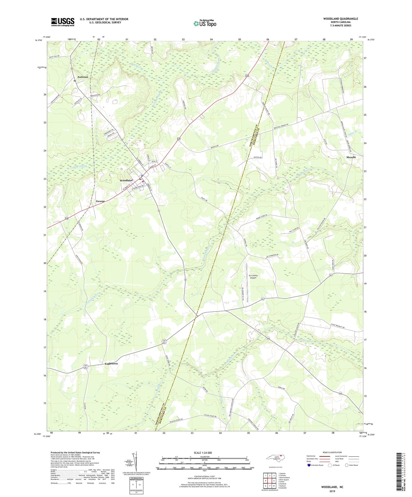
2022 topographic map quadrangle Woodland in the state of North Carolina. Scale: 1:24000. Based on the newly updated USGS 7.5' US Topo map series, this map is in the following counties: Northampton, Hertford. The map contains contour data, water features, and other items you are used to seeing on USGS maps, but also has updated roads and other features. This is the next generation of topographic maps. Printed on high-quality waterproof paper with UV fade-resistant inks.
Quads adjacent to this one:
West: Rich Square
Northwest: Galatia
North: Conway
Northeast: Murfreesboro
East: Union
Southeast: Aulander
South: Kelford
Southwest: Norfleet
This map covers the same area as the classic USGS quad with code o36077c2.
Contains the following named places: Eagletown, George, Grace Church, Hebron Church, Hortons Church, Jerusalem Church, Menola, Menola Church, Mill Branch, Mill Branch Church, Mintons Store, Pleasant Grove Church, Potecasi, Potecasi Post Office, Town of Woodland, Tri-County Airport, Urahaw Swamp, Woodland, Woodland Fire Department, Woodland Police Department, Woodland Post Office, Woodland Rescue Squad Ambulance Service, Woodland-Olney Elementary School, Zion Grove Church, ZIP Code: 27897