MyTopo
Kelly North Carolina US Topo Map
Couldn't load pickup availability
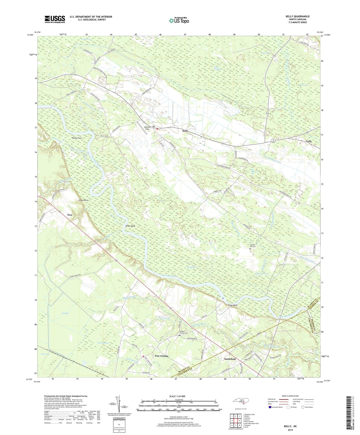
2019 topographic map quadrangle Kelly in the state of North Carolina. Scale: 1:24000. Based on the newly updated USGS 7.5' US Topo map series, this map is in the following counties: Bladen, Columbus, Pender. The map contains contour data, water features, and other items you are used to seeing on USGS maps, but also has updated roads and other features. This is the next generation of topographic maps. Printed on high-quality waterproof paper with UV fade-resistant inks.
Quads adjacent to this one:
West: Council
Northwest: Singletary Lake
North: Rowan
Northeast: Atkinson
East: Point Caswell
Southeast: Acme
South: Freeman
Southwest: Lake Waccamaw East
Contains the following named places: Beaverdam Creek, Big Slough, Bladen Technical College, Bob Peterson Bay, Burnt Bay, Carvers Creek, Centerville Church, Colly, East Arcadia, East Arcadia Fire Department, East Arcadia School, Elwells Ferry, Frenchs Creek, Frenchs Creek Church, Gap Bay, Graham Chapel, Graham Chapel Cemetery, Grays Point, Holmes Hill Cemetery, Horsepen Branch, Kelly, Kelly Census Designated Place, Kelly Church, Kelly Post Office, Kelly Volunteer Fire Department, Kellys Cove, Kings Bluff, Lock and Dam Number One, Lock Number 1, Locks Point, Mitchell Field, Mount Zion Church, Natmore Church, Natmore Creek, Natmore Dam, Otter Slide Bay, Pleasant Union Church, Plummers Run, Salt Marsh Dam, Salt Marsh Ditch, Sandyfield, Steep Run, Town of East Arcadia, Township of Frenches Creek, Trinity Chapel, Turkeypen Bay, Weyman Chapel, White Oak Canal, White Oak Dam, Wilson Chapel, Worth Canal, Zara