MyTopo
Council North Carolina US Topo Map
Couldn't load pickup availability
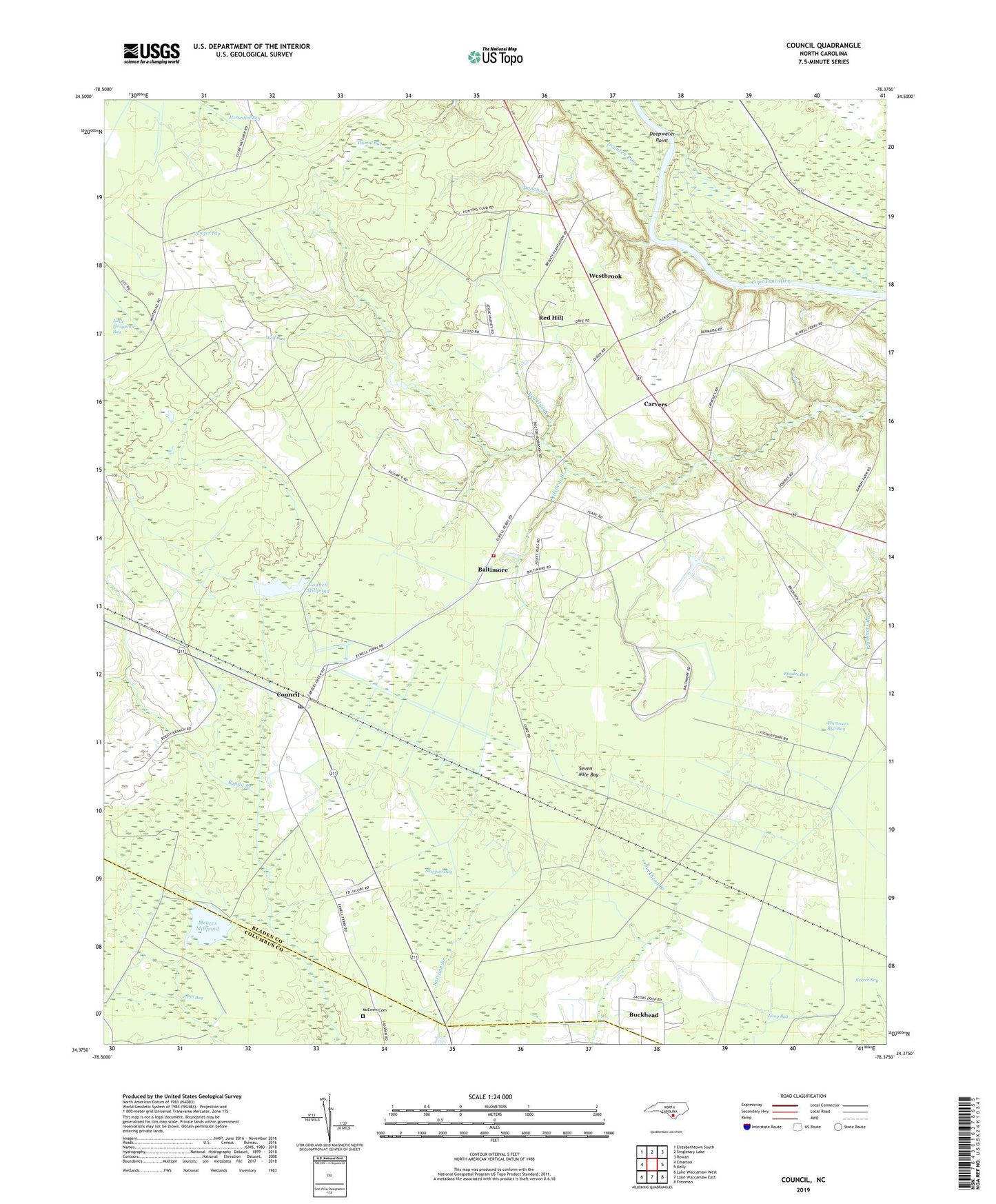
2022 topographic map quadrangle Council in the state of North Carolina. Scale: 1:24000. Based on the newly updated USGS 7.5' US Topo map series, this map is in the following counties: Bladen, Columbus. The map contains contour data, water features, and other items you are used to seeing on USGS maps, but also has updated roads and other features. This is the next generation of topographic maps. Printed on high-quality waterproof paper with UV fade-resistant inks.
Quads adjacent to this one:
West: Emerson
Northwest: Elizabethtown South
North: Singletary Lake
Northeast: Rowan
East: Kelly
Southeast: Freeman
South: Lake Waccamaw East
Southwest: Lake Waccamaw West
This map covers the same area as the classic USGS quad with code o34078d4.
Contains the following named places: Ashwood Church, Baltimore, Boggy Branch, Carvers, Carvers Creek Church, Carvers Creek Volunteer Fire Department, Council, Council Mill Pond Dam, Council Millpond, Council Post Office, Deepwater Point, Dismal Bay, Dodds Millpond, Donoho Creek, Drunken Run, Gilliam Lake, Gilliam Lake Dam, Horseshoe Bay, Juniper Bay, Keeter Bay, Kitchens Branch, Lighthouse Church, Long Bay, McEwen Cemetery, Meares Millpond, Plummers Run Bay, Red Hill, Red Hill Branch, Rhodes Bay, Sasspan Bay, Seven Mile Bay, Township of Carvers Creek, Webb Bay, Westbrook, Wolf Bay, Zion Church, ZIP Code: 28434