MyTopo
Lake Waccamaw East North Carolina US Topo Map
Couldn't load pickup availability
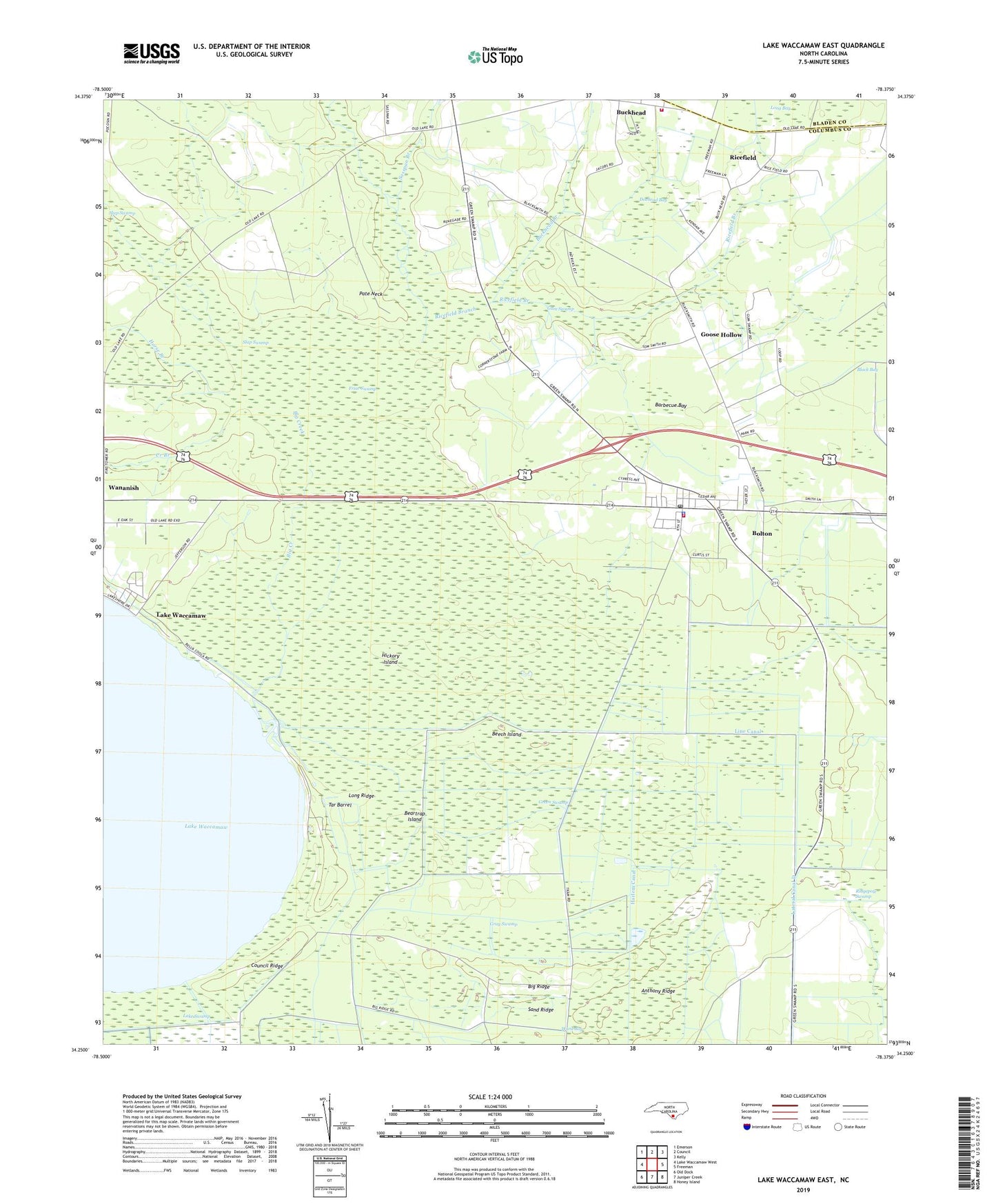
2022 topographic map quadrangle Lake Waccamaw East in the state of North Carolina. Scale: 1:24000. Based on the newly updated USGS 7.5' US Topo map series, this map is in the following counties: Columbus, Bladen. The map contains contour data, water features, and other items you are used to seeing on USGS maps, but also has updated roads and other features. This is the next generation of topographic maps. Printed on high-quality waterproof paper with UV fade-resistant inks.
Quads adjacent to this one:
West: Lake Waccamaw West
Northwest: Emerson
North: Council
Northeast: Kelly
East: Freeman
Southeast: Honey Island
South: Juniper Creek
Southwest: Old Dock
This map covers the same area as the classic USGS quad with code o34078c4.
Contains the following named places: Anthony Ridge, Barbecue Bay, Beartrap Island, Beech Island, Big Creek, Big Ridge, Bolton, Bolton Airport, Bolton Police Department, Bolton Post Office, Bolton Volunteer Fire Department, Buckhead, Buckhead Branch, Buckhead Volunteer Fire and Rescue Department, Council Ridge, Creek Branch, Doehead Bay, Friar Swamp, Goose Hollow, Gray Swamp, Gum Swamp, Harlem Canal, Hickory Island, Horse Branch, Lake Swamp, Lake Waccamaw State Park, Lateral Canal D, Lee Chapel, Line Canal, Long Ridge, New Hope Church, Pate Neck, Ricefield, Ricefield Branch, Ridgepole Swamp, Sand Ridge, Sasspan Branch, Shiloh Church, Smith Chapel, Tar Barrel, Town of Bolton, Township of Bolton, Union Chapel, Ward Bay, ZIP Code: 28423