MyTopo
Point Caswell North Carolina US Topo Map
Couldn't load pickup availability
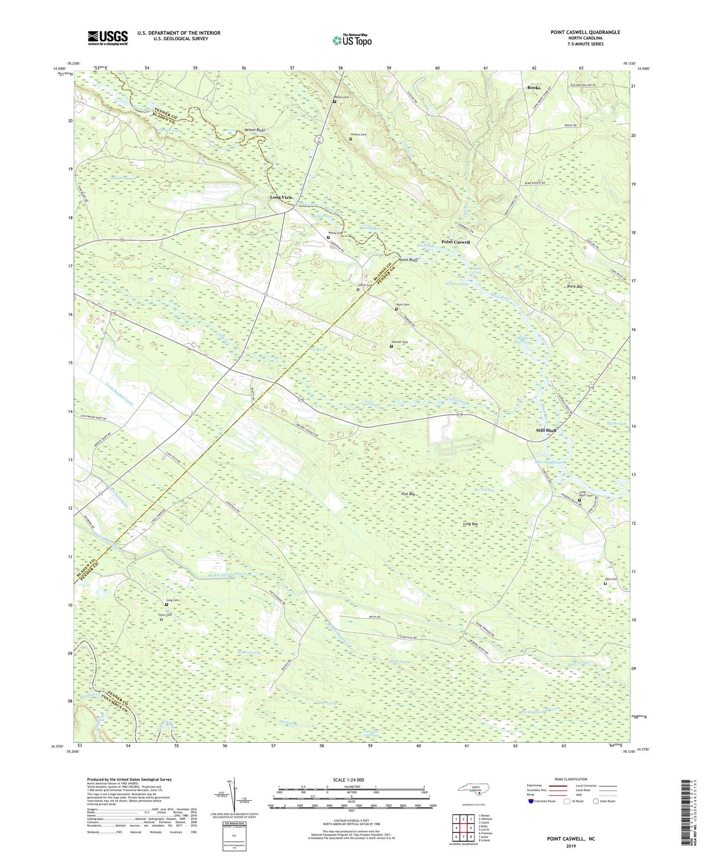
2022 topographic map quadrangle Point Caswell in the state of North Carolina. Scale: 1:24000. Based on the newly updated USGS 7.5' US Topo map series, this map is in the following counties: Pender, Bladen, Columbus. The map contains contour data, water features, and other items you are used to seeing on USGS maps, but also has updated roads and other features. This is the next generation of topographic maps. Printed on high-quality waterproof paper with UV fade-resistant inks.
Quads adjacent to this one:
West: Kelly
Northwest: Rowan
North: Atkinson
Northeast: Costin
East: Currie
Southeast: Leland
South: Acme
Southwest: Freeman
This map covers the same area as the classic USGS quad with code o34078d2.
Contains the following named places: A and W Camp Mobile Home Park, Aldermans Cove, Bear Swamp, Bee Tree Bay, Bethel Church, Bethlehem Church, Betty Hole Cove, Big Bay Swamp, Big Branch, Black Bay, Black Swamp Creek, Buckle Swamp, Caintuck Church, Caintuck School, Cape Fear Lowlands, Colly Creek, Colly Marsh, Colvin Cemetery, Colvins Cove, Colvins Creek, Dew Cemetery, Double Branch, Flat Bay, Flynn Cemetery, Gaylor Cove, Haw Bluff Church, Haw Mill Creek, Hunt Cemetery, Hunts Bluff, Kelley Cemetery, Kelley Cove, Larkins Cemetery, Larkins Cove, Loebs Landing, Long Bay, Long Bluff Cemetery, Long Bluff Landing, Long Cemetery, Long View, Lyon Landing, Lyon Swamp Canal, Moore Cemetery, Narrow Gap Landing, Nelson Bluff, Point Caswell, Point Caswell Church, Pridgens Landing, Raccoon Swamp, Red Star Camp, Rock Hole Cove, Rollins Branch, Rooks, Rosa Green Church, Sheman Cemetery, Sparkleberry Landing, Still Bluff, Township of Canetuck, Weyman Creek, Wheeler Lake, Wilson Cove