MyTopo
Kings Creek North Carolina US Topo Map
Couldn't load pickup availability
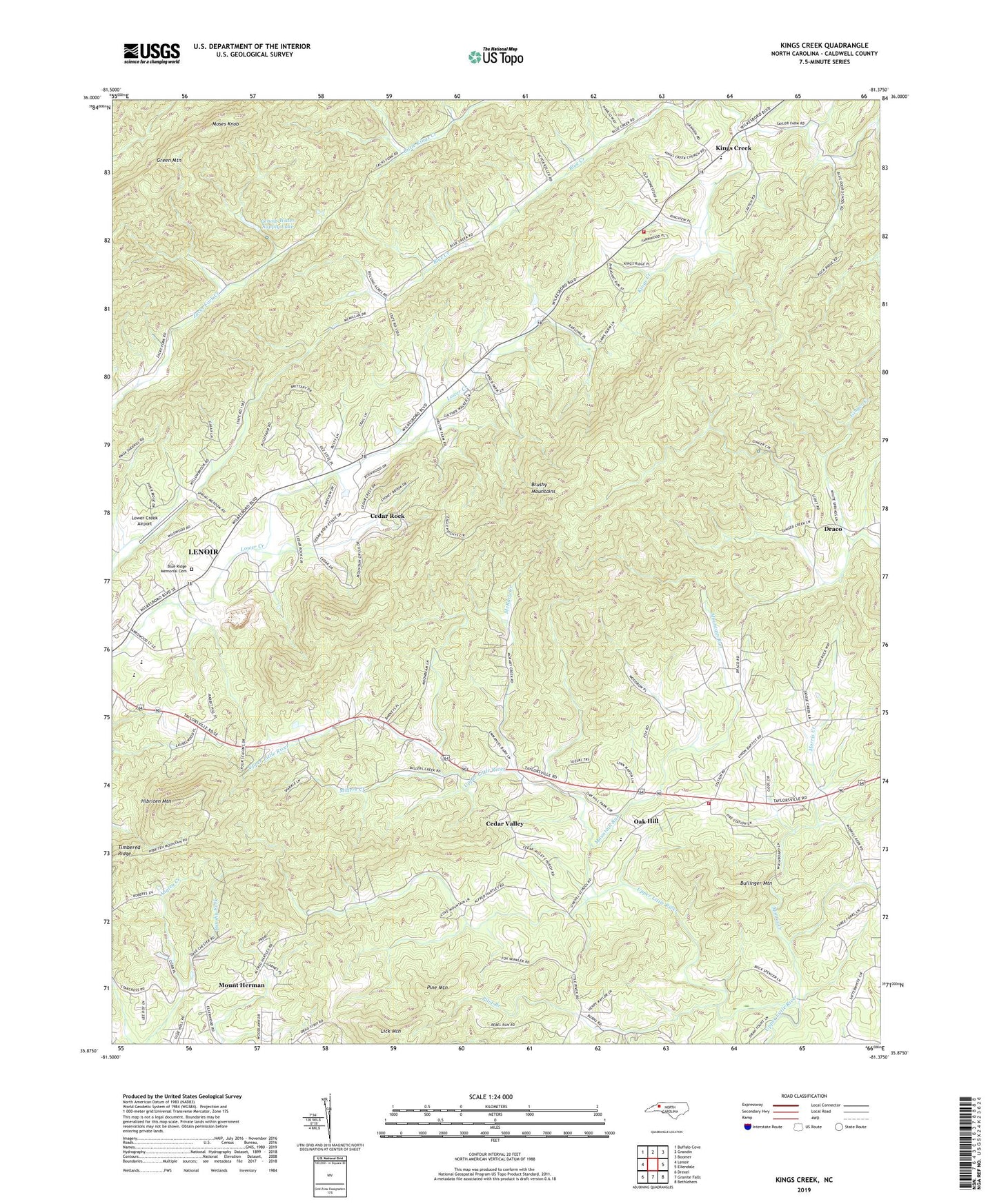
2019 topographic map quadrangle Kings Creek in the state of North Carolina. Scale: 1:24000. Based on the newly updated USGS 7.5' US Topo map series, this map is in the following counties: Caldwell. The map contains contour data, water features, and other items you are used to seeing on USGS maps, but also has updated roads and other features. This is the next generation of topographic maps. Printed on high-quality waterproof paper with UV fade-resistant inks.
Quads adjacent to this one:
West: Lenoir
Northwest: Buffalo Cove
North: Grandin
Northeast: Boomer
East: Ellendale
Southeast: Bethlehem
South: Granite Falls
Southwest: Drexel
Contains the following named places: Auld Farm, Berkshire Hills, Bethel Church, Blue Ridge Memorial Cemetery, Bullinger Mountain, Cedar Rock, Cedar Rock Church, Cedar Rock Country Club, Cedar Rock Estates, Cedar Valley, Clearview Church, Draco, Emanuel, Girl Scout Dam, Girl Scout Lake, Green Mountain, Hibriten, Hibriten High School, Hibriten Mountain, Kings Creek, Kings Creek School, Kings Creek Volunteer Fire Department, Laurel Hollow, LeMar Park, Lenoir Community Church, Lenoir Water Supply Dam, Lenoir Water Supply Lake, Lick Mountain, Little River Volunteer Fire Department, Lower Creek Airport, Maple Valley, McRary Creek, Millers Creek, Morris Creek, Moses Knob, Mount Herman, Mount Zion Church, Mountain Run, Oak Hill, Oak Hill School, Old Farm, Pilot Branch, Pine Mountain, Saint Johns Church, Timbered Ridge, Township of Little River, Turkey Hen Quarry, Union Baptist Church, Village of Cedar Rock, Wesley Memorial Church, Worship Point Mission