MyTopo
Boomer North Carolina US Topo Map
Couldn't load pickup availability
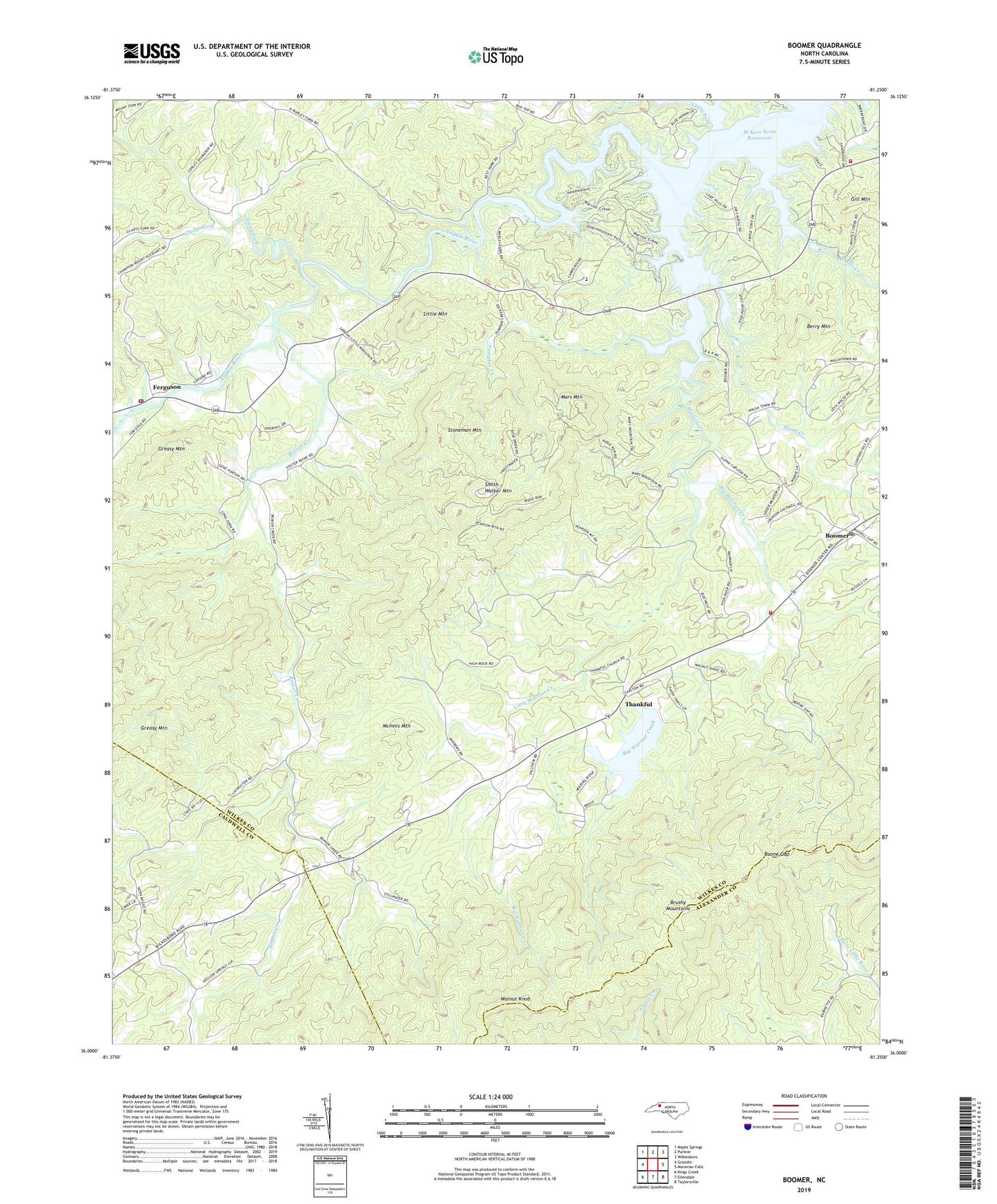
2022 topographic map quadrangle Boomer in the state of North Carolina. Scale: 1:24000. Based on the newly updated USGS 7.5' US Topo map series, this map is in the following counties: Wilkes, Caldwell, Alexander. The map contains contour data, water features, and other items you are used to seeing on USGS maps, but also has updated roads and other features. This is the next generation of topographic maps. Printed on high-quality waterproof paper with UV fade-resistant inks.
Quads adjacent to this one:
West: Grandin
Northwest: Maple Springs
North: Purlear
Northeast: Wilkesboro
East: Moravian Falls
Southeast: Taylorsville
South: Ellendale
Southwest: Kings Creek
This map covers the same area as the classic USGS quad with code o36081a3.
Contains the following named places: Beaver Creek, Beaver Creek Church, Berry Mountain, Big Warrior Creek, Blood Creek, Blood Creek Overlook, Boomer, Boomer Post Office, Boomer Road Access Area, Boomer Volunteer Fire Department, Boomer-Ferguson School, Boone Gap, Broyhills Mill, Coffees Mill, Cosfort, Davis Memorial Church, Ferguson, Ferguson Fire Department, Ferguson Post Office, Gill Mountain, Gladys Fork, Goshen Bridge, Goshen Church, Goshen Volunteer Fire Department, Goulds, Greasy Mountain, Hollow Springs Church, Laws Pond, Laws Pond Dam, Lewis Fork, Little Mountain, Little Rock Baptist Church, Little Warrior Creek, Mars Mountain, McInnis Mountain, Oakdale, Parsons Store, Pumpkin Creek, Pumpkin Creek School, Smith Walker Mountain, Stoneman Mountain, Stony Fork, Thankful, Thankful Baptist Church, Thankful School, Township of Beaver Creek, Township of Boomer, W Kerr Scott Reservoir, Walker Church, Walnut Knob, Walsh Fishing Lake, Walsh Fishing Lake Dam, Warrior Creek, Warrior Creek Boat Ramp, Whites Creek, Zion Hill Baptist Church, ZIP Code: 28606