MyTopo
Manns Harbor North Carolina US Topo Map
Couldn't load pickup availability
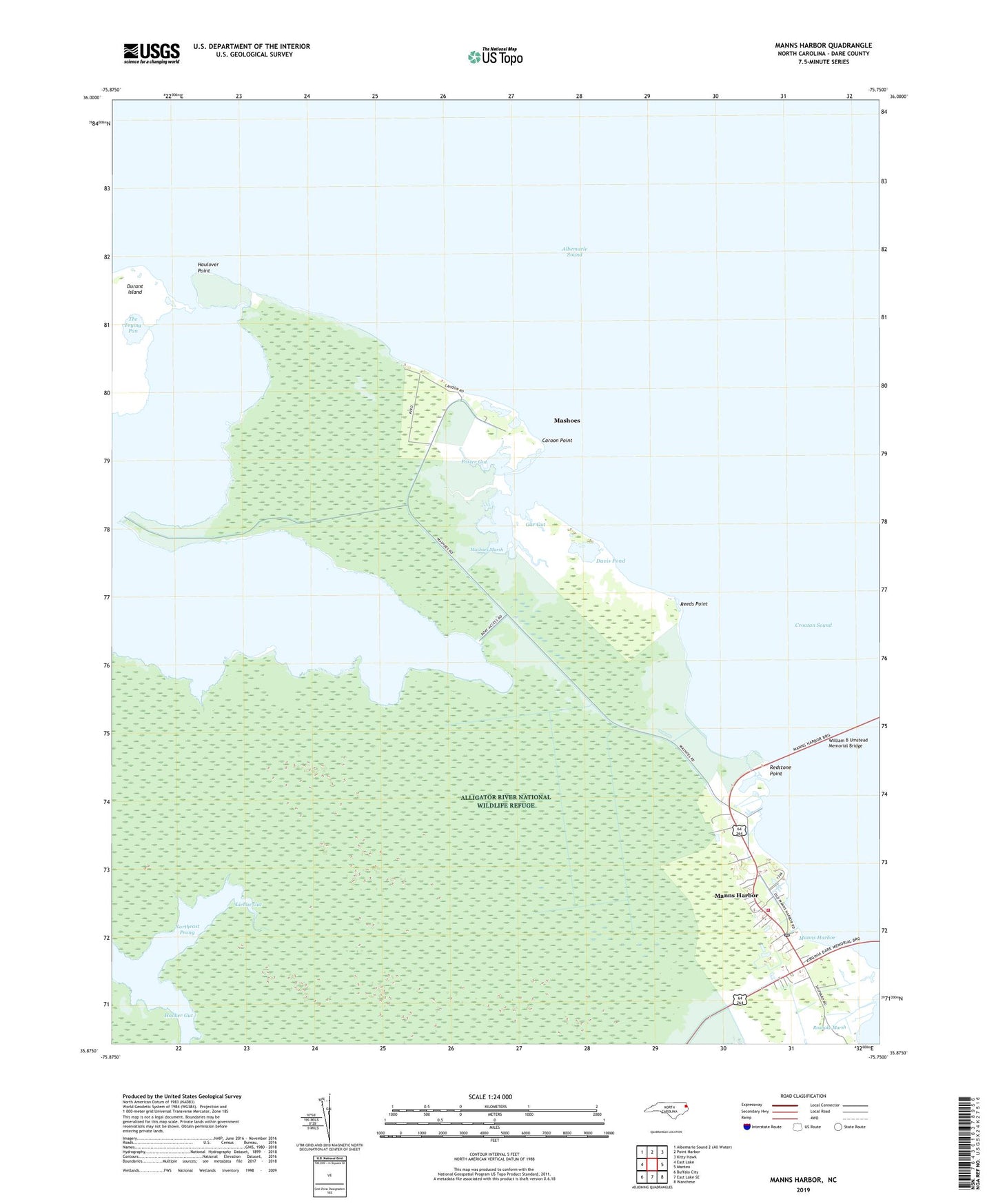
2022 topographic map quadrangle Manns Harbor in the state of North Carolina. Scale: 1:24000. Based on the newly updated USGS 7.5' US Topo map series, this map is in the following counties: Dare. The map contains contour data, water features, and other items you are used to seeing on USGS maps, but also has updated roads and other features. This is the next generation of topographic maps. Printed on high-quality waterproof paper with UV fade-resistant inks.
Quads adjacent to this one:
West: East Lake
North: Point Harbor
Northeast: Kitty Hawk
East: Manteo
Southeast: Wanchese
South: East Lake SE
Southwest: Buffalo City
This map covers the same area as the classic USGS quad with code o35075h7.
Contains the following named places: Caroon Point, Dare County Emergency Medical Services Station 8, Davis Pond, Gar Gut, Haulover Point, Hooker Gut, Liehue Gut, Manns Harbor, Manns Harbor Census Designated Place, Manns Harbor Fire Department Station 18, Manns Harbor Post Office, Mashoes, Mashoes Marsh, Mount Carmel Church, Mount Mitchell Church, Northeast Prong, Peter Mashoes Creek, Poster Gut, Redstone Point, Reeds Point, Spence Creek, The Frying Pan