MyTopo
La Grange North Carolina US Topo Map
Couldn't load pickup availability
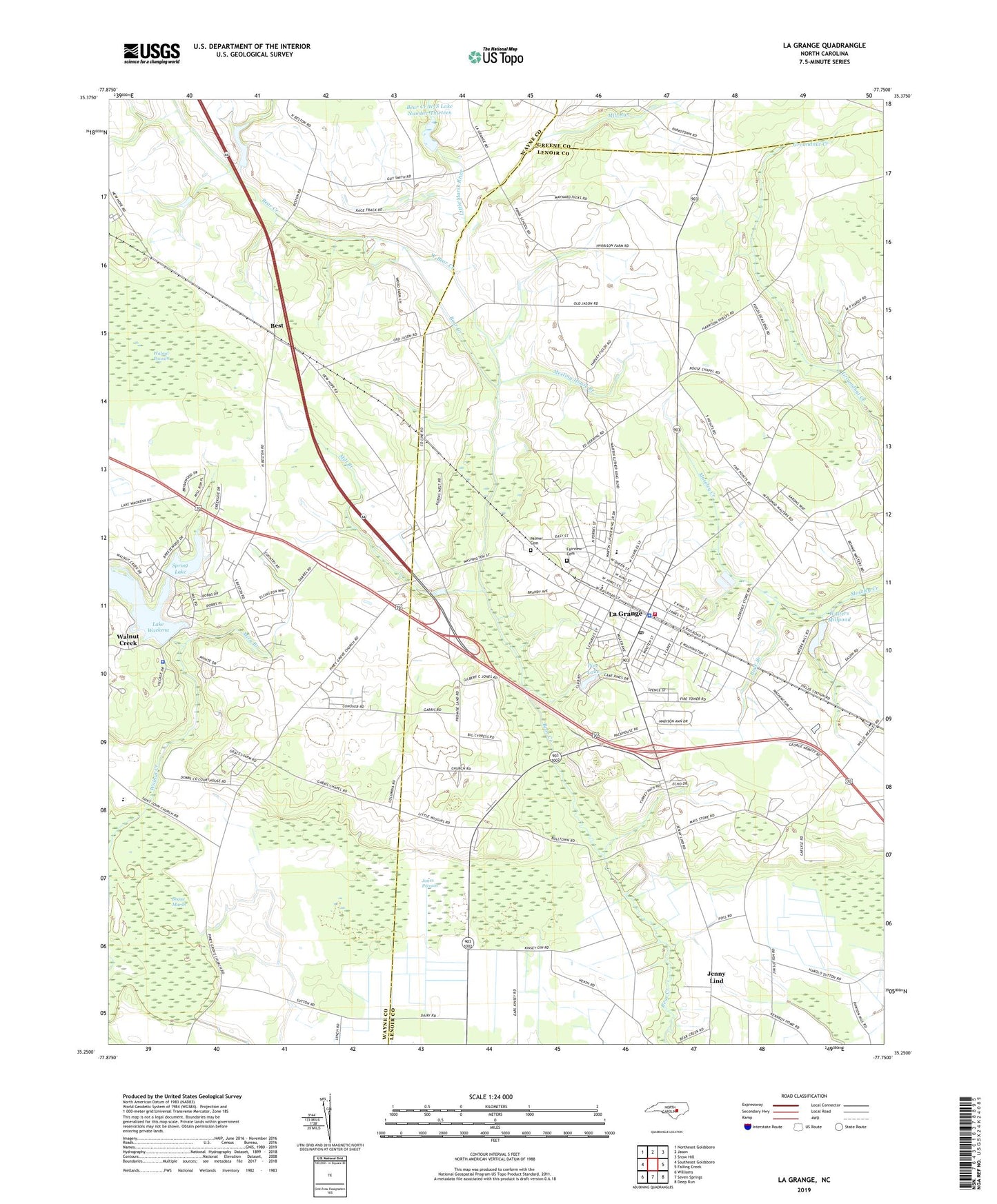
2019 topographic map quadrangle La Grange in the state of North Carolina. Scale: 1:24000. Based on the newly updated USGS 7.5' US Topo map series, this map is in the following counties: Lenoir, Wayne, Greene. The map contains contour data, water features, and other items you are used to seeing on USGS maps, but also has updated roads and other features. This is the next generation of topographic maps. Printed on high-quality waterproof paper with UV fade-resistant inks.
Quads adjacent to this one:
West: Southeast Goldsboro
Northwest: Northeast Goldsboro
North: Jason
Northeast: Snow Hill
East: Falling Creek
Southeast: Deep Run
South: Seven Springs
Southwest: Williams
Contains the following named places: Bear Creek W/S Lake Number Thirteen, Best, Bogue Marsh, Buck Branch, Eastwood, Fairview Cemetery, Frink School, Garris Chapel, Holly Hill Church, Humphrey Sand Hill Church, Jackson Chapel, Jenny Lind, Jones Pocosin, La Grange, La Grange Elementary School, La Grange Fire Department, La Grange Police Department, La Grange Post Office, La Grange Town Hall, La Grange Wastewater Treatment Plant, Lake Wackena, Lake Wackena Dam, Liberty Grove Church, Little Baltimore, Little Marsh River, Mays Store, Meeting House Branch, Mill Branch, Mill Run, Mira Branch, Neuse Regional Library - La Grange Branch, Newsom, Palmer Cemetery, Pine Lake, Piney Grove Church, Rouse Chapel, Saint Matthews Church, Shadetown, Simroe Church, Spring Lake, Spring Lake Dam, Taylors Chapel, Town of La Grange, Township of Moseley Hall, Village of Walnut Creek, Walnut Creek, Walnut Creek Church, Walnut Creek Police Department, Walters Millpond, Walters Millpond Dam, West Bear Creek, White Oak Grove Church, William Creuse Dam, ZIP Code: 28551