MyTopo
Little Kinnakeet North Carolina US Topo Map
Couldn't load pickup availability
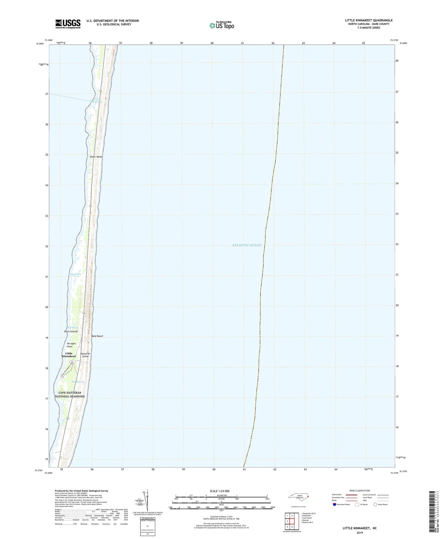
2022 topographic map quadrangle Little Kinnakeet in the state of North Carolina. Scale: 1:24000. Based on the newly updated USGS 7.5' US Topo map series, this map is in the following counties: Dare. The map contains contour data, water features, and other items you are used to seeing on USGS maps, but also has updated roads and other features. This is the next generation of topographic maps. Printed on high-quality waterproof paper with UV fade-resistant inks.
Quads adjacent to this one:
West: Gull Island
Northwest: Rodanthe OE W
North: Rodanthe
South: Buxton OE E
Southwest: Buxton
This map covers the same area as the classic USGS quad with code o35075d4.
Contains the following named places: Bald Beach, Bog Opening, Drain Islands, Gull Island Bay, Hatteras Island, Little Kinnakeet, National Park Service Headquarters, Phipps Cove, Terrapin Point, The Drain