
MyTopo
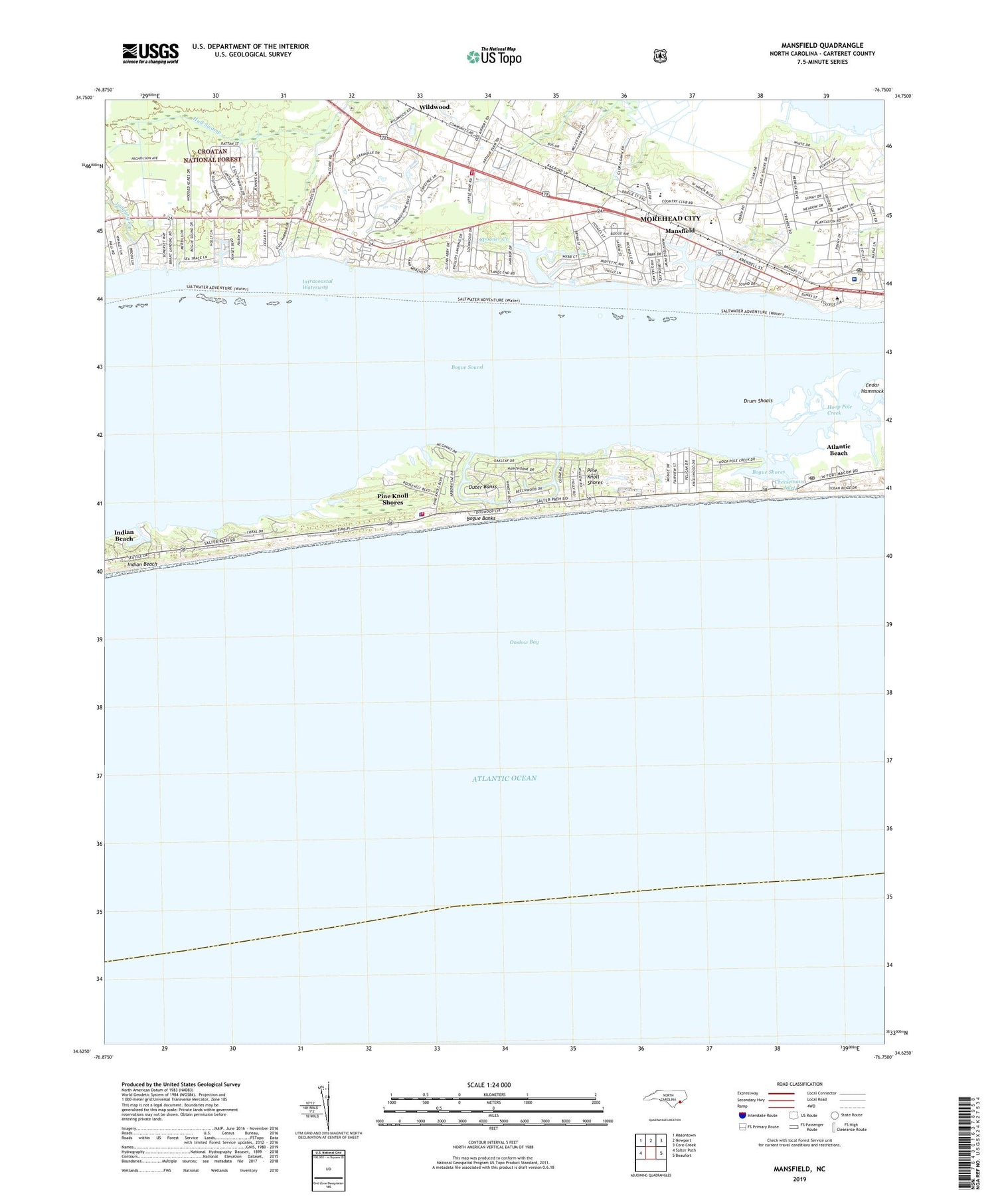
Mansfield North Carolina US Topo Map
Couldn't load pickup availability
2019 topographic map quadrangle Mansfield in the state of North Carolina. Scale: 1:24000. Based on the newly updated USGS 7.5' US Topo map series, this map is in the following counties: Carteret. The map contains contour data, water features, and other items you are used to seeing on USGS maps, but also has updated roads and other features. This is the next generation of topographic maps. Printed on high-quality waterproof paper with UV fade-resistant inks.
Quads adjacent to this one:
West: Salter Path
Northwest: Masontown
North: Newport
Northeast: Core Creek
East: Beaufort
Contains the following named places: Atlantic Beach Post Office, Atlantic Mobile Home Park, Atlantis Station Shopping Center, Bogue Bank Country Club, Bogue Banks, Bogue Shores, Bogue View Shores, Bonham Heights, Brandywine Bay Census Designated Place, Camp Glen, Camp Glenn Elementary School, Camp Morehead, Carolinas Center for Surgery, Carteret Community College, Carteret County Civic Center, Carteret County Museum of History, Carteret General Hospital, Carteret Historical Museum, Chamber of Commerce Visitor Center, Cheesemans Inlet, Coastal Mobile Estates, Coastal Shores, Coral Bay Shopping Center, Croatan Game Land, Crotan Mobile Home Park, Cypress Bay Shopping Center, Drum Shoals, Hedrick Estates, Hollywood, Hoop Pole Creek, Hoop Pole Landing, Hoop Pole Woods, Indian Beach, Jumping Run, Lake and Shores Estates, Mandy Farms, Mansfield, Mansfield Park, Market Place Shopping Center, Mitchell Village, Morehead City Airport, Morehead City Country Club, Morehead City Fire Department Station 3, Morehead City Post Office, North Carolina Marine Resources Center, North Carolina State Highway Patrol Troop A District 8, North Caroling Marine Resources Center, North Woods, Oaksmith Acres, Parkway Shopping Center, Peletier Creek, Pine Knoll Shores, Pine Knoll Shores Fire Department, Pine Knoll Shores Police Department, Pine Knoll Shores Rescue Squad, Pine Knoll Shores Town Hall, Saint Marks Chapel, Spooner Creek, Spooners Creek East Harbor, Spooners Creek Harbor, Spooners Creek Marina, Spooners Creek North, Swinson Park, Theodore Roosevelt Natural Area, Town of Pine Knoll Shores, Township of Morehead, West Carteret High School, Wildwood, Wildwood Mobile Home Park, Wildwood Volunteer Fire Department, Willis Landing, WMBJ-FM (Morehead City), WMBL-AM (Morehead City), ZIP Code: 28512


