MyTopo
Newport North Carolina US Topo Map
Couldn't load pickup availability
Also explore the Newport Forest Service Topo of this same quad for updated USFS data
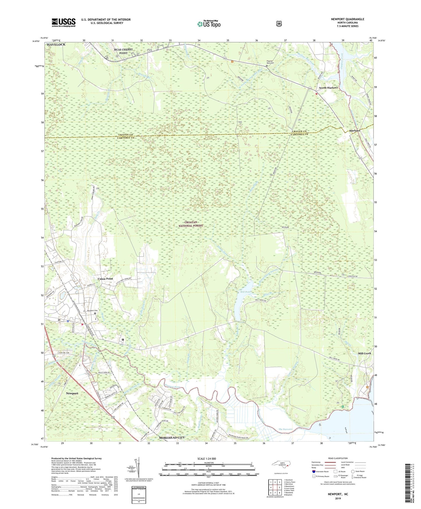
2022 topographic map quadrangle Newport in the state of North Carolina. Scale: 1:24000. Based on the newly updated USGS 7.5' US Topo map series, this map is in the following counties: Carteret, Craven. The map contains contour data, water features, and other items you are used to seeing on USGS maps, but also has updated roads and other features. This is the next generation of topographic maps. Printed on high-quality waterproof paper with UV fade-resistant inks.
Quads adjacent to this one:
West: Masontown
Northwest: Havelock
North: Cherry Point
Northeast: Merrimon
East: Core Creek
Southeast: Beaufort
South: Mansfield
Southwest: Salter Path
This map covers the same area as the classic USGS quad with code o34076g7.
Contains the following named places: Billys Branch, Black Creek, Blakes Branch, Body of Christ Holiness Church, Britthaven of Newport, Carteret Correctional Center, Cedar Grove Cemetery, Cemetery Newport Elementary School, Craven Cor Church, Deep Creek, Dickson Park, Docs Mobile Home Park, East Prong Mortons Mill Pond, Ghouls Fork, Harlow Community Chapel Church, Harlowe, Harlowe Volunteer Fire Department, Hull Swamp, Hymans Chapel, Laurel Branch, Little Creek Swamp, Little Deep Creek, Lodge Creek, Main Prong, Mill Creek, Mill Pond, Mococks Branch, Money Island Swamp, Mortons Mill Pond, Neusiok Trail, New Hope Missionary Baptist Church, Newport, Newport Elementary School, Newport Fire Department Station 1, Newport Police Department, Newport Post Office, Newport River Park, Newport Town Hall, North Harlowe, Pilgrims Rest Cemetery, Pilgrims Rest Church, Sandy Branch, School House Branch, Smiths Swamp, Smiths Swamp Branch, Snows Swamp Branch, The Narrows, Township of Newport, Union Point, West Prong Mortons Mill Pond, ZIP Code: 28570