MyTopo
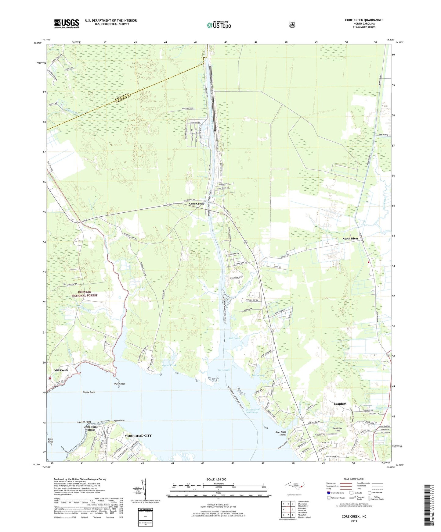
Core Creek North Carolina US Topo Map
Couldn't load pickup availability
Also explore the Core Creek Forest Service Topo of this same quad for updated USFS data
2022 topographic map quadrangle Core Creek in the state of North Carolina. Scale: 1:24000. Based on the newly updated USGS 7.5' US Topo map series, this map is in the following counties: Carteret, Craven. The map contains contour data, water features, and other items you are used to seeing on USGS maps, but also has updated roads and other features. This is the next generation of topographic maps. Printed on high-quality waterproof paper with UV fade-resistant inks.
Quads adjacent to this one:
West: Newport
Northwest: Cherry Point
North: Merrimon
Northeast: South River
East: Williston
Southeast: Harkers Island
South: Beaufort
Southwest: Mansfield
This map covers the same area as the classic USGS quad with code o34076g6.
Contains the following named places: Adams Creek Canal, Alligator Creek, Barge Landing Basin, Bayview Church, Bell Creek, Big Creek, Cedarville Estates, Core Creek, Crab Point Village, Craven Corner, Cross Rock, Dead Cow Field, Deer Field Shores, Eastman Creek, Feltons Creek, Freewill Church, Graham Chapel, Harlowe Canal, Harlowe Church, Harlowe Creek, Joslyn Trace, Lawton Point, Little Creek, Live Oak Grove Church, McDaniels, Mill Creek, Mill Creek Volunteer Fire Department, Mount Tabor Missionary Baptist Church, North Harbor, North River, North River and Laurel Road Volunteer Fire Department, North River Corner, North River United Methodist Church, Oyster Creek, Penn Point, River Heights, Russell Creek, Seagate, Tattles Grove Church, Township of Beaufort, Township of Harlowe, Turtle Rock, Ware Creek, White Rock