
MyTopo
Manteo North Carolina US Topo Map
Couldn't load pickup availability
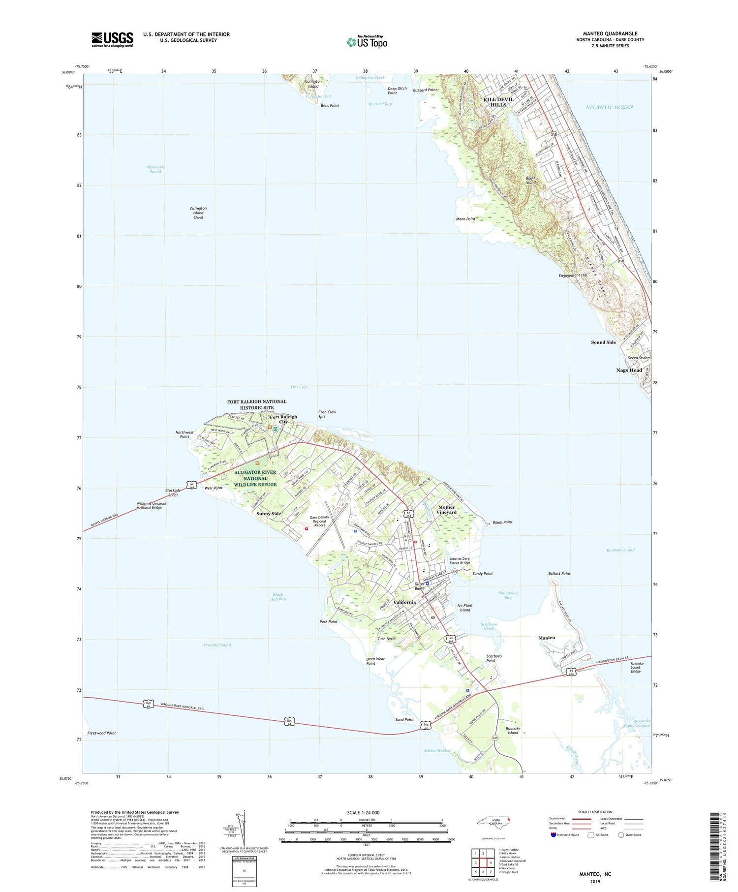
2019 topographic map quadrangle Manteo in the state of North Carolina. Scale: 1:24000. Based on the newly updated USGS 7.5' US Topo map series, this map is in the following counties: Dare. The map contains contour data, water features, and other items you are used to seeing on USGS maps, but also has updated roads and other features. This is the next generation of topographic maps. Printed on high-quality waterproof paper with UV fade-resistant inks.
Quads adjacent to this one:
West: Manns Harbor
Northwest: Point Harbor
North: Kitty Hawk
East: Roanoke Island NE
Southeast: Oregon Inlet
South: Wanchese
Southwest: East Lake SE
Contains the following named places: Ananias Dare Street Bridge, Ashbee Harbor, Ballast Point, Baum Point, Bens Point, Black Hall Bay, Blockade Shoal, Britthaven of Outer Banks, Burnside Headquarters, Buzzard Bay, Buzzard Point, California, Cape Hatteras Group Headquarters, Colington Cut, Colington Island Shoal, Crab Claw Spit, Crime Line, Dare County Emergency Medical Services Station 2, Dare County Emergency Medical Services Station 7, Dare County Regional Airport, Dare County Regional Airport Fire Station, Dare County Sheriff's Office, Dare County Sheriff's Office - Manteo, Deep Ditch Point, Deep Wear Point, Doughs Creek, Elizabeth II Boat Shop, Elizabeth II Vistor Center, Elizabethan Gardens, Engagement Hill, First Creeks, Fleetwood Point, Fort Raleigh City, Fort Raleigh National Historic Site, Fulker Island, Fulker Shoal, Hammock Ditch, Haven Creek Church, Ice Plant Island, Jockeys Ridge, Jockey's Ridge State Park, Johns Creek, Lindsay Warren Visitor Center, Mann Point, Manteo, Manteo Police Department, Manteo Post Office, Manteo Well Field Site, McKnights Ditch, Mother Vineyard, Nags Head Pier, Nags Head Woods, North Carolina Marine Resources Center, Northwest Point, Old Ferry Dock, Otis Cove, Outer Banks Airport, Outer Banks Mall, Pain Fort, Pork Point, Roanoac, Roanoke Island, Roanoke Island Church, Roanoke Island Festival Park, Roanoke Island Volunteer Fire Department Station 17 North Station, Roanoke Sound Bridge, Sand Beach Creek, Sand Point, Sandy Point, Scarboro Creek, Scarboro Point, Shallow Bag Bay Club Marina, Shallowbag Bay, Skyco, Sound Side, Sunny Side, Thomas Hariot Nature Trail, Town of Manteo, Town of Nags Head, Turn Basin, Weir Point, William B Umstead Memorial Bridge, ZIP Code: 27954


